|
HOME
|
 The Streets Where You Lived
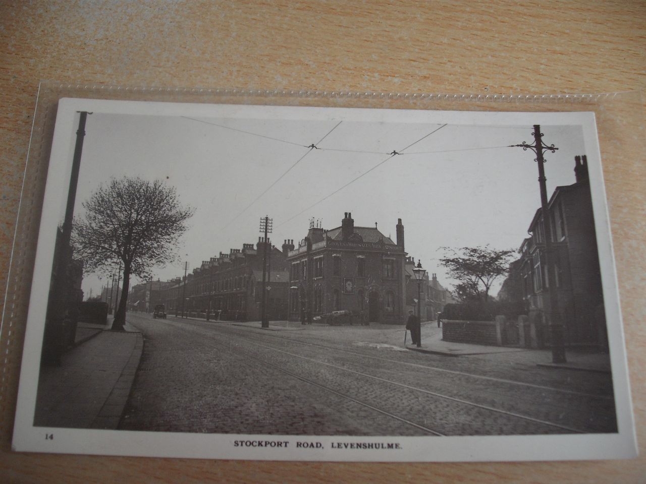
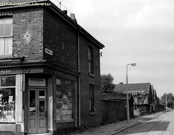
This page is intended to be a resource for the Streets, Avenues, Roads, Drives, Lanes and other byways where people lived in Levenshulme. Each street had its stories, personalities, happy times & sad times. I hope to include some memories on this page as the site grows. to start with I will include the street where I lived for most of my time in Levenshulme. Crayfield Road/Station Road Memories. Crayfield Road was originally called Station Road because it was adjacent to South Levenshulme Railway Station. South Levenshulme Station, built in 1894, existed before Station Road was built. The station was located in a cutting below the road level. The name changed to Crayfield Road after the station closed at the end of the 1950s. How the name was chosen is anybodies guess! The road ran east to west between Stockport Road & Broom Lane. It consisted of late Victorian 3 storey terraced houses, numbered 1-20, at the Stockport Road end. I lived at number 14.At the Broom Lane end were two rows of newer two storey terraced houses probably built in the 1930s. All these houses, both old & new, had front & back gardens, with walls & hedges. The top of Gordon Avenue divided the old houses from the newer ones. In the 1950s the road was still cobbled and the pavements were flagged. The road was upgraded in the early 60s. Gas lights were still in place in the 1950s. In the back entry, behind my house was Poysers Scrap Yard. They broke up old cars & lorries for parts & scrap metal. We used to play in the cars & trucks that were dumped at the yard gates. Poyser's had a shop next to Levenshulme Town Hall. Also behind the Town Hall was a council yard where Refuse Trucks were garaged. There was also a weigh scale at the yard gates. The only commercial business on Crayfield Road was the London & Manchester Assurance office on the corner of Stockport Road Update:- I have now started to compile my family history on the " Links" page. June 2010.
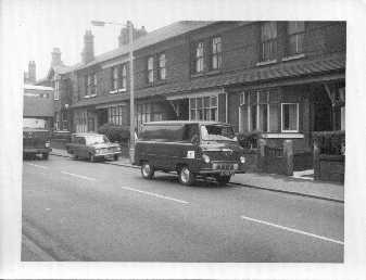
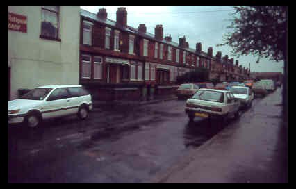
Crayfield Road from Stockport Road corner 1994. Note all the parked cars . In the 1950s there would have been few, if any vehicles!
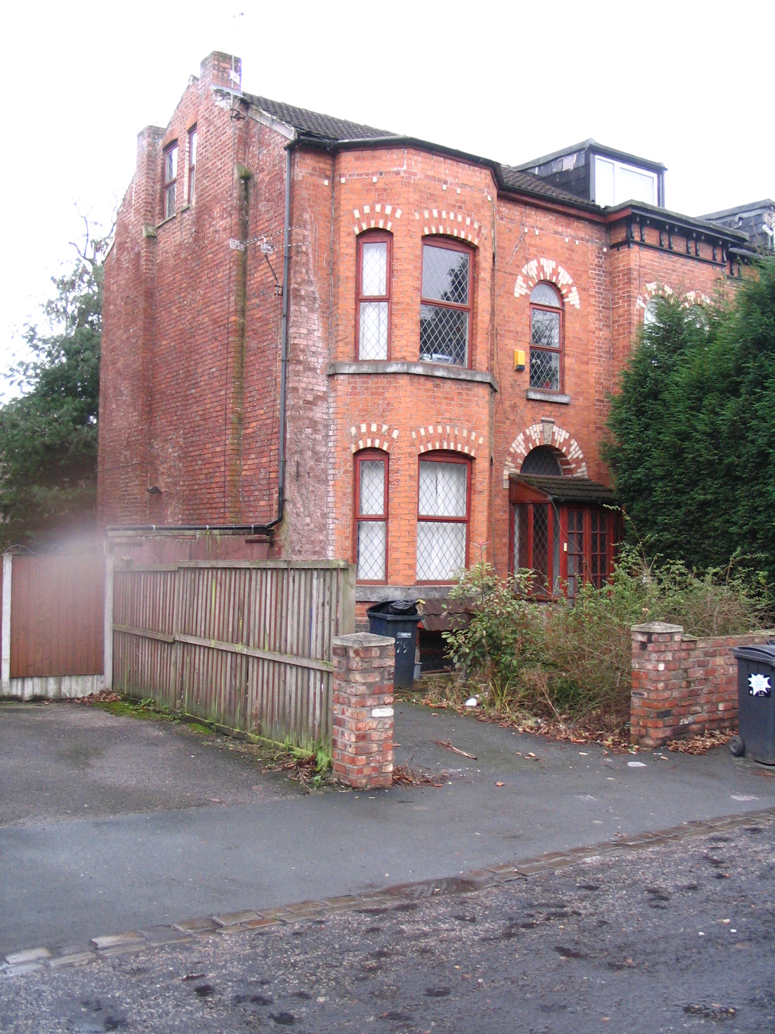
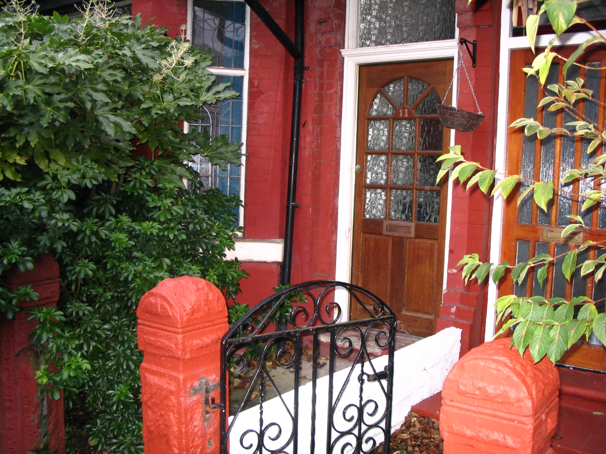
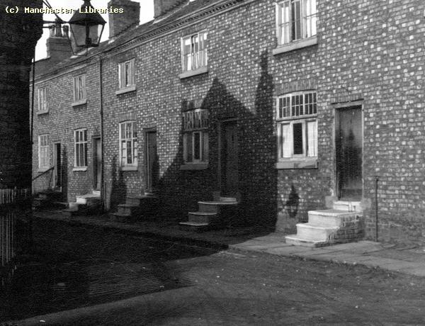
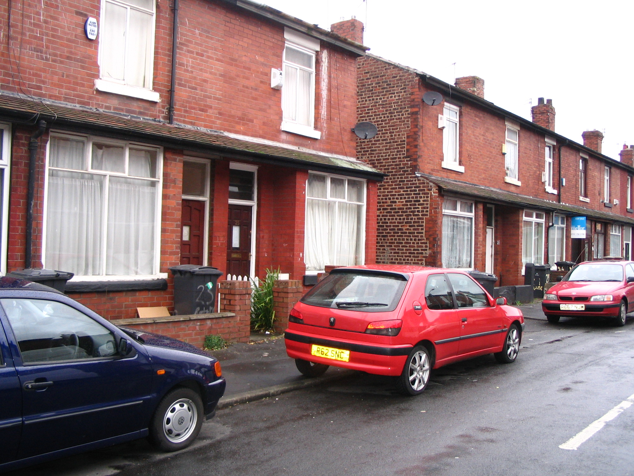
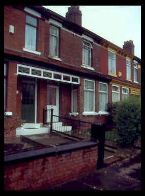
This photograph taken in March 2004 shows no's 13, 14 & 15 Crayfield Road. A definite improvement on 1999! New garden wall & gates. A real sense of pride. Well done to the present occupiers! If you know who lives there now, it would be really nice to connect with the owners. ( Photo Carole Daniels )
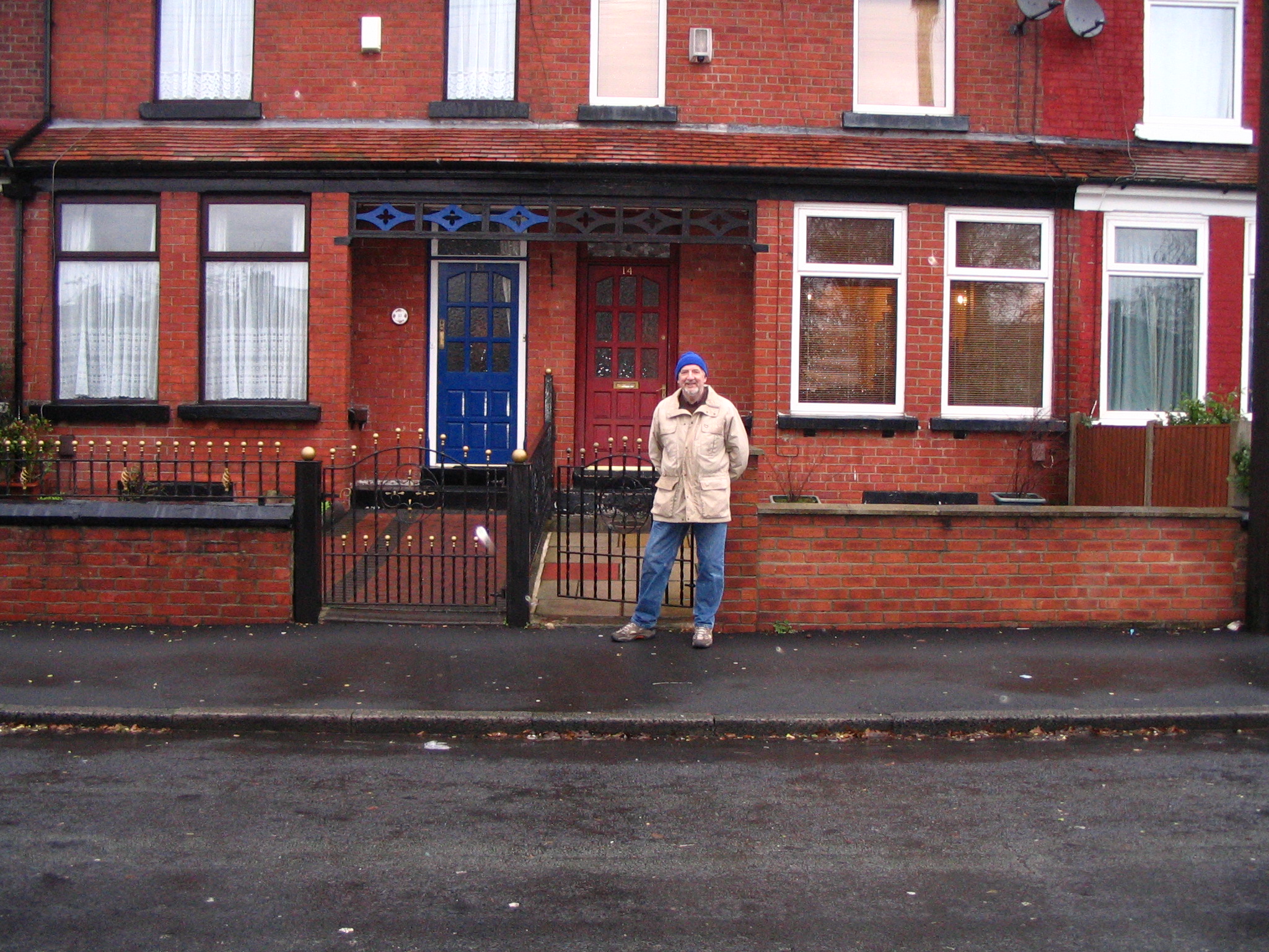
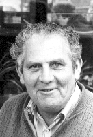
December 2007.George Nixon standing outside 14 Crayfield Road. I last lived here in 1973.
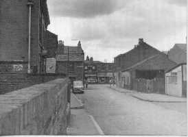
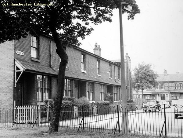
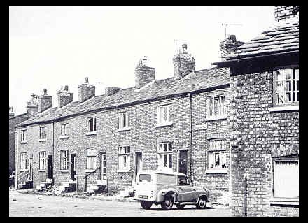
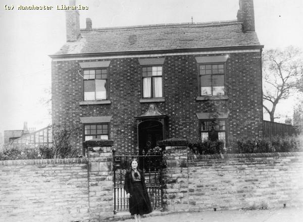
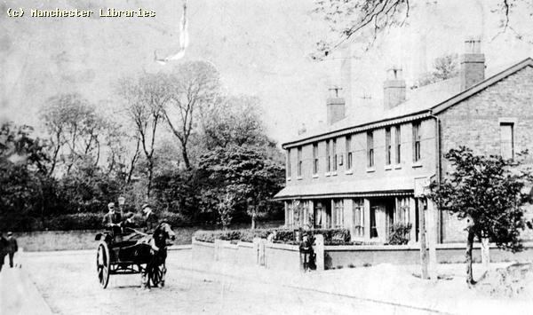
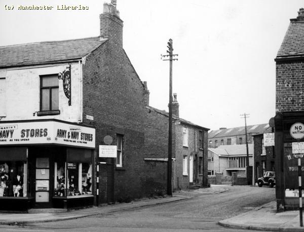
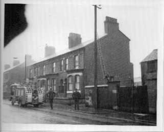
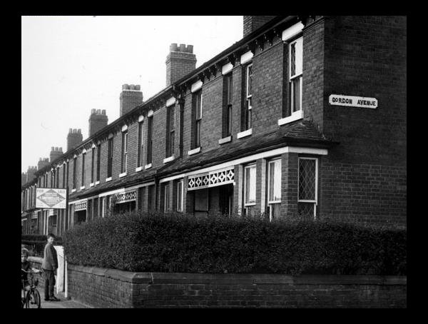
The Stockport Road end of Crayfield Road with the older houses in 1959, taken at the corner with Gordon Ave. (Photo Manchester Libraries)
The same corner January 2010. Snow!! A rare sight in Levenshulme. (via Eamonn Lavin)
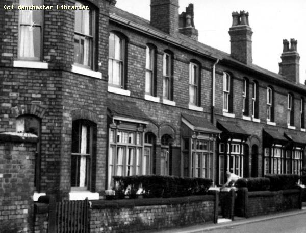
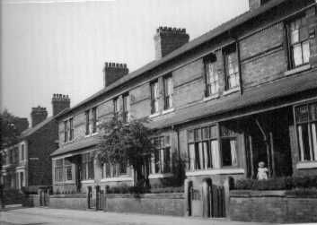
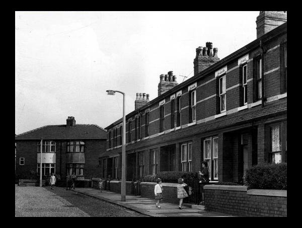
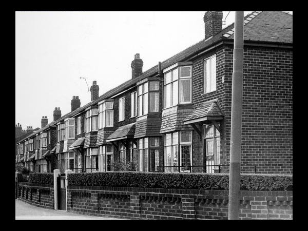
The " newer" houses in Crayfield Road at the corner with Broom Lane. There were two separate rows divided by an entry. The houses were much more modern than my house. When were they built? ( Photo. Manchester Libraries)
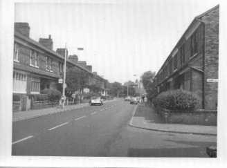
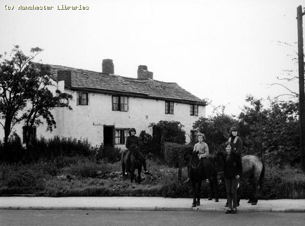
The "newer" houses January 2010. Note the sign pointing to cycle and walking path. (via Eamonn Lavin) The neighbours that I remember from the 1950s were:- Masters @ No 1, Grundys @No.13,Ashtons @ No 13, Lavins @No.13, Dempseys @ No 15, Rennies @ No.16, Braithwaites @ No 17 & Bolshaws @ No 18. We also played with the Stringfellow boys and my sisters friend Christine Pollock in the newer houses. Neighbours came and went frequently during the time that I lived there, but some people probably lived on Crayfield Road all of their lives.
Mr Lavin, with daughter Geraldine and twins Eamonn and Jarlatt. (via Eamonn Lavin)
Mrs. Vera Lavin and Mr Gerard Lavin (via Eamonn Lavin)
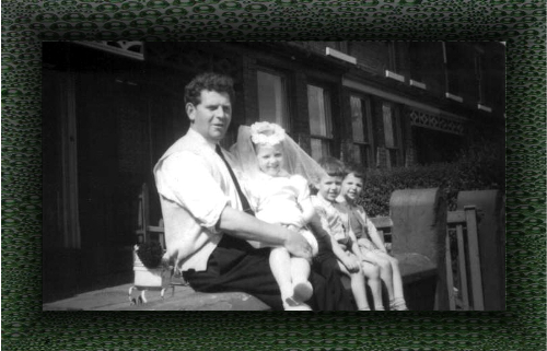
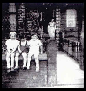
This photo supplied by Patrick Dempsey, probably taken around 1956, shows Me, Patrick & James Dempsey sitting on the wall at No 15 Crayfield Road. Mrs. Dempsey is standing in the doorway.
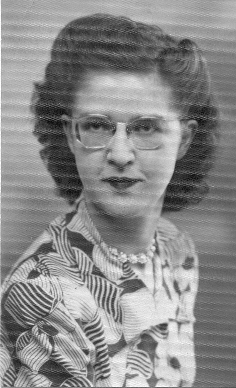
The above, rather grainy, photograph was sent to me recently by Andrew Hey. It shows his two sisters Margaret & Jessie standing outside No.17 Station Road in about 1922/23. Note the two prams. I would think very expensive toys at the time! Andrew states that this was taken before he was born. He is 87 years of age in 2011! He also states that the neighbours at No 18 were the Bolshaws, who were still there in the 1960s. PS. Margaret & Jessie are also still living aged 92 & 91!!
The two photographs above were taken in the early 1960s. The first shows me and my friend & neighbour Patrick Dempsey. The "decapitated" girl is my sister Rosemary. The second photo shows me and my friends/neighbours James Dempsey, Kevin Dempsey, Laurence Dempsey & Paul Braithwaite. This would be around 1961-62 as I am wearing my Didsbury Tech. school uniform.
The above picture shows Crayfield Road looking from the Broom Lane end in 1965. You can see the Co-op building, Levenshulme South Station and houses on Stockport Road.
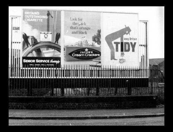
Another view of the same corner at a later date. Some nice period advertisements. ( Photo Manchester Libraries)
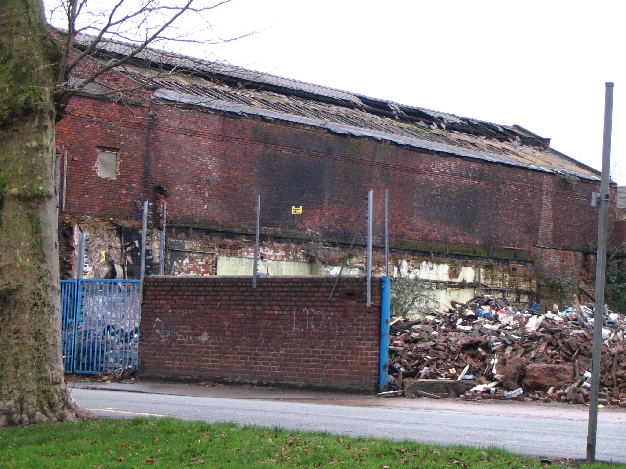
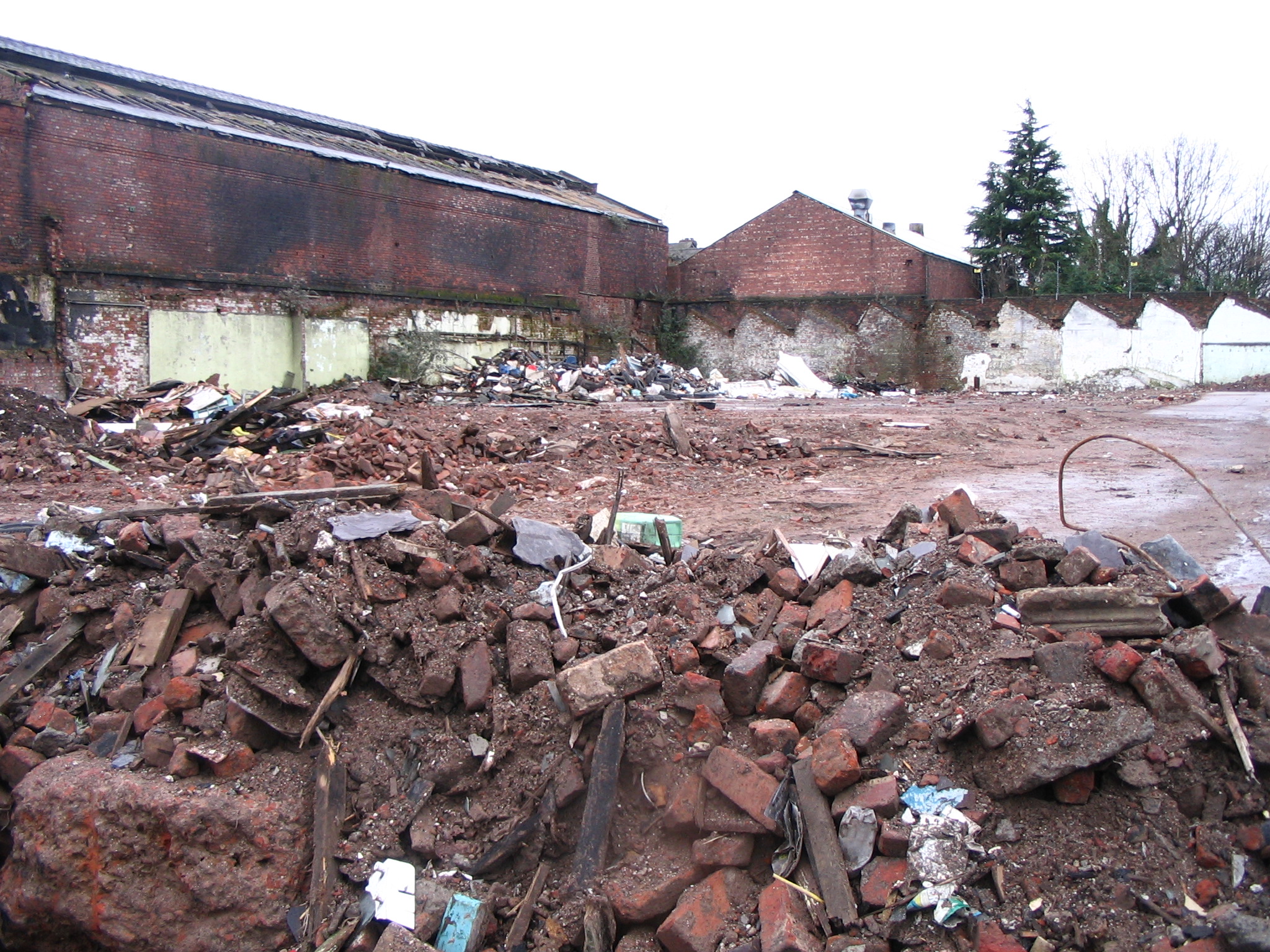
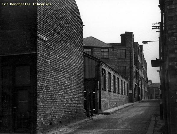
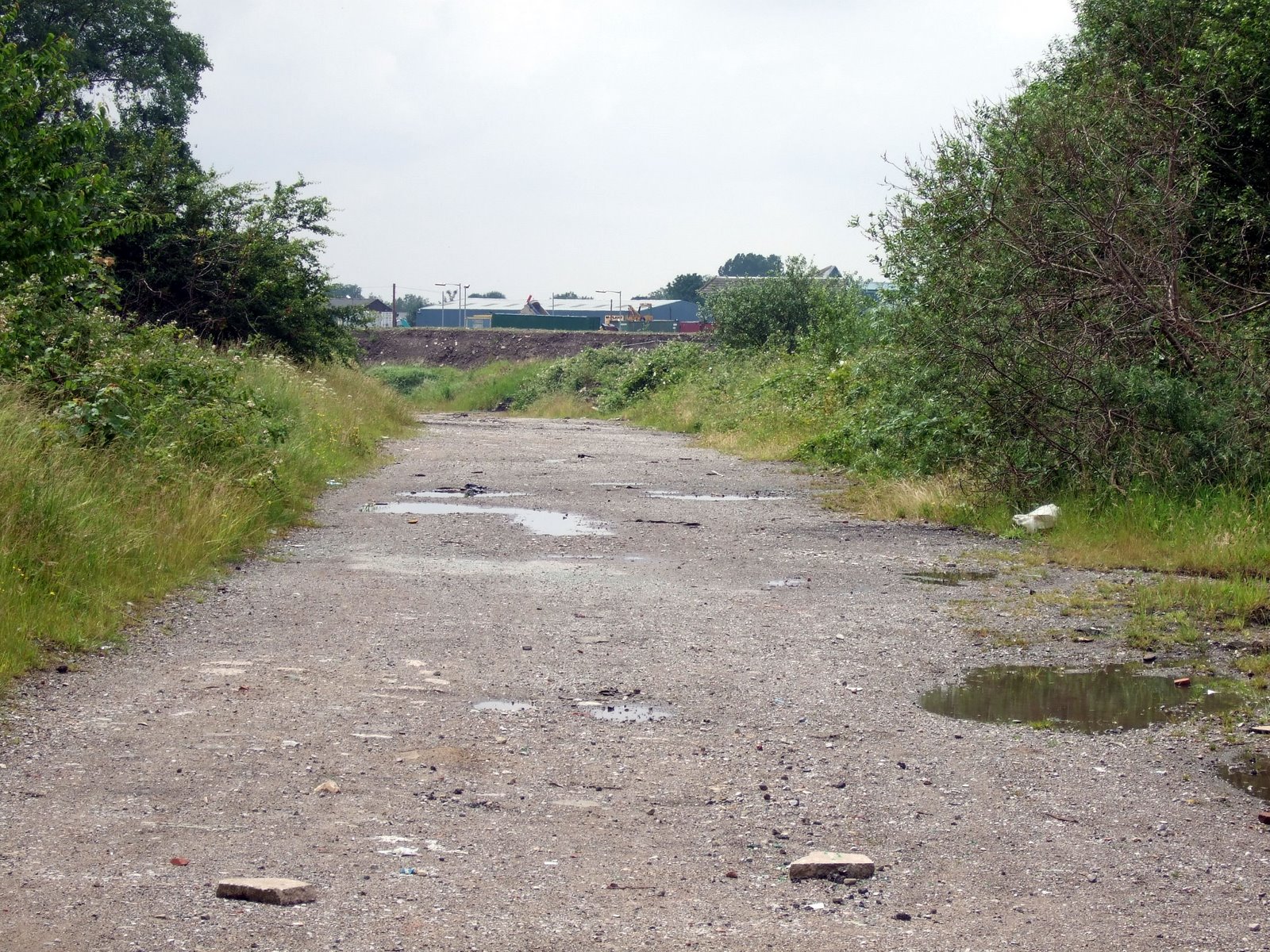
Back entry behind Crayfield Road, looking west to the back of the Town Hall. Photo taken February 2004 by Andrew Barber. The house nearest to the camera is my old house No 14. Poysers scrap yard was on the right hand side of the entry.
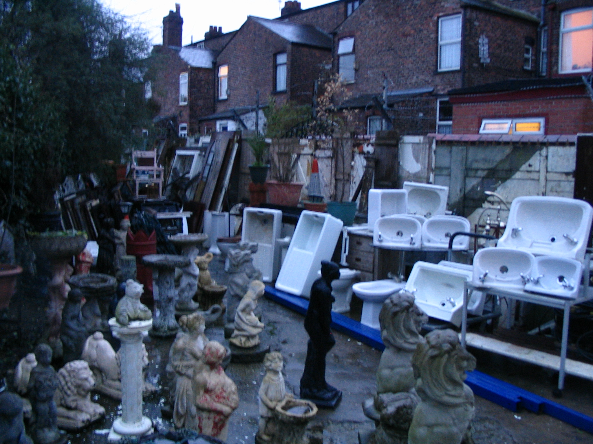
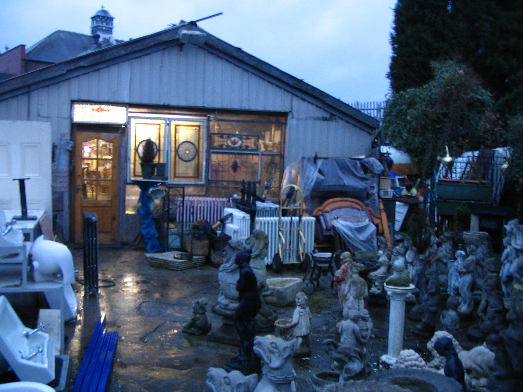
Two interesting views of the rear of Crayfield Road, December 2007. The first shows the backs of the houses, including no.14. The second shows the old Poysers yard. This yard and building now house an antique store and architectural salvage business. They are part of the Levenshulme Town Hall Antiques Village. The Other Streets Where I lived Osborne Road
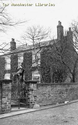
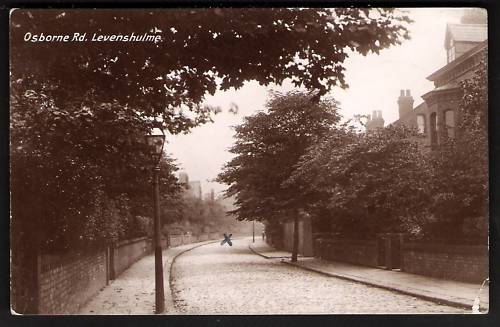
When I lived after I was born in September 1949, my parents lived at 79 Osborne Road. I believe that they rented the property. My maternal grandparents lived nearby in Windsor Road. This is 79 Osborne Road in December 2007. Thorncliffe Grove
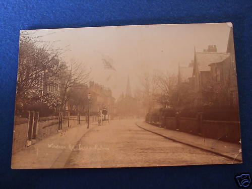
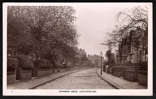
The second house that I lived in was at 20 Thorncliffe Grove. I believe that my parents bought this house, but we only lived here for a couple of years. I have very vague memories of this house. Especially of being terrified of a male neighbour who used to wave a broom at me. This photo shows 20 Thorncliffe Grove in December 2007. Windsor Road My maternal grandparents moved to Windsor Road at some time. The view below shows Windsor Road in the early 20th Century. At this time Windsor Road was considered an affluent area. Note the Hansom Cab in the background, and the spire of St Peters Church.
Lime Street/Langthorne Street Memories My wife Mavis was born in Longsight in 1951, and moved to 11 Lime Street in 1956. Lime Street, situated off Clare Road near the Zion Congregational Church , was a typical South Manchester street of neat terraced houses with small walled front gardens. A step up from the terraced houses that had doors opening right on to the street, a la "Coronation Street". Its name changed to Langthorne Street in the "60s. Strangely for such a short street it boasted two shops! The Shops were Willis's bakers and Jackson's grocers in the 1950s.
The above photo taken in Lime Street in the late 1950s features Christine Blackburn, Mavis Arnold, Auntie Doreen Shurmer, Susan Whitehead & cousins Stephen & Lynn Shurmer. The second photo shows 11 Langthorne Street in 2007.
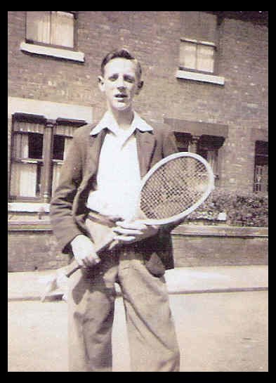
The above photos were sent to me by Roy Peak, who lived next door to my wife's family in Lime Street. The first shows Roy in the 1940s, off for a game of tennis at Errwood Park. The second shows Roys nieces, Sandra & Jean Kearn, in the back yard at 13 Lime Street in the 1950s.
Outside 11 Lime Street 1957, ready for the Whit Walks. Jean Kearn, Mavis Arnold, David Arnold & Sandra Kearn.
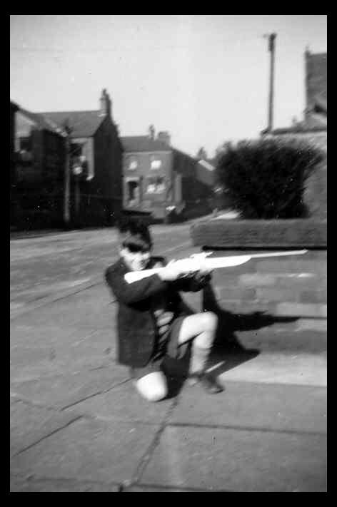
David Arnold on the corner of Lime Street & Livesey Street. Clare Road & Griffin Grove in the background. Looks like David got the gun for his birthday! Note the flagged pavement & the corner of the old Zion Church in the background. Barlow Road Memories. The following group of photos were E-mailed to me by Laurence Halstead, an old friend from Chapel Street School. They were taken around the Barlow Road area in 2002.
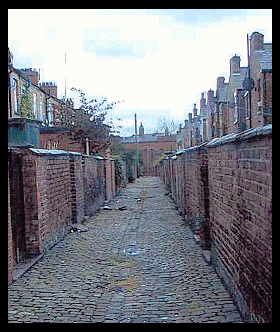
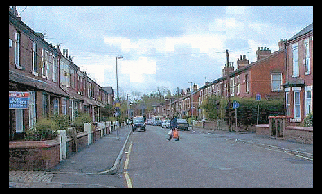
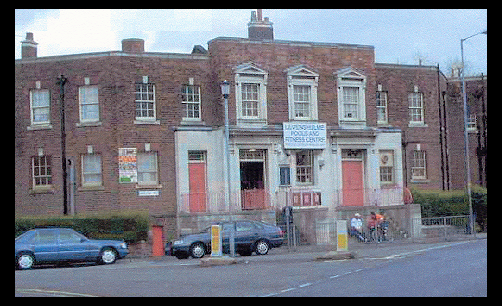
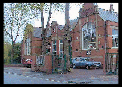
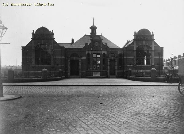
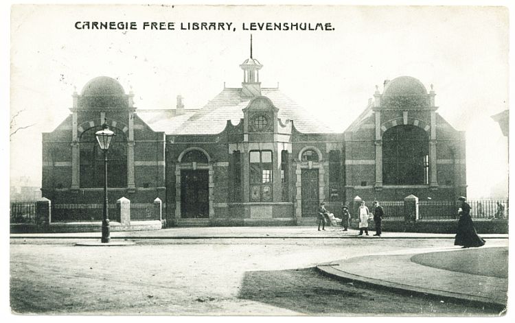
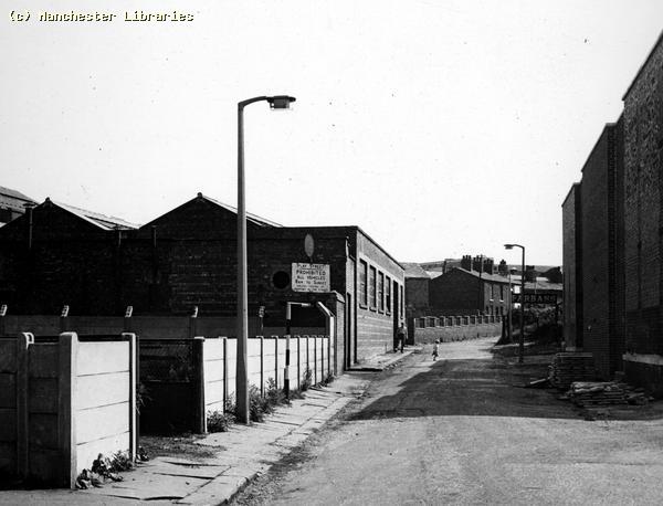
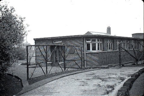
The photographs are as follows:- 1) Typical Levenshulme back entry, off Barlow Road, looking south to the rear of Levenshulme Baths. 2) Looking south from Manor Road corner of Barlow Road. 3) Levenshulme Baths, on the corner of Barlow Road & Cromwell Grove. 4) Levenshulme Public Library. This building was erected due to the generosity of the Andrew Carnegie Foundation. The Andrew Carnegie Foundation was an American philanthropic institution set up by the Scots born American Industrialist to fund such buildings worldwide. The photos below show the houses on Barlow Road that Laurence Halstead lived in between 1952 and 1968 ( via Laurence Halstead)
The two photos above show Levenshulme baths 1921, and Levenshulme Library in 1907, both on Barlow Road. Compare to the more contemporary photos above. (Manchester Libraries)
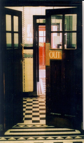
An interesting photo showing some of the interior doors of Levenshulme Baths. (via Brian Carter). ( This photo is the copyright of Neil Roland www.neilroland.co.uk)
Another postcard view of the library when it was known as the Carnegie Free Library. The Scots entrepreneur Andrew Carnegie, who made a fortune from owning coal mines in North America, funded free libraries all over the world.
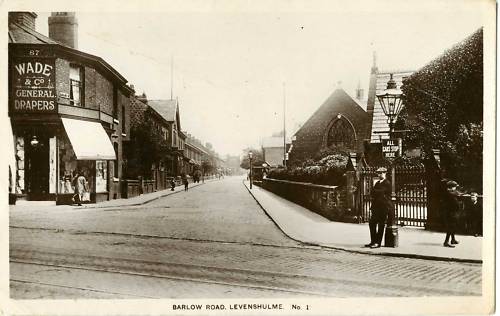
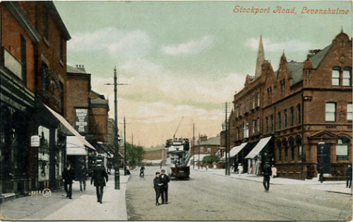
An early 20th century postcard view of the Stockport Road end of Barlow Road.
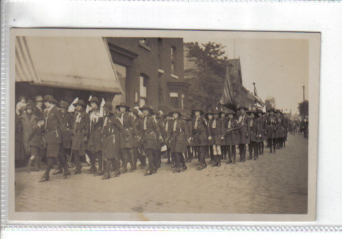
An interesting photo showing Girl Guides marching on the corner of Barlow Road & Stockport Road A Barlow Road Celebrity Does anyone remember Jack Atherton? Jack was a former professional wrestler who turned to promoting wrestling bouts in the 50s,60s and 70s. I called on him in the 1970s when he lived in a house on the bend of Barlow Road, near Manor Road. I was his Prudential agent. His living room/office was liberally plastered with old wrestling posters.
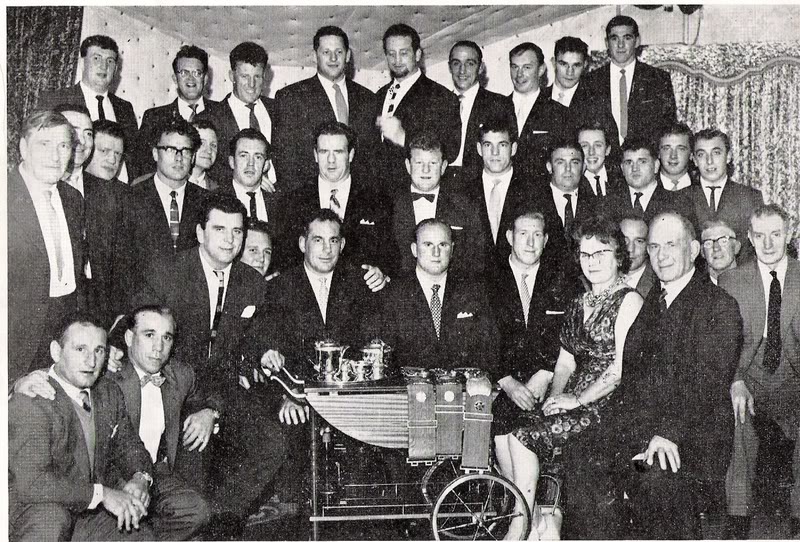
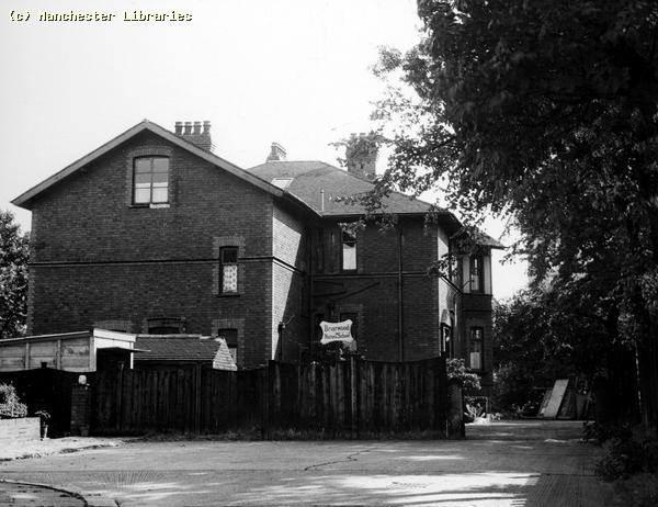
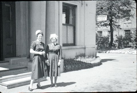
This looks like a wrestling gathering sometime in the 1960s. Jack Atherton is the gentleman on the far left in the second row.( photo via Stephen Mitchell) Does anyone remember the nurses home/residence which was located in Marcliffe Grove off Barlow Road? When was it used, where did the nurses work and does it still exist? The House was called Briarfields or Briarwood.
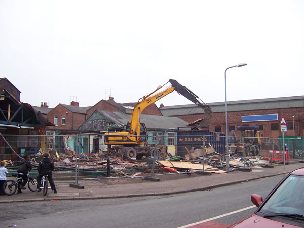
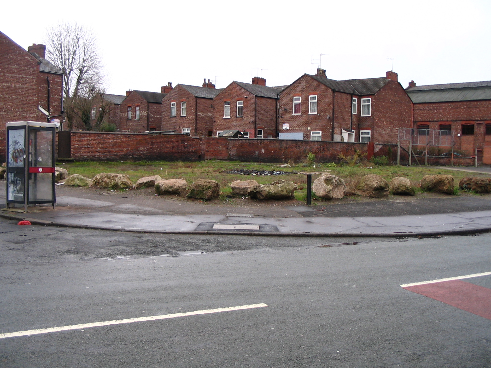
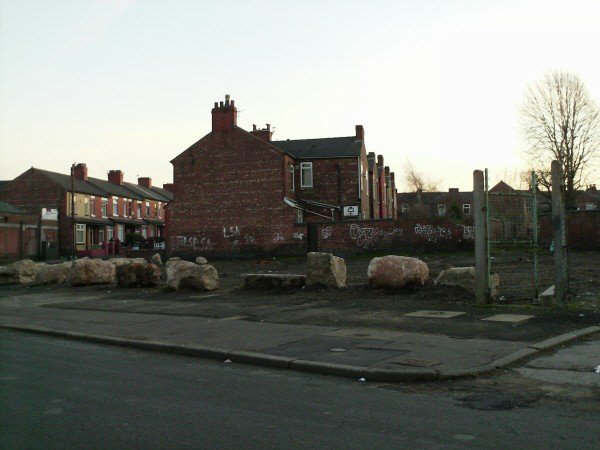
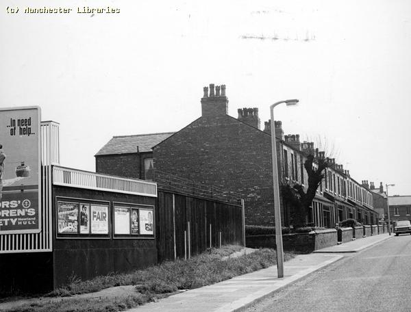
Nurses Home/School Marcliffe Grove (photo via Manchester Libraries & Anita Entwhistle) I received an Email from Ann Halton in March 2010 regarding the use of Briarwood. " You ask on your web page what Briarwood on Marcliffe Drive was used for. Briarwood was the training school for nurses working at the Duchess Of York. At the beginning of training the intake of nurses (there was an intake of about 10 girls every 3 months) was resident there for 6 weeks. There were practical rooms in the basement, and on the ground floor there was a dining room lounge, tutors room and classroom. Upstairs were 2 nurses dormitories and a bedroom for the sister tutor. The nurses returned to Briarwood for a further 2 weeks prior to their preliminary exam about 18 months into training, and for a final 2 weeks prior to sitting final exams. I trained at the Duchess Of York from 1962-1965, though I was a cadet nurse there from 1960, and have many happy memories of my time there". Chapel Street Memories Chapel Street ran from Stockport Road to Broom Lane, and was probably one of the original streets in Levenshulme. It housed residential , industrial & commercial premises. Also, it had a large school and a well kept park At the Stockport Road end, a familiar landmark was Sivories Cafe & Ice Cream Parlour. This later became Johnnies Cafe. Next to the cafe was a motor coach company, where you could book coach tours or day trips to the seaside. I believe that the company was called Hartley's Tours. Further along Chapel Street there was a bakery, a pharmaceutical company and two engineering works. There was a row of shops opposite Chapel Street School.
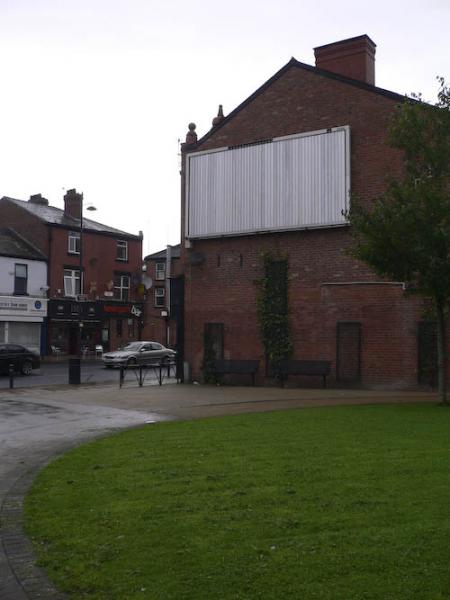
This green space, Levenshulme Green, was where Allendales greengrocers used to stand on the corner of Chapel Street and Stockport Road. Photo taken in 2007.
This photograph, taken in the early 1960s, shows the Wesleyan Chapel which probably gave Chapel Street its name! The chapel, built in 1797, was a simple and unremarkable building. It fell into disrepair, and was unceremoniously demolished in the 1970s. In more enlightened times it would probably have been restored, and could have made a fine local history museum. I don't know when it last served as a place of religious worship. I seem to remember that in the early 1950s it may have been used as a dining hall for Chapel Street School. Can anyone confirm that? The chapel grounds was a graveyard, and had many well worn grave stones, covering the graves. There was also a large tomb, surrounded by an ornate fence, by the main gate. Obviously the grave of an important family. Again, does anyone know who was buried there? I have to admit, as a child, I used to climb on top of this tomb and rock the large tombstone back & forth! In the background of the photo you can see the end of Robinsons Bakery on Ethel Terrace, and also a communal air raid shelter.( Photo: Looking Back at Levenshulme & Burnage ) Does anyone have any further photos of this old building?
The same corner December 2007. Not a pretty site!! Was the ground ever de-consecrated? Are there still graves there?
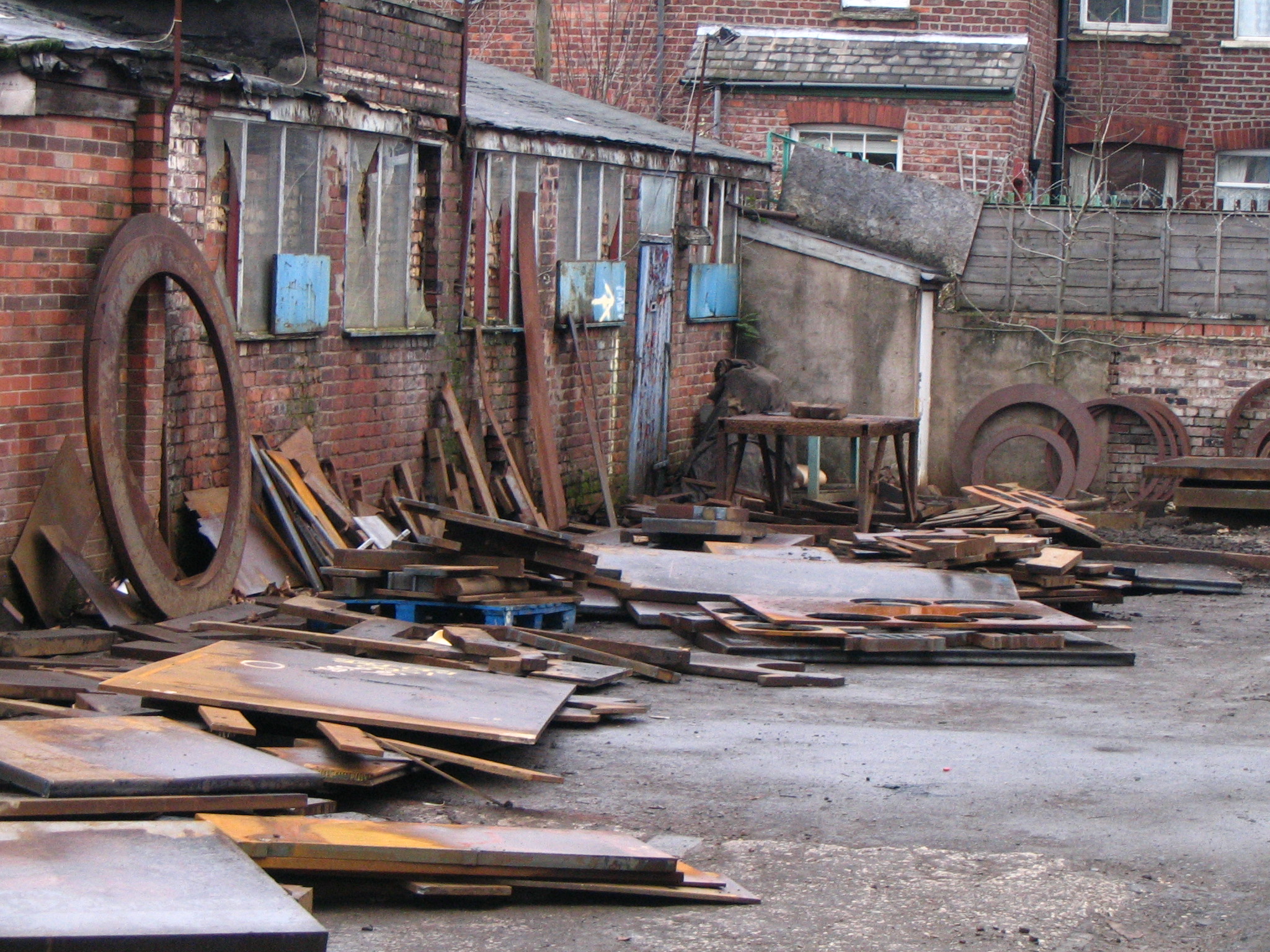
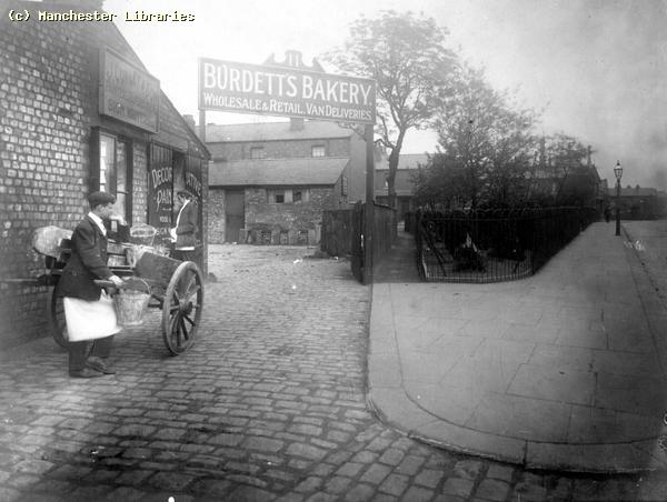
Two photos taken at the bottom of Chapel Street in the early 1960s. Old shops and Hubert Hacket's coach garage! Burdetts Bakery Burdetts original bakery once operated out of these premises before moving to modern premises in Farmside Place during the 1920s. Strangely the "new" premises were demolished some time ago, but the original building still exist . Now part of the general dereliction that is Chapel Street, I doubt that they have any future use!!
The Burdetts Bakery site on Chapel Street. Most of what you see in this photo still exists. The little "muddy entry" and the small grassy park, although in this photo the park is completely fenced off! ( Manchester Libraries)
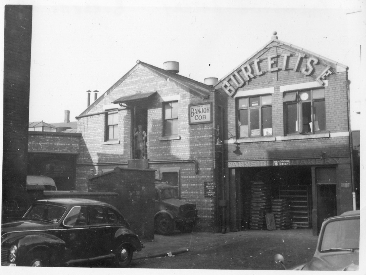
This photo was taken during the 1950s and shows Burdetts Bakery. Note the man hoisting flour bags from the truck and the name "Farmside Bakery. Also, I think that the black car is a Jowett Javelin Both this and the next photo were sent to me by Tim Burdett, a member of the Burdett family. What was a "Banjoh Cob"?( Via Tim Burdett)
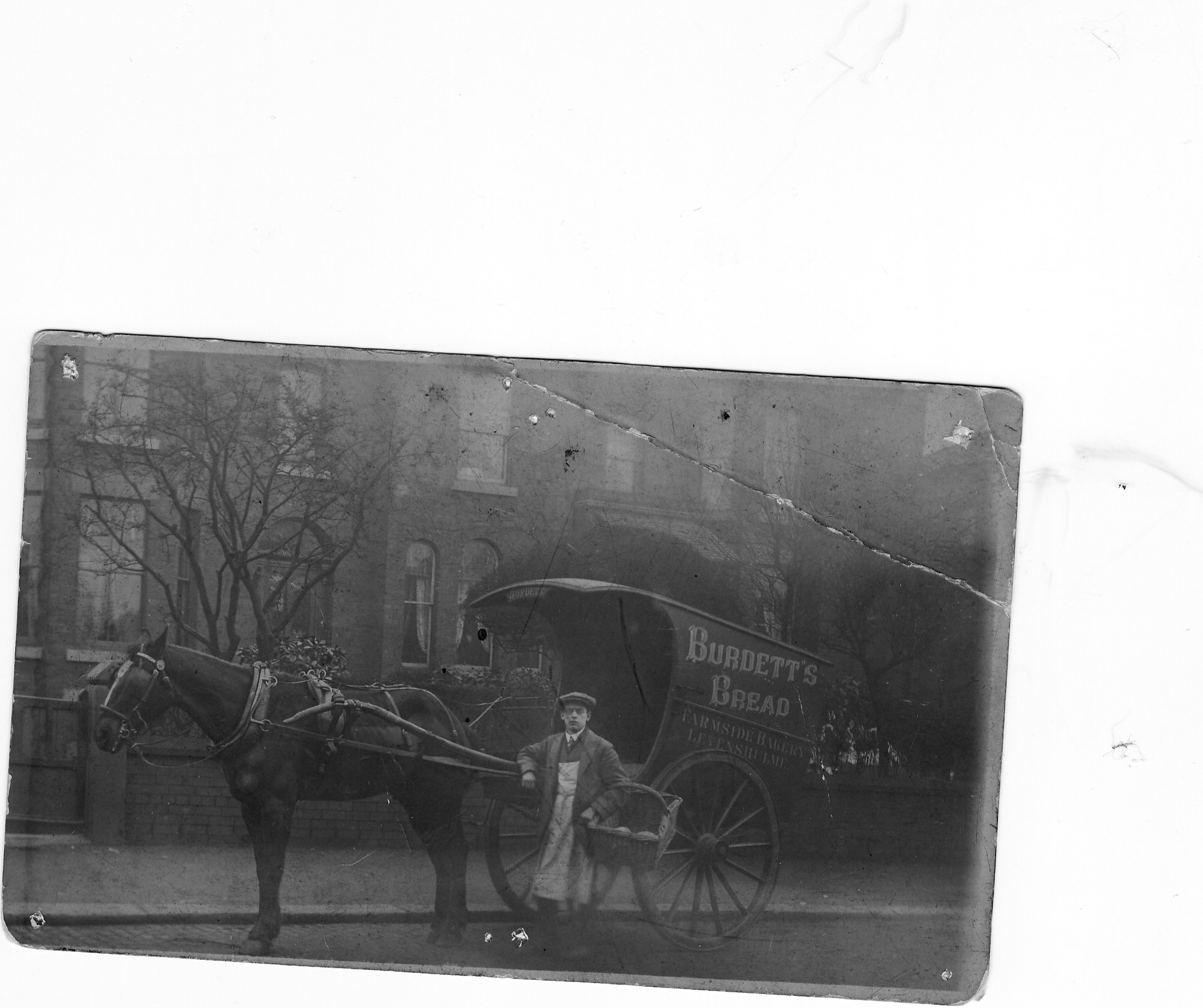
This very old photo shows a Burdetts Bread delivery van on Albert Road, Levenshulme. Probably early 20th Century. ( via Tim Burdett) Apparently this area was also the location of a Smithy, and the firm of H. Forrest and Sons and the Manchester Rubber Grinding Company Limited. H. Forrest and Sons were engineers and pattern makers. ( information via Barry Forrest).
This photo shows a little bit of the small grassy park on Chapel Street, looking towards Mercer Street and Cromwell Grove in 1959. ( Manchester Libraries) The Buffoline Noiseless Gear Company The Buffoline Noiseless Gear Company was situated at 19 Chapel Street near to the Atlas Works and Hough Hoseason. Does anyone have any history on the company?
Buffoline advertisement. The Atlas Engineering Works
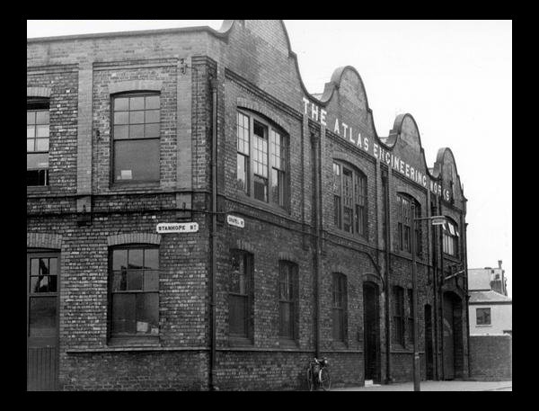
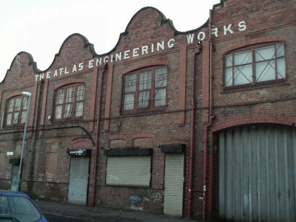
The Atlas Engineering Works on the corner of Stanhope Street and Chapel Street. I remember looking into this works through the open loading doors. Lots of wheels and pulleys, and the distinctive sounds and smells of an engineering works! What did they actually manufacture? ( Manchester Libraries)
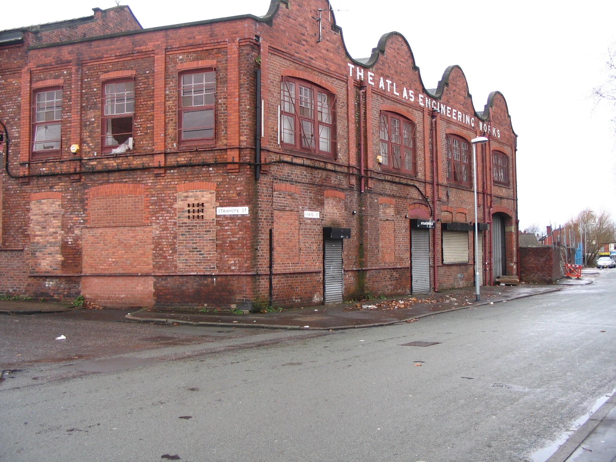
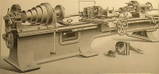
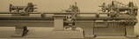
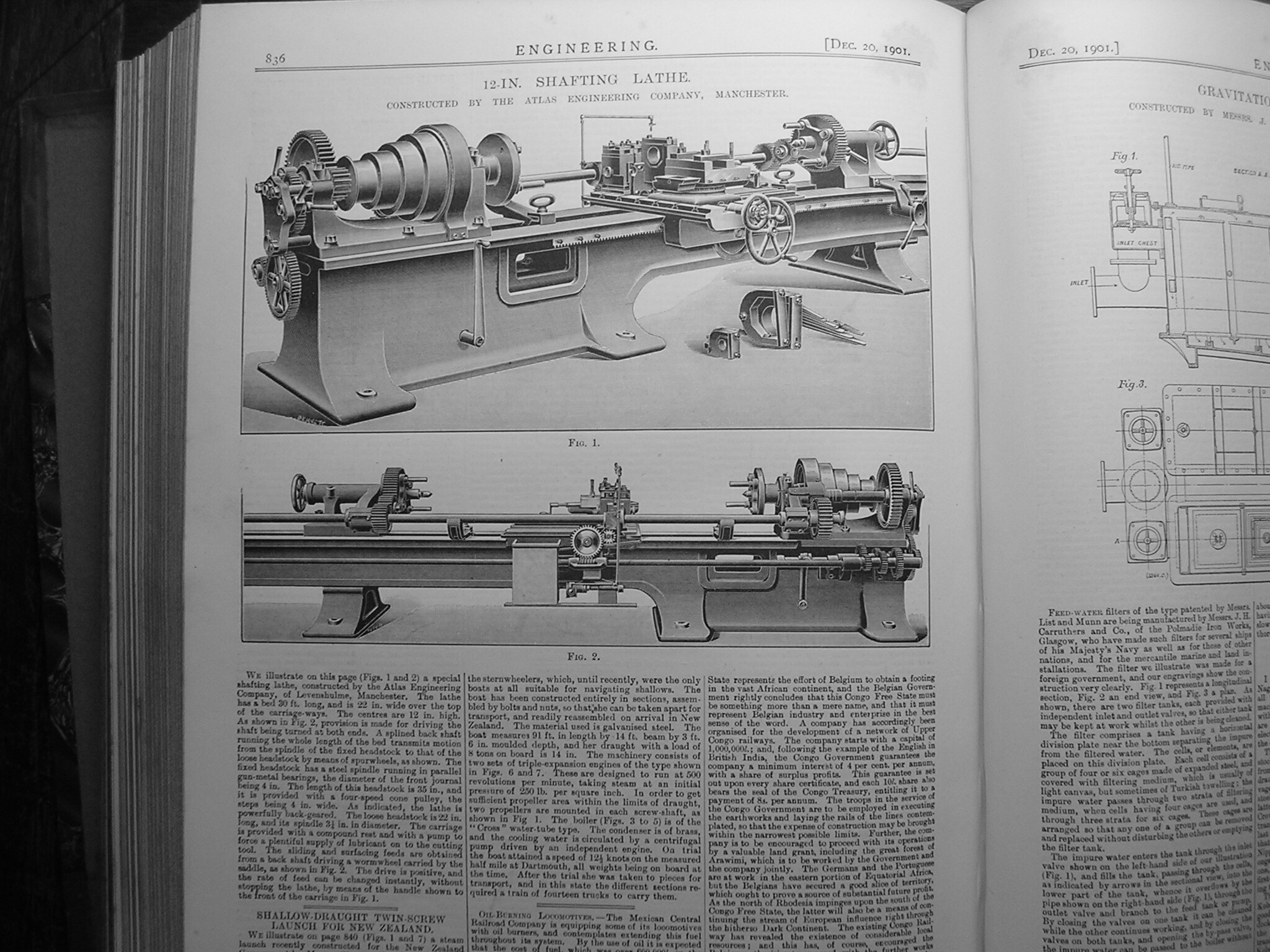
December 2007. Still standing, but for how much longer? Could part of this be saved , are there any plans? Update:- I posed the question, "What did Atlas Engineering make?". A recent correspondent, John Ditchfield, supplied the answer! Atlas Engineering manufactured precision lathes and machine tools. John supplied some illustrations of these which are included below.
The above illustration, probably from a trade journal called " Engineering", shows the two industrial lathes illustrated above and manufactured by Atlas Engineering at Chapel Street, Levenshulme. The journal is dated Dec 1901.
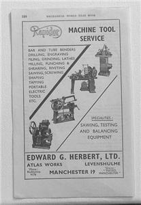
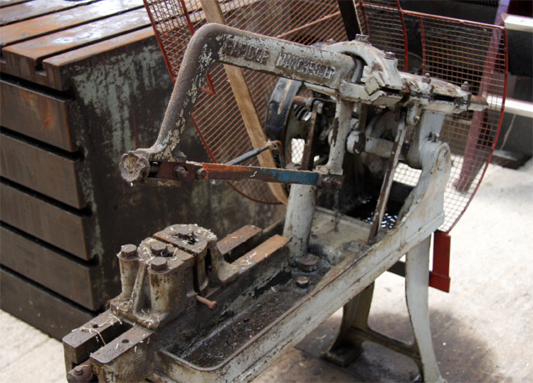
Several Edward G Herbert advertising images found on the internet. They show that the Atlas Works at this time were operated by Edward G Herbert Ltd, using the trade name Rapidor Machine Tool Service. Does anyone know when this would have been date wise?
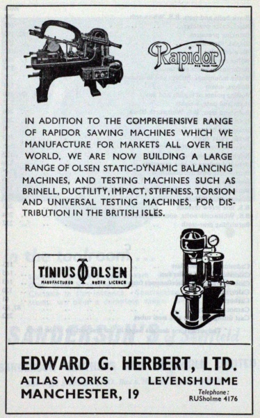
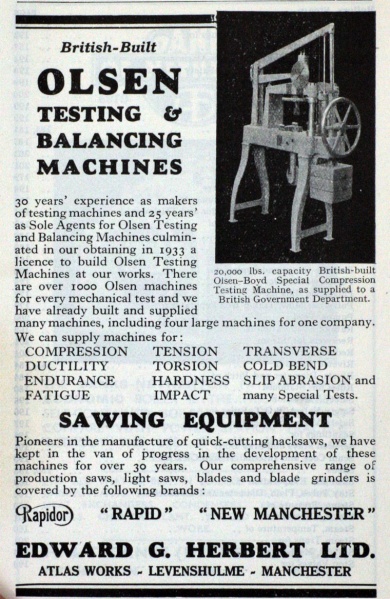
Another Edward Herbert advert. From Atlas Works. ( via Brian Carter)
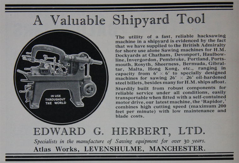
An Actual Rapidor Machine Tool still in use! (via Brian Carter)
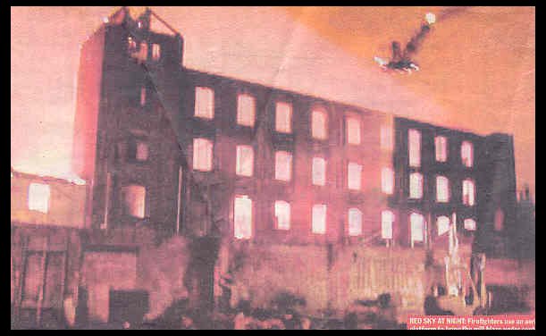
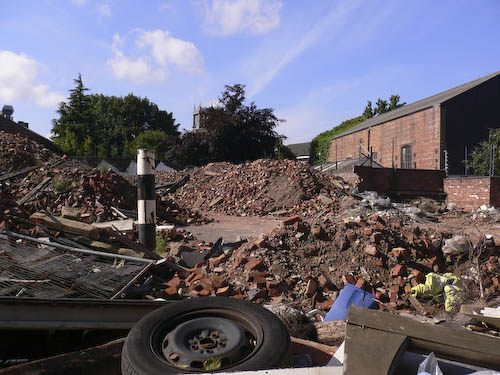
Atlas Engineering and Atlas Mill fire, March 23rd 2005
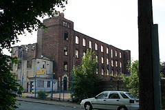
This dramatic photo, via the Manchester Metro News, shows the devastating fire that recently gutted the old Atlas Mill and Atlas Engineering works on the corner of Chapel Street and Stanhope Street. The four story Atlas Mill was for many years home to Hough Hoseason Manufacturing Chemists. Another piece of Old Levenshulme sadly gone! Does anyone know the age of Atlas Mill, and what its original use was. Apparently there was another mill called Albert Mill adjacent to this mill at the turn of the 20th Century. Albert Mill produced carpets. There were also two reservoirs on the site, located where St Mary's Church and rectory now stand.
These two photos show the burned out Atlas Mill, and the desolation with St Mary's Church in the background. The white building in front of Atlas Mill was originally the premises of Hough Hoseason Industrial Chemists.
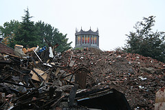
December 2007, looking like a scene from the Manchester "Blitz". What is to become of this site? Update: This site was the location of two firms during the 1950s and 60s. Buffoline Gears and Hough Hoseason ( Industrial Chemists)
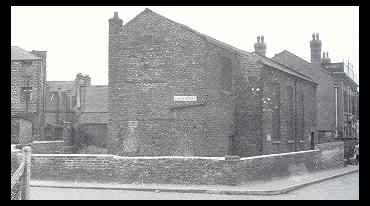
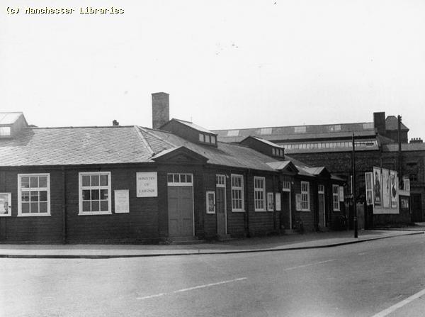
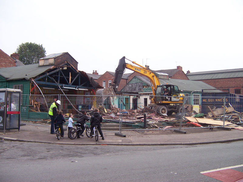
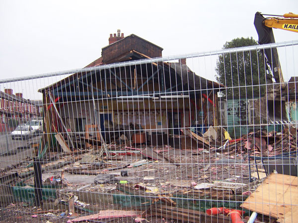
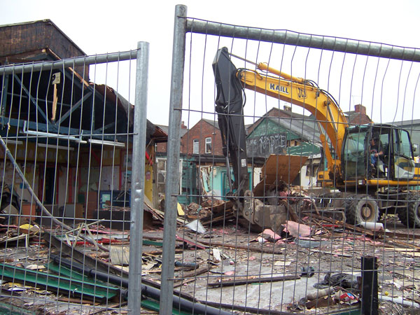
St Mary's Rectory in Elbow Street, with Atlas Mill in the background. Compare to the above photograph. Does the single story brick building still exist? What was its purpose? This photo was taken in 1965, before the new St. Mary's church was built. ( Manchester Libraries) The Labour Exchange. Corner of Chapel Street and Gordon Avenue This familiar landmark was recently demolished, after serving the Levenshulme community for over 80 years. Originally built as a "Labour Exchange", where you could find work or collect the infamous "dole". For more on its history see Jez Halls account in the "Memories" page.
Part of the "Labour Exchange", Gordon Avenue 1959 ( Manchester Libraries)
The Chapel Street Labour Exchange in 1965. Still a going concern at this date. In the background can be seen Atlas Works and Atlas Mill. ( Manchester Libraries)
Going-going-going-going!!! And finally!!!
GONE!!! December 2007. Any plans for this site, other than bonfires and fly-tipping??
This is the corner of Stanhope Street and Chapel Street 1965. The land behind the advertising hoardings was part of the Labour Exchange property.( Manchester Libraries)
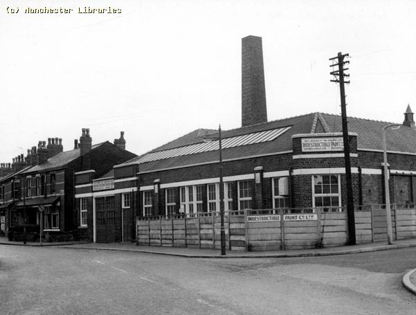
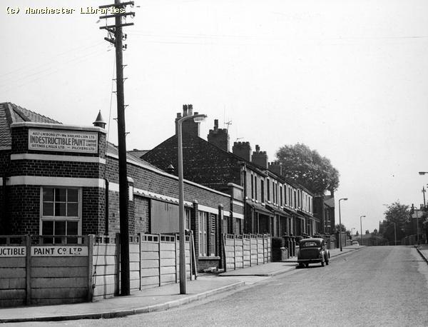
This is the corner of Gordon Avenue and Chapel Street 1965. The factory "Indestructible Pant Co. Ltd" was on the opposite corner to the Labour Exchange. The view is looking south. ( Manchester Libraries)
These are the shops on Chapel Street opposite Chapel Street School 1965. Most of these shop premises have now reverted to houses again! Apparently during the Second World War 1940 Squadron Air Cadets had their Headquarters over one of these premises. ( Manchester Libraries)
Believe it or not this is the same row as above. What happened to all the shops? Just one left!! December 2007
This photo shows the corner of Bankley Street and Chapel Street in 1965. Bankley Street did not have any houses, mainly the backs of shops situated on Stockport Road. The shop on the corner was, I think, a cobblers. On the other corner at some time there may have been a blacksmiths. Further up the street was the side of Robinsons Bakery. I am not sure what the single storey business was! ( Via Manchester Libraries)
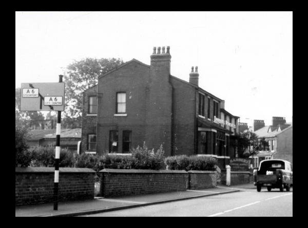
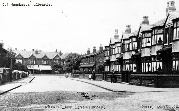
Broom Lane Memories Broom Lane is one of the major roads in Levenshulme , starting in South Levenshulme by the Wheatsheaf Hotel it meanders north until it joins Barlow Road. For most of its length it is lined with rows of houses and shops. It has very little commercial use. As a child I always felt that Broom Lane had "one foot in the countryside" , because of its proximity to the farms & smallholdings that lined the area to the east . From my house we could see the Pennines to the east which also emphasized that country connection! I have included a few photographs taken in the Broom Lane area. I would be interested to see more views of this important Levenshulme road.
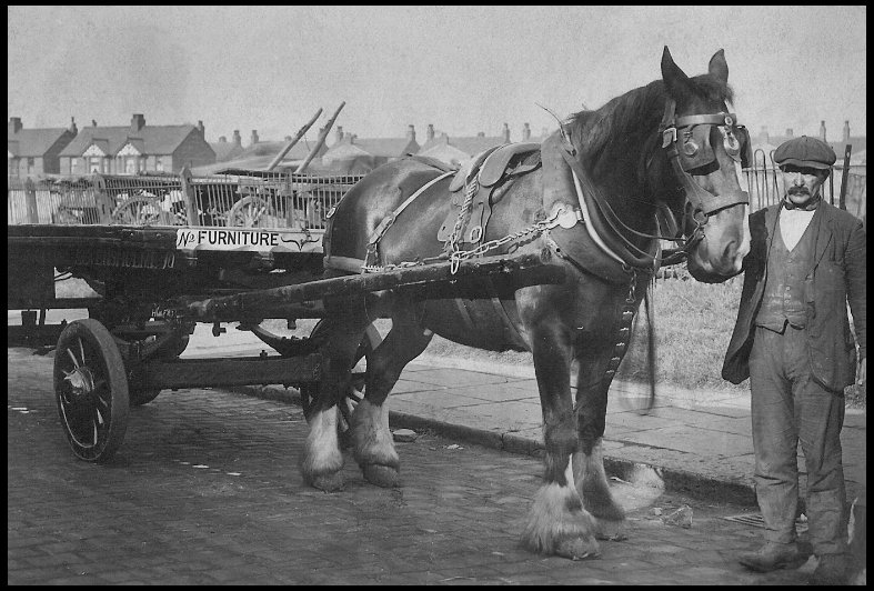
Barbers cart on Broom Avenue. Barbers removals owned the yard on the corner of Broom Ave and Broom Lane. Note the carts behind in the yard & houses in background on Bristol Ave.
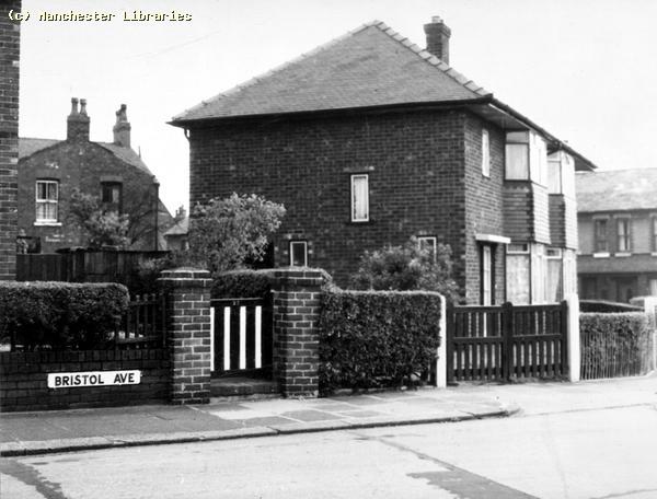
Houses on the corner of Broom Lane and Bristol Avenue. I remember these houses being built in the mid-1950s. We used to play inside the, as yet, unfinished houses and play in the sand piles. This photo was taken in 1965 ( Manchester Libraries)
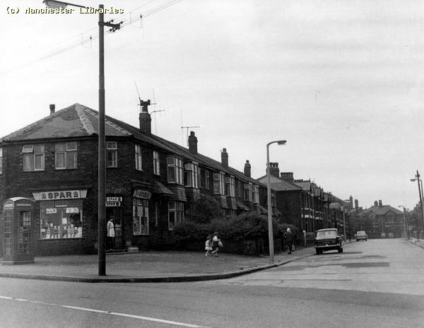
This view shows the Spar store on the opposite corner of Broom Lane and Bristol Avenue. This was our local " corner shop". Does the Spar organization still exist? The Spar was a confederation of small shopkeepers set up to compete with the new phenomenon of supermarkets during the late 1950s. ( Manchester Libraries)
Early 18th Century cottages on Cradock Fold. This picture from the 1950s shows the cottages & the similar cottages on Broom Lane. They were all demolished in the 1960s. They probably needed to be, but another example of the lost chance to preserve local historical sites!
Another view of Craddock fold in the late 1950s. Note the old gas lamp and unadopted dirt road. ( Manchester Libraries)
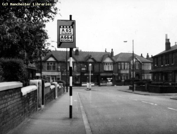
Broom Lane 1910. This photograph shows the "very" narrow beginning of Broom Lane in the early part of the 20th Century. It is not much wider today considering the volume of traffic that now uses this corner. Note cobbled road surface, narrow pavement on west side which is still there!! Also two tier pavement on east side, also still remaining to this day.
Another view of the Stockport Road end of Broom Lane in 1965. This is the west side with the very narrow pavement. Nothing much has changed since the earlier view. ( Manchester Libraries)
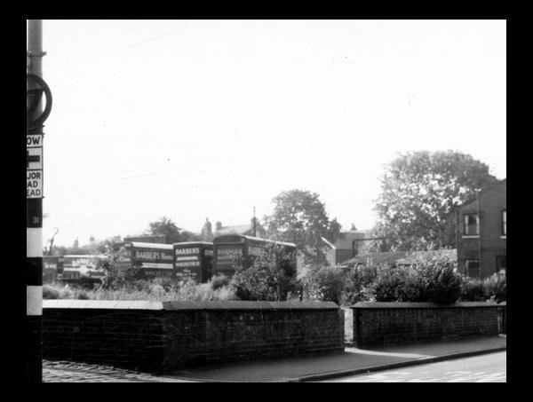
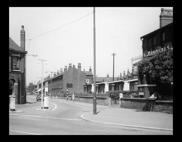
The Broom Lane prefab site after they were demolished. Note Barbers removals vans. (Manchester Libraries)
Closer to the corner showing the garden walls of the demolished prefabs, taken in 1965. ( Manchester Libraries)
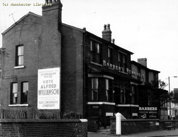
Another view of Barbers Removals, taken sometime in 1965 during the local council elections. "Vote Alfred Williamson", did he win? ( Manchester Libraries)
The corner of Broom Lane & Stockport Road in 1959. Note the pre-fab bungalows just beyond Barbers Removals. My friend Brian Carter lived at the farthest bungalow until the early 1960s when these were all demolished, and Grasmere Old Folks Home was built on the site.( Photo Manchester Libraries)
A similar view to the above. Taken during a quiet day, possibly pre-WW1. (via Brian Carter)
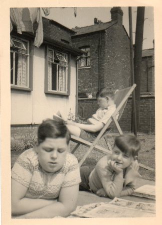
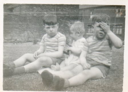
I made contact with my old friend Brian Carter last year, 2008. And we met up in Orlando, Florida, USA. Our first meeting in nearly 40 years! ( See my reunion pages) Brian lived in the pre-fabs at the bottom of Broom Lane , opposite the back of the Wheatsheaf Hotel. He recently sent me these photos from the 1950s. 1) this photo shows Brian with his brothers Michael and David at the back of the pre-fab reading their comics, Brian is the boy in front looking at Michael, David is in the deck chair. 2) This photo from the early fifties shows David, Brian and Michael. The houses in the background are on Julius Street. Brian looks very young. I never knew you were blond Brian!! ( Photos via Brian Carter)
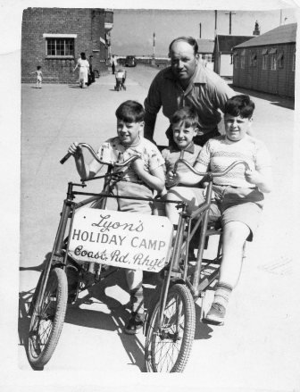
Another photo of the Carter boys and Dad, Stan Carter, on holiday at Lyons Holiday Camp in Rhyl, North Wales. Brian is in the middle. Second photo shows Brian's Mum Mary Carter. My Mum and Brians Mum were good friends and would spend "hours" chatting on Stockport Road. (via Brian Carter)
Brian Carter and his brothers at Brians 40th Birthday Celebration. Brian, Mike and David. ( via Brian Carter)
The Carter boys visiting Father Christmas. Nice beret Brian!! ( Via Brian Carter)
Brian and his Dad, Stan Carter, on holiday. Stan was way ahead of the times with his "Hairstyle" ( Via Brian Carter) See more of Brian Carter on the "Memories Page" Whit Walks.
Byrom House towards the north end of Broom Lane. It looks a fairly grand house for the area. Apparently now demolished. The photo was taken in 1934. ( Manchester Libraries)
The two images above show Byrom House. The first shows a side view in 1899. The second shows part of the garden in 1896. The house looks like it was owned by a wealthy family. (Manchester Libraries)
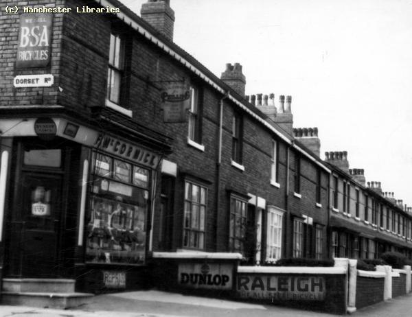
Almost opposite Byrom House was McCormicks cycle shop, on the corner of Dorset Road. They also sold Dinky Toys. I remember my friend Tony Woodford buying a Dinky Rolls Royce Silver Wraith from this shop. it was the first Dinky to have windows and independent suspension!! Note all the old enamel signs, Dunlop, Raleigh, BSA. These would be worth a small fortune today as collectibles! ( Manchester Libraries)
Two similar views taken at the Barlow Road end of Broom Lane. The first taken in 1900 shows trees and bushes on the north side of Barlow Road. The second taken in 1912 shows that Byrom Parade has been built. ( Manchester Libraries)
The same view as above in 1965.Byrom Parade in the background. (Manchester Libraries)
A postcard view showing Byrom Parade, Barlow Road at the junction of Broom Lane.
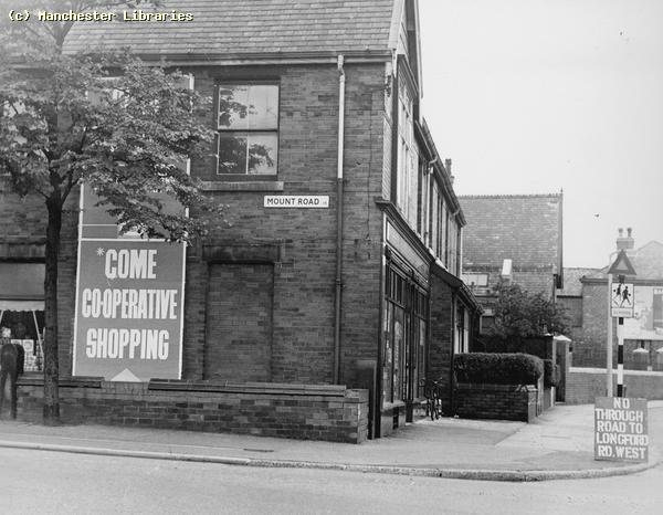
Mount Road Memories Mount Road ran from the corner of Barlow Road, near St. Marks Church, to Hyde Road, Gorton, near the Lake Hotel, Belle View. I do not know when Mount Road was built, but on the 1907/1905 Ordnance Survey map it is only shown as Back Lane. On the map it is shown as a lane leading to the Levenshulme Print works and Print Works Farm. I would imagine by the age of some of the houses along Mount Road that the road was built some time before the First World War.
Mount Road/Barlow Road corner in 1965. There was a Co-op store on the corner. Note St. Marks school in the background. ( Manchester Libraries)
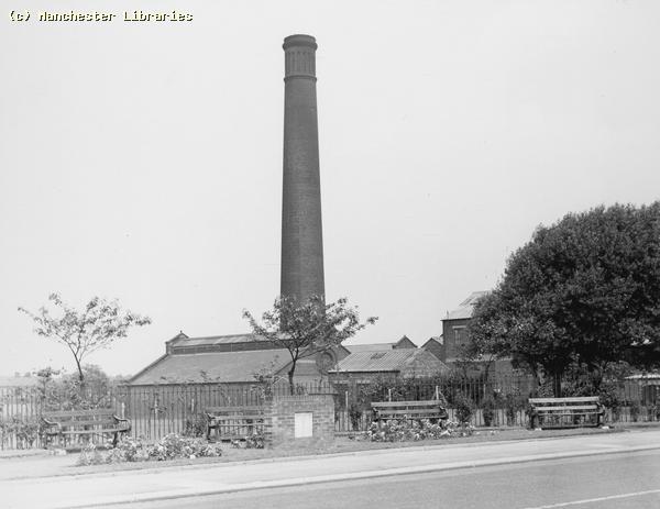
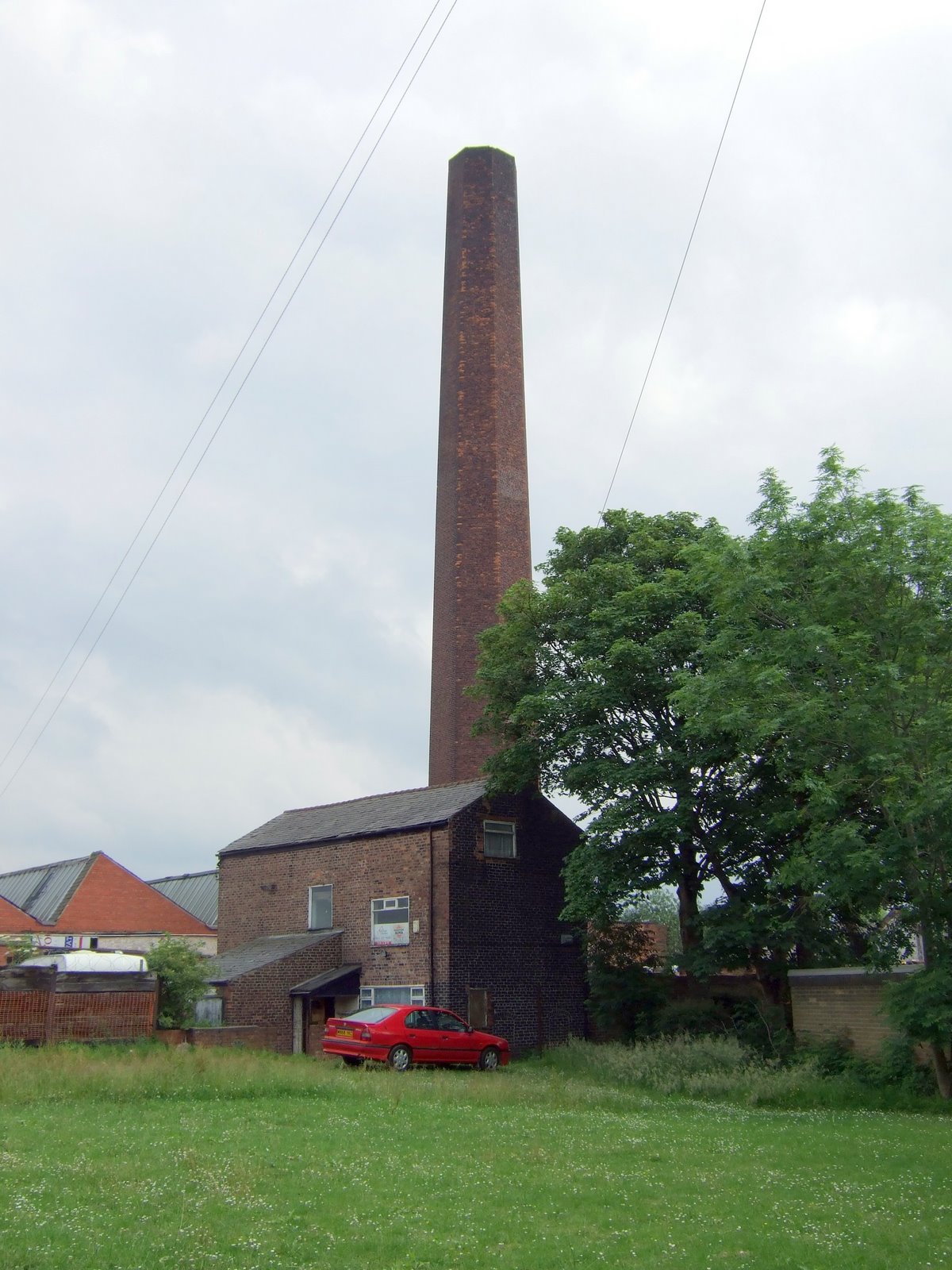
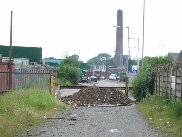
Factory and chimney off Mount Road 1965. Not quite sure where this is! Answers please! (Manchester Libraries)
Levenshulme Printworks chimney from Mount Road 2010.
Two views of Sandfold Lane, near the Print works, in 2007. Typical Levenshulme dereliction!!
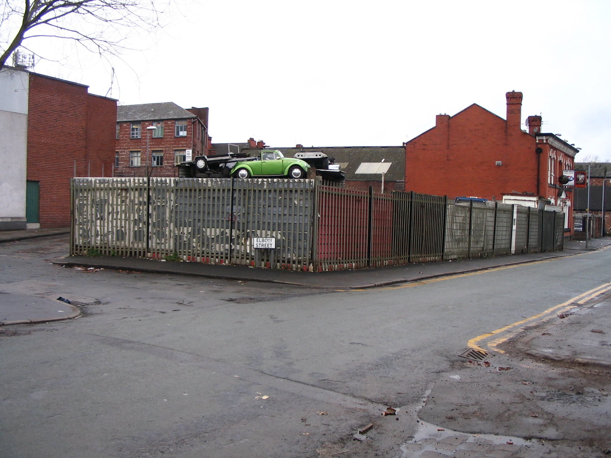
Elbow Street This oddly named street ran from Stockport Road to Chapel Street. It had a bend about 100 yards from Stockport Road, making the street look like an arm with an elbow. This could be how it got its name! There were old houses close to Stockport Road, and more houses on the west side of the street as you got closer to Chapel Street. There were also industrial premises on both sides of the street, and a electricity sub-station nearer to the Chapel Street end.
The top of Elbow Street corner with Stockport Road 1965. You can see some of the older houses, which have all since been demolished. St Mary's new hall in the background along with old mills.. (Manchester Libraries)
Elbow Street corner of Chapel Street 1965. Note Electricity sub-station on the right. Elbow Street was designated a play street and vehicles were banned between certain times. Note the sign beyond the Street lamp. Also the scarcity of street lamps. 9 Manchester Libraries)
More Levenshulme dereliction near Elbow Street 2007. Note the black and white post, a left over from the wartime "blackout" era! Can anyone figure out the exact location. (via the internet) Windsor Road & Osborne Road Memories Both Windsor Road & Osborne Road, links to Royal residences*, have family links to myself. My maternal grandparents, the Wilsons, lived on Windsor Road in the 1940s. My parents, Tom & Doris Nixon, lived on Osborne Road. Both myself and my sister Rosemary lived on Osborne Road as young children. ( * Royal Residences! Windsor Castle and Osborne House on The Isle Of Wight)
Windsor Road early 20th century (via Ebay)
Osborne Road early 20th century (via Ebay) X marks the spot!! Central Avenue Memories
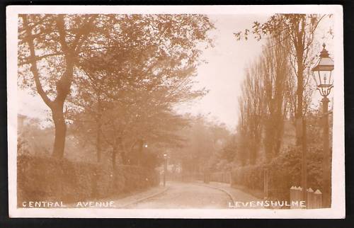
An early 20th Century postcard view of Central Ave. Very much a "posh" area of Levenshulme in those days. (via Ebay)
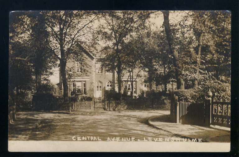
More Central Avenue. Very "up market" !! Rushford Avenue Memories
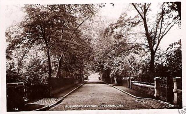
This view of Rushford Avenue was found on the Internet. Very leafy!!
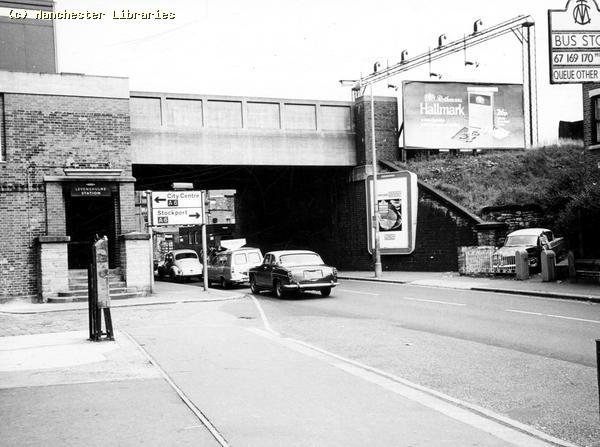
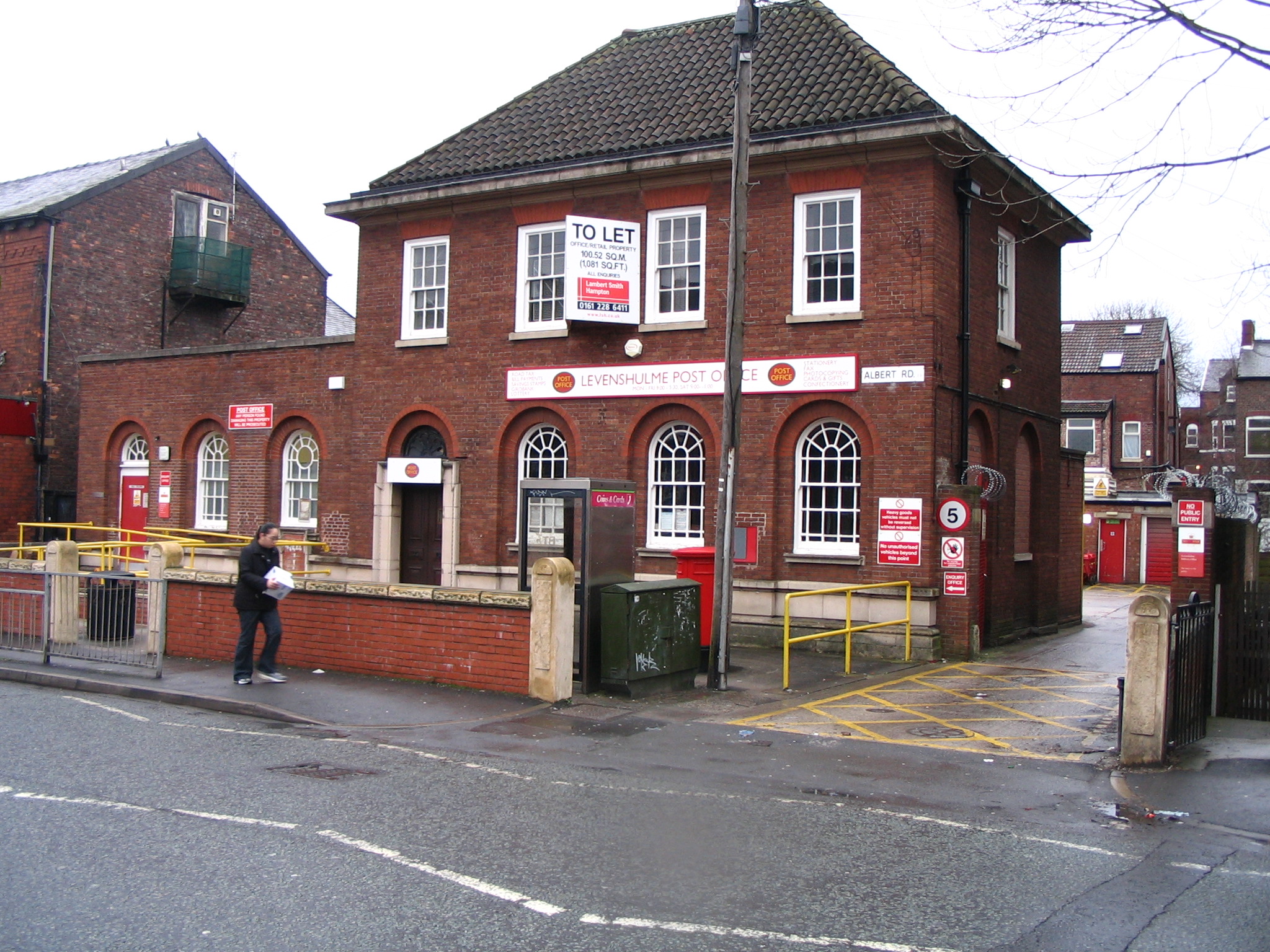
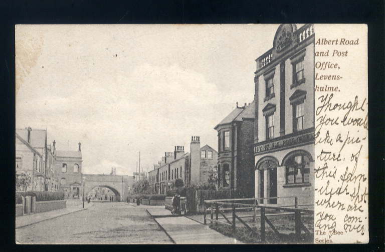
Albert Road Memories. Although Albert Road was, and still is, a fairly narrow road. It is one of Levenshulme's busiest roads. It provides the main East/West route through central Levenshulme. In the early 20th Century Albert Road was the area where middle class families settled because of its easy access to Manchester from Levenshulme North railway station.
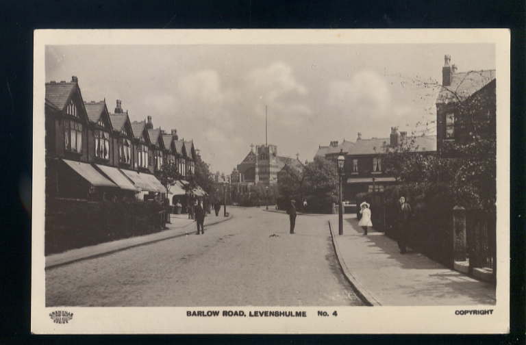
The shops on Albert Road, near the railway station. Photo dated 1913.The shops look well stocked & prosperous, an indication of the middle class nature of this area prior to the First World War.( Photo Via Cliff Garratt)
The shops on Albert Road In 1971. (Manchester Libraries)
A view looking East from the shops. Note the cigarette machine and the old bus stop sign showing the familiar 169, 170 bus routes. ( Manchester Libraries)
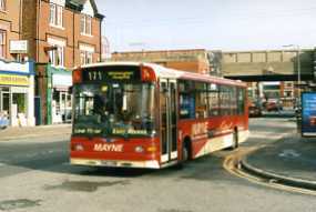
A Maynes single deck bus in the same location as above.
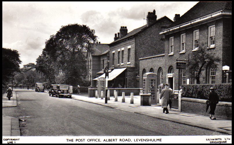
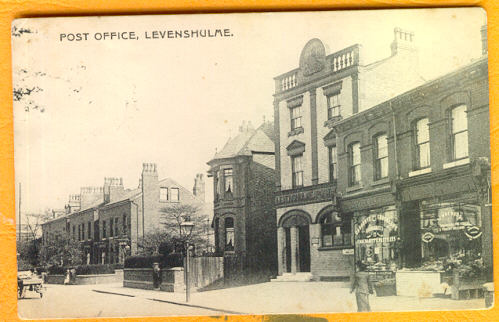
A very nice photograph of Albert Road Post Office in the early 1950s. This was Levenshulme's main post office. Broadley's Travel Agency was located in the premises beyond the post office. Note the early TV aerial on the chimney. Also little evidence of street lighting.
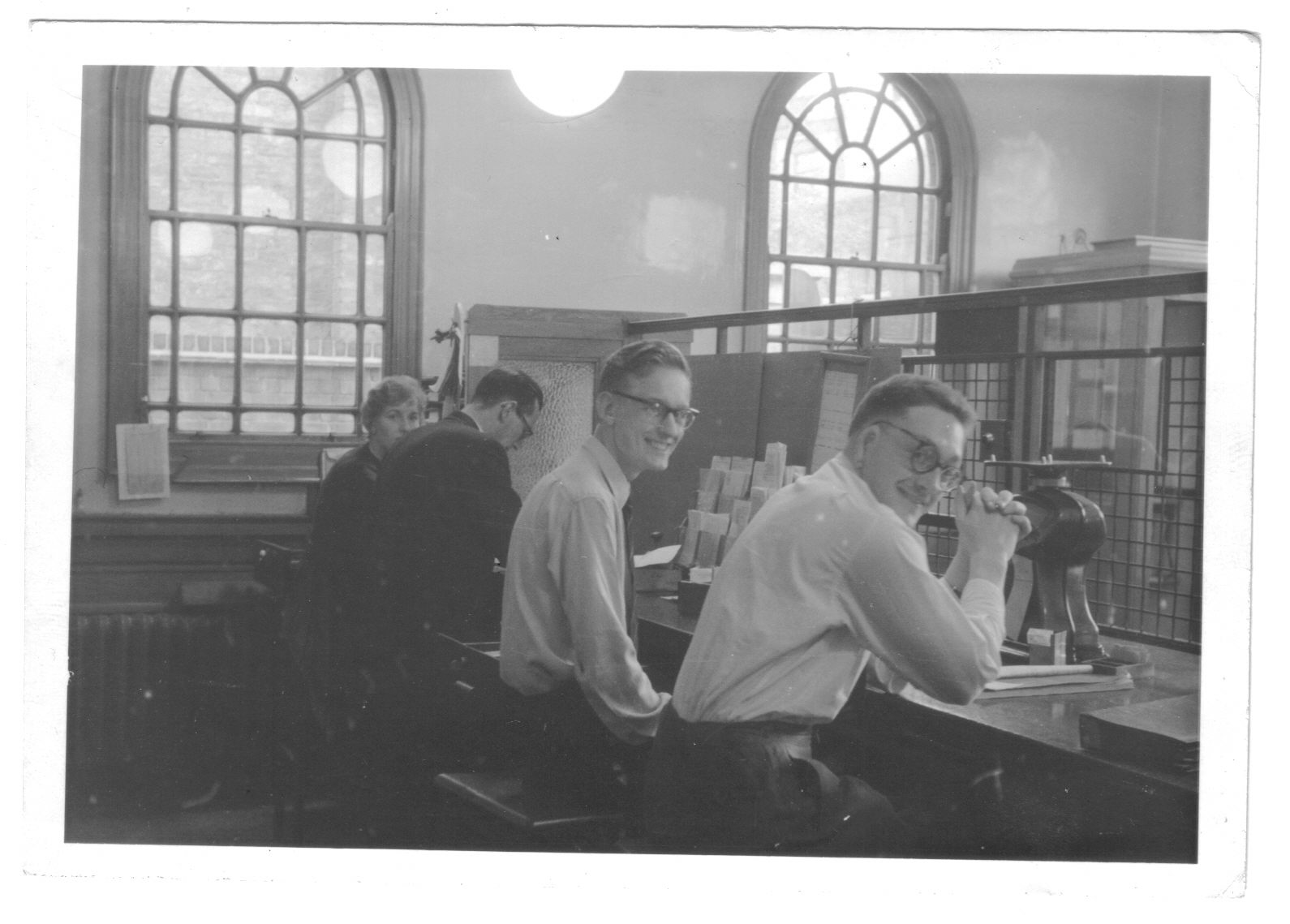
This photo taken behind the counter at Albert Road Post Office in 1960 was sent to me by Mike Berrell. Mike who worked as a clerk is nearest the camera. A unique "behind the scenes" photo. The post office always had a peculiar smell. (via Mike Berrell)
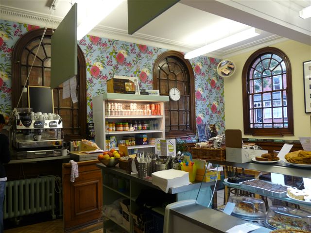
Inside the Post Office Deli, August 2010. A good comparison with the preceding photo. "Could I have a Pastrami on Rye Bread, and a Two Shilling Postal Order please!!" ( via Mike Berrell)
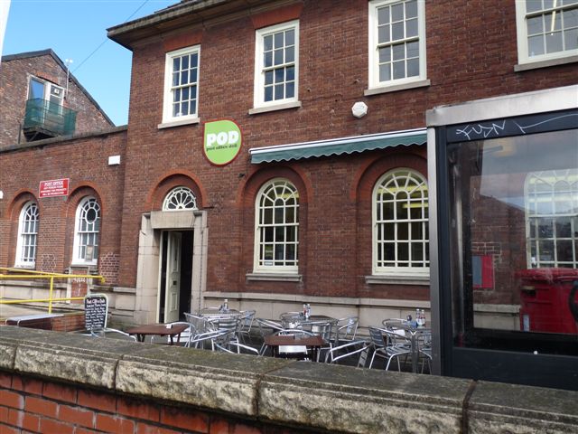
Albert Road Post Office December 2007. No longer in use as a post office. Hopefully some use can be found for this fine building. Update:- The building is now a deli and cafe, June 2010. See below.
August 2010, now the Post Office Deli (POD). Who would have thought in the 1950s that people would be eating their lunch on a patio, on Albert Road!! (via Mike Berrell)
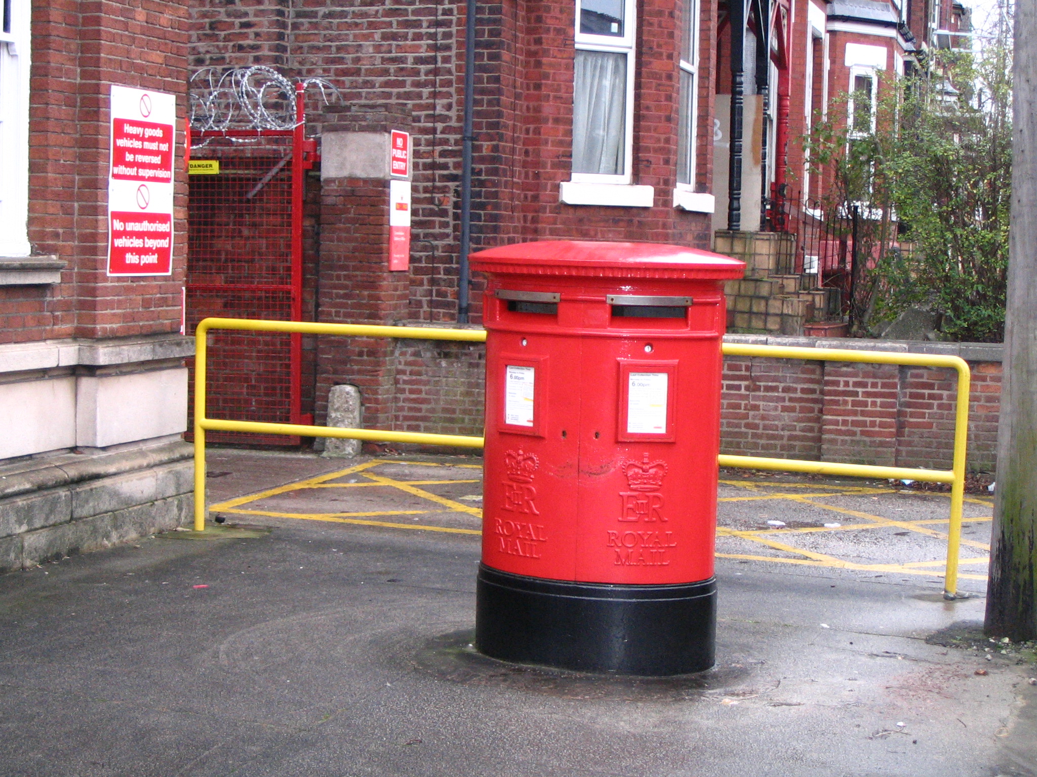
Still standing, and in use, a double pillar box outside the old Albert Road Post Office.
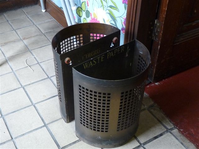
Remember these? Post Office issue waste paper baskets! Still in use in the Post Office Deli. (via Mike Berrell)
This photo from 1905 shows the original Levenshulme Post office on Albert Road. This scene has changed little in over 100 years. The building is now partly used by ALL Fm 98, the local radio station. Note the Royal coat-of-arms on the roof pediment. A unique building, Hopefully it will be preserved in the future! Question? Why is the building at an angle?
Another postcard view of the original post office. Looks like this was taken when the shops next to the post office were being built.
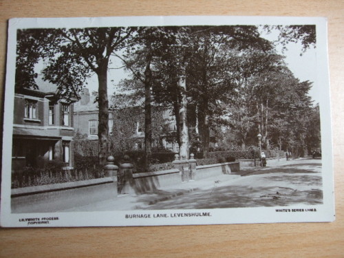
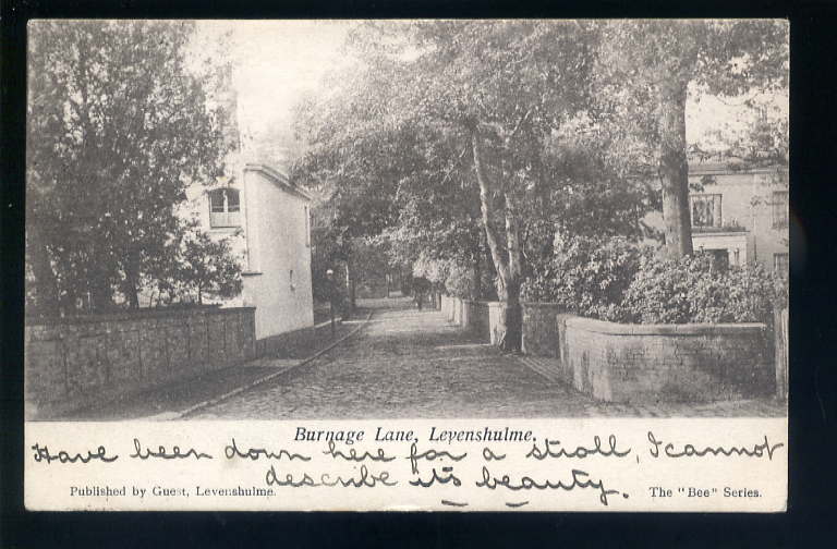
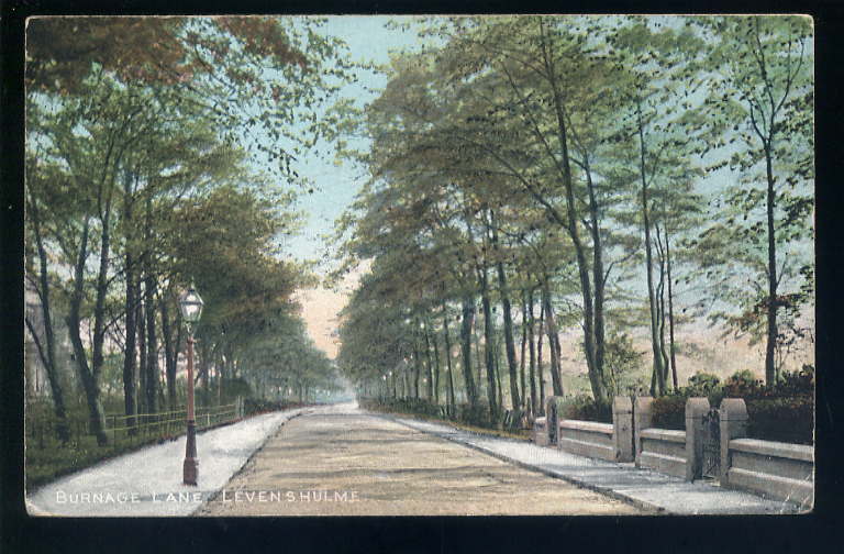
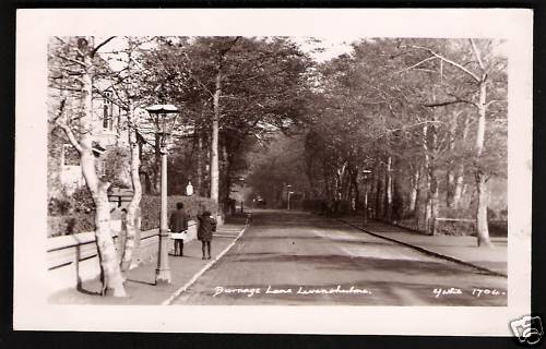
The house on the left of the photo was the home and surgery of my dentist, George Armitage. George Armitage built a number of hovercraft at these premises. I would like to find out more information on his exploits! Update: I contacted the Hovercraft Club of Great Britain and I have received more information on George Armitage ( See the Aviation pages) Burnage Lane, Levenshulme! There are many postcards labeled Burnage Lane, Levenshulme. Can anyone give the exact location to the following views?
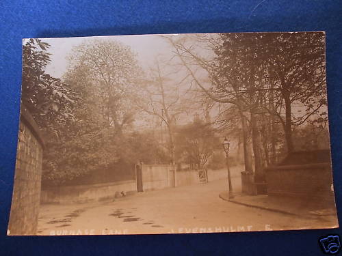
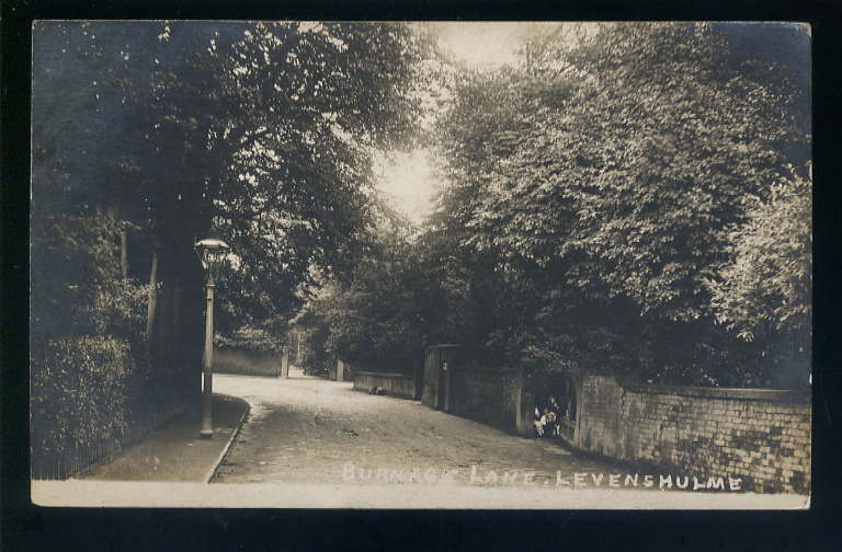
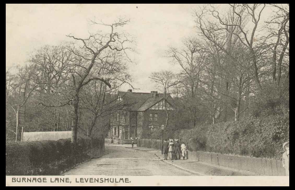
Yes, but where? ( via the internet)
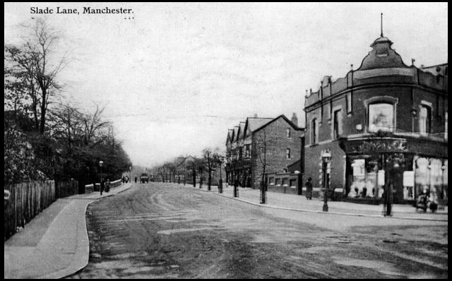
I have come across several postcard views of Burnage Lane, Levenshulme. Where did Burnage Lane, Levenshulme end and Burnage Lane, Burnage begin? Slade Lane Memories Slade Lane ran from Burnage Lane, Duchess of York hospital, to the junction of Stockport Road and Slade Lane in Longsight. For most of its length it ran through and formed the western boundary of Levenshulme.
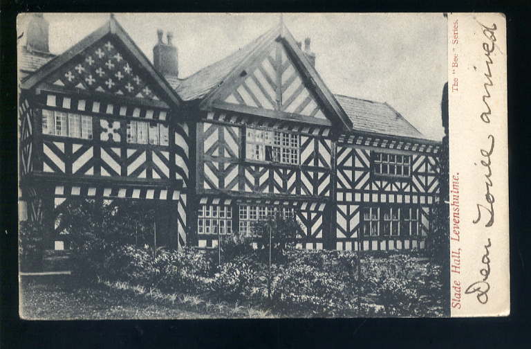
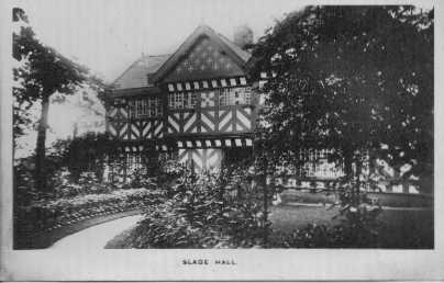
Probably the oldest building in South Manchester. Elizabethan period? Survived the coming of the railway which runs along its east boundary. Is the hall situated in Longsight or Levenshulme?
Another postcard view of Slade Hall from the 1950s or early 1960s. How does it look in 2012?
This is an interesting view of the corner of Slade Lane, Albert Road & Moseley Road. The building on the corner was a Co-op store. View probably from the 20s or 30s. ( Photo via Les Cotton).
The same location in an earlier time.
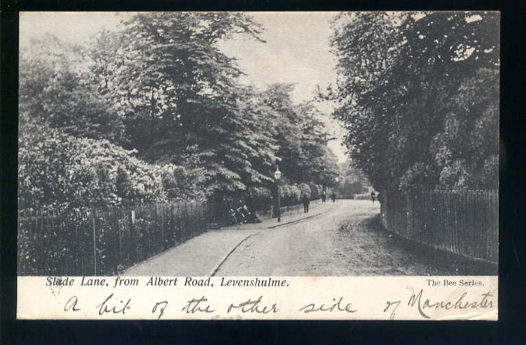
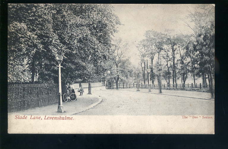
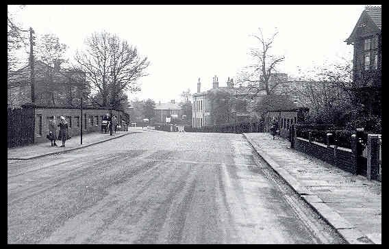
Slade Lane, but exactly where?
This postcard view, pre First World War, states that it shows Burnage Lane, Levenshulme. I believe it to show the reverse view of the previous photo, note the fence and lamp post! The House in the background still stands on the corner of Albert Road and Slade Lane. Was Slade Lane originally Burnage Lane at this time?
Slade Lane bridge, October 1949. Not much has changed here in 55 years! The Fallowfield Loop line ran under this bridge. Duchess of York Hospital in the right background. This bridge marks the Levenshulme /Burnage boundary.
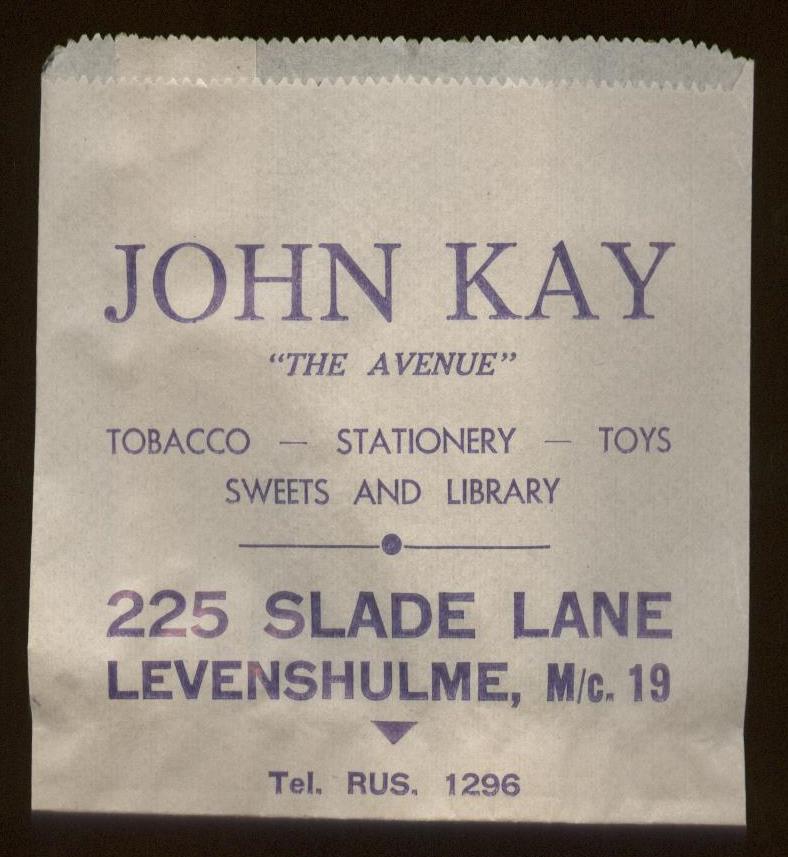
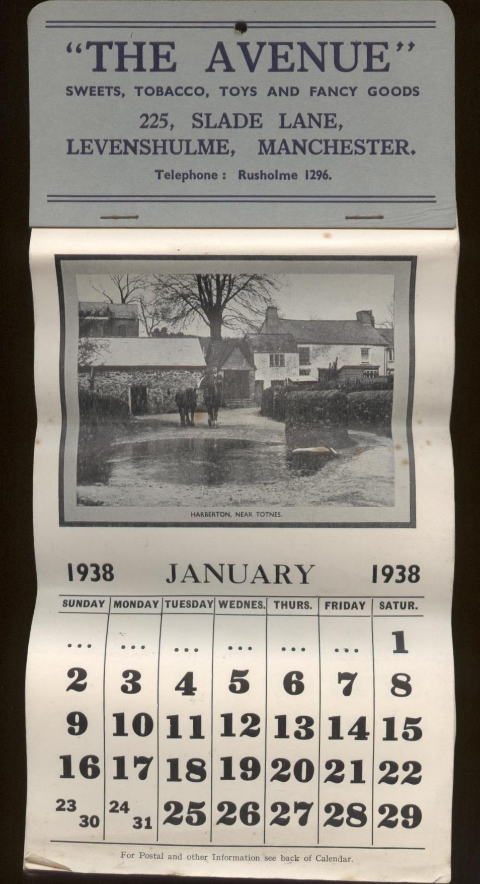
The above two images were sent to me recently. They show a "sweet" bag and a 1938 calendar from a shop owned by a John Kay. The shop called "The Avenue" was at 225 Slade Lane. The premises are now part of Arthur Doodson Insurance Brokers. (images via Dave Skinner who runs a collectables business. See Links page) West Point Memories West Point is situated on the North West side of Levenshulme. Slade Lane widens at West Point, and this was probably to accommodate the tram car terminus which was situated in the middle of the road. The name West Point always had an association in my mind with its namesake in the USA, the military academy at West Point in Virginia. I don't know where the name actually came from!
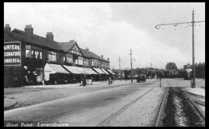
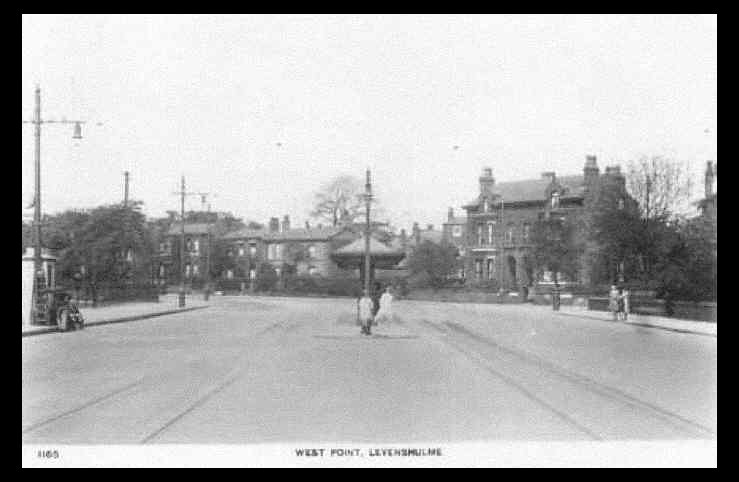
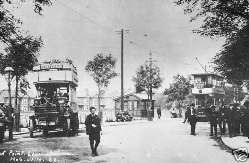
Two views, probably pre-war, showing the shops & tram terminus at West Point. The tram shelter, was removed sometime in the 1960s, but a similar one still exists at the entrance to Heaton Park.
Another view of West Point possibly before the First World War! Note both the open topped omnibus and the covered deck tramcar.
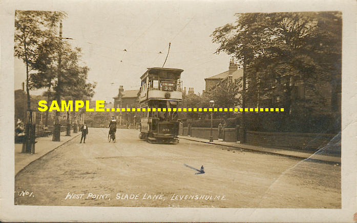
Another postcard view of a tramcar at West Point. Sorry about the "Sample". Some people who list things on Ebay are not "much fun"!! ( via Ebay)
Ratcliffe Street Memories. My best friend, Tony Woodford, lived at 25 Ratcliffe Street. I spent many hours playing in the vicinity of this street. It runs between Chapel Street & Cromwell Grove, and was built on a very gradual incline. It had a shop at both ends in the 50's & 60's. Both were Grocers I seem to remember.
This photograph shows Ratcliffe Street sometime after the First World War, and it shows the residents celebrating Peace Week. Does anyone have any knowledge of this event? The incline in the street is very noticeable in this view.
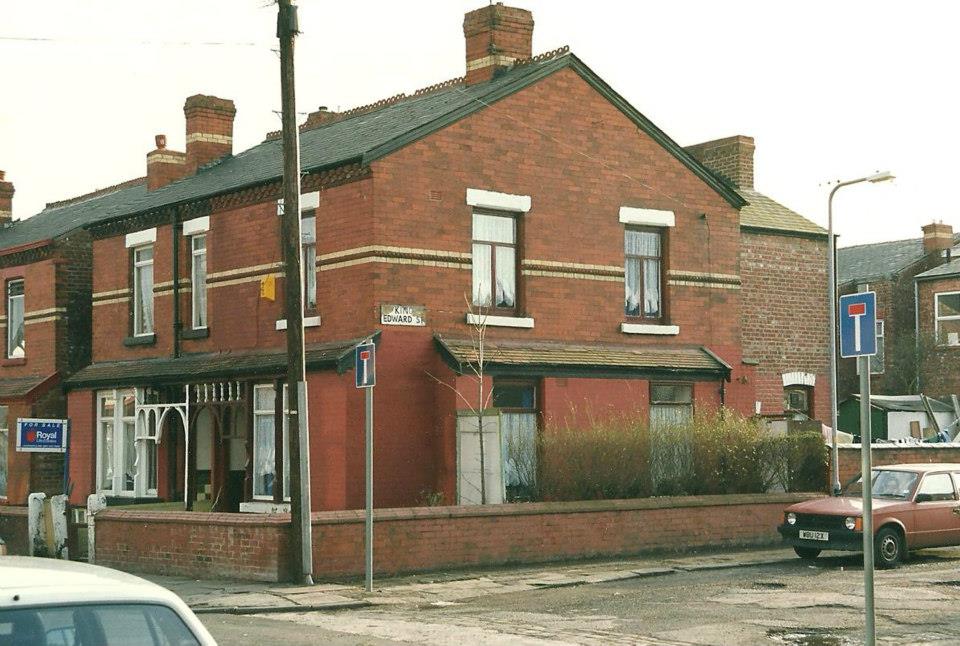
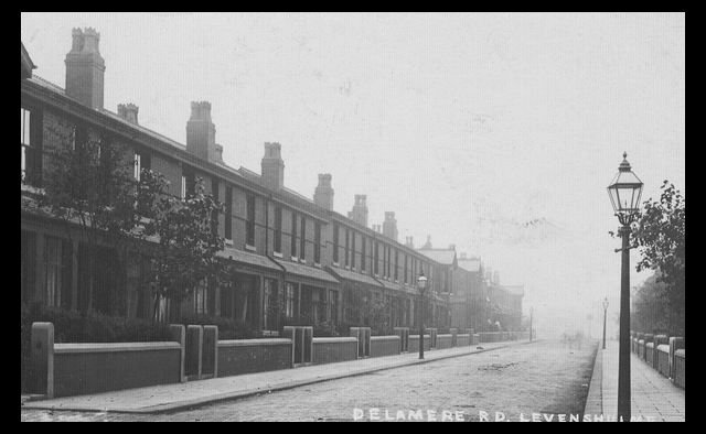
This is a photo of 25 Ratcliffe Street, The house where my best friend Tony Woodford lived in the 50s & 60s. Number 25 is the end terraced with the nearest red car parked outside. Note the house has all the necessary accoutrements of 21st Century living namely a satellite dish and burglar alarm! Delamere Road Memories Delamere Road runs east to west, and is situated off Stockport Road in the south part of Levenshulme. It is a residential street, and there are no shops or commercial businesses located on its entire length. It would appear to have been constructed in two phases. The Stockport Road to Gordon Ave houses came first , followed by those between Gordon Ave & Essex Street. There are two streets that join Delamere Road, Stanhope Street running north to Chapel Street & Dalby Street which is a dead end with an archway leading to the back entry that runs at the back of Chapel Street. The archway is an "odd", yet attractive design feature, another one exists at the end of King Edward Street. Are there any more in Levenshulme?
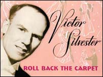
A postcard view of Delamere Road, probably taken in the early 20th Century. The view extends as far as Gordon Ave. Its hard to tell if there are any houses beyond Gordon Ave at this time. During the 50s & 60s, buses would turn down Delamere Road & the service would terminate in Crayfield Road. The actress Dorothy Bromiley lived on Delamere Road.( See the Film & TV page) Apparently at one time Victor Sylvester the famous band leader also resided here!( Photo via Les Cotton)
I have read somewhere that Victor Silvester, the famous British conductor, lived on Delamere Road at some time. Can anyone tell me whether this is true? Cromwell Grove Memories. Cromwell Grove ran from Stockport Road to Barlow Road. Although not a very long road it was, and is, a major east west artery in Levenshulme. Mainly residential, it has always been a busy road.
A postcard view of the bank on the corner of Cromwell Grove and Stockport Road. Not not much traffic, people standing and walking in the road!
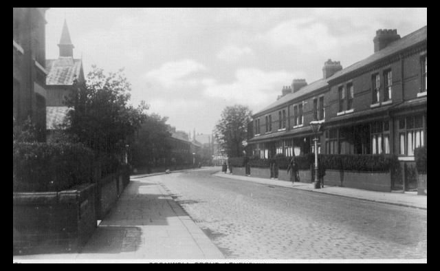
This postcard view of Cromwell Grove, looking west, was taken from the corner of Rostron Street. It shows the Tin Chapel on Mercer Street. Not very busy in this early 20th century scene. ( Photo via Les Cotton)
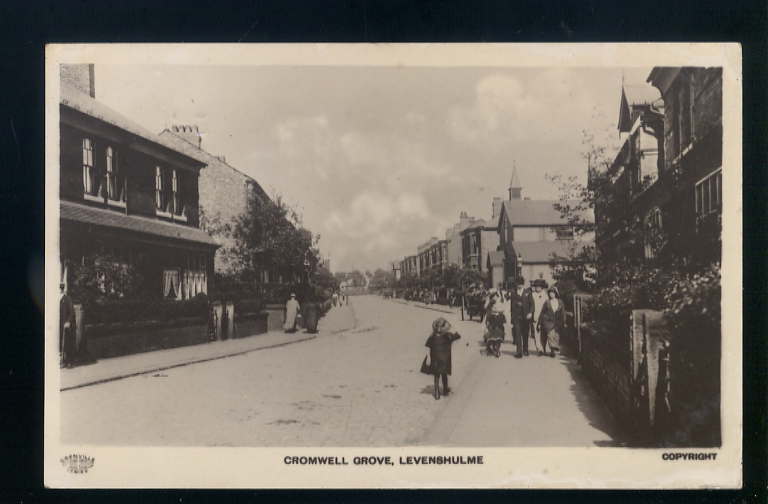
Another early postcard view of Cromwell Grove, looking east in roughly the same area as the previous photo. Once again showing the Tin Church as the prominent feature at that time. This view has not changed much in the intervening 90 odd years!
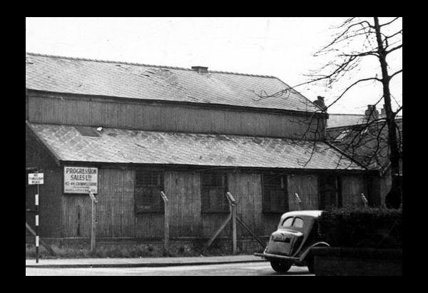
A view of the Tin Chapel off Cromwell Grove in 1959. Obviously no longer in use as a place of worship ( Manchester Libraries) Update:- I have read that this building was used as a "film studio" around about World War 2.
Above various views of Cromwell Grove. Brian Robinson who took these scenes lived at 25 Cromwell Grove. Cranage Road Memories Dave Wrench sent me the photo below showing Cranage Road in the 1960's Cranage Road was situated off Broom Lane, and backed onto the South Levenshulme Goods Yard & the path to the "Brickie". Dave, his Mum & sister are all in the photograph. ( Photo via Dave Wrench)
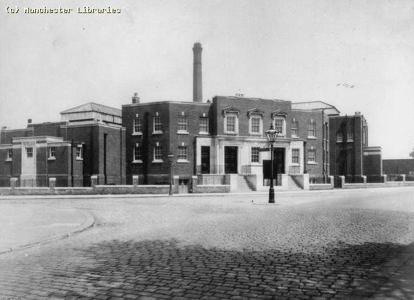
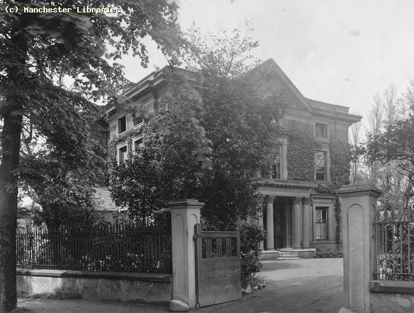
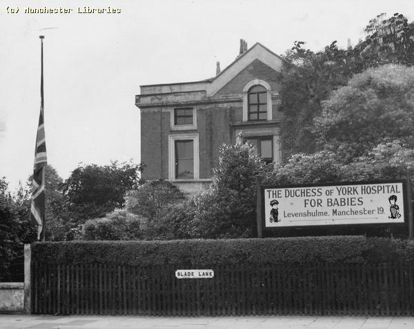
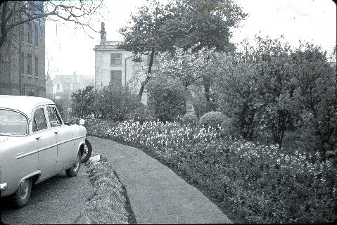
The Duchess Of York Babies Hospital, Slade Lane, Levenshulme. The Duchess of York Babies Hospital was the only hospital in Levenshulme. It began with the conversion of an old house near the railway bridge on Slade Lane, and was added to over the years to become one of the few hospitals in Manchester dealing with children's medical care.
This interesting postcard view, probably from the 1920s, shows the parade of shops opposite the DOY hospital. Gas lamps, lack of traffic or people points to a slower pace of life. The house in the far right background had been replaced by newer middle class houses by the 1950s.
This is a photo of Slade Lane in 1910. The house on the left would eventually become part of The Duchess Of York Hospital, and as far as I know is still standing in 2009. ( Manchester Libraries)
Site of the original DOY hospital 1924 ( Manchester Libraries)
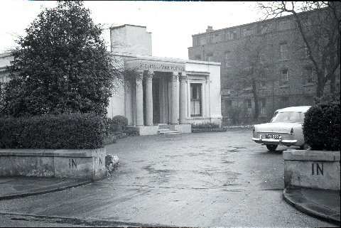
A nice photo of the main entrance to the Duchess of York Hospital. Compare to the previous photo, notice that the columns are the same, so parts of the original building were retained! (copyright Dr. Peter Ward)
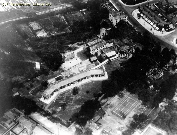
This is an aerial view of the Duchess Of York taken in 1928. Note the original old houses and the new additions. Also the large area of land next to the railway at the top of the picture. A new extension , Rodney House, would occupy part of this land in the early 1960s. ( Manchester Libraries)
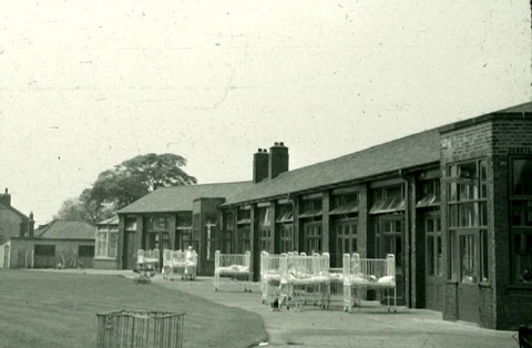
This is the newer wing of the hospital, built in the 1920s. Compare to the above aerial view. It must be summer, as the beds/cots have been moved outside. (copyright Dr. Peter Ward)
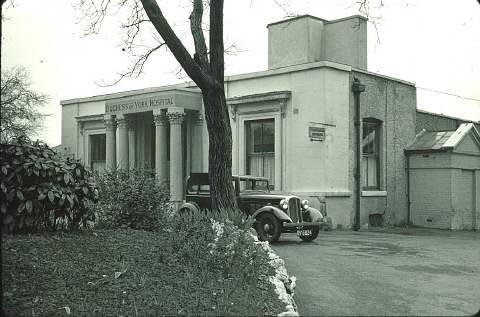
The same building in 1954. Note the sign, and flag. ( Manchester Libraries)
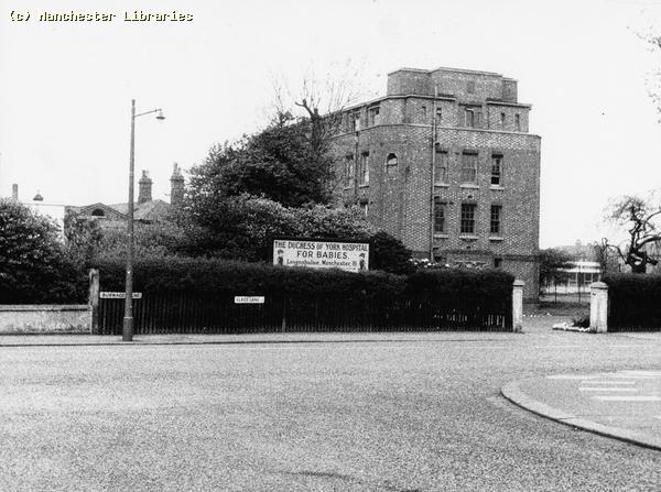
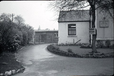
This view taken in 1962 shows that the old house has been demolished. It also shows the newer hospital block. This also shows that this is the end of Slade Lane and the beginning of Burnage Lane. ( Manchester Libraries)
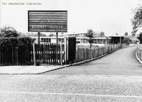
Rodney House, Slade Lane Levenshulme 1962. Built on the DOY property but run by the Manchester and District Spastics Society. ( Manchester Libraries) More photos of The Duchess Of York Hospital taken in April 1957. I was recently contacted by Dr Peter Ward regarding a couple of the previous photos taken by him in 1957. He kindly agreed to me including more of his photos taken at the same time. Peter was a medical student at DOY. His wife was a sister there.
Sisters Danilo & Prendergast
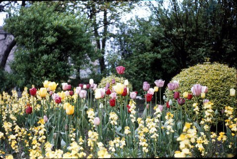
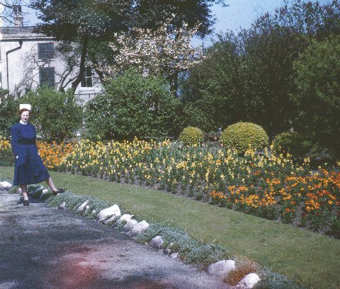
Spring colours at the DOY April 1957. The Second photo features Sister Ward, Dr Peter Wards wife. ( All above photos copyright Dr Peter Ward)
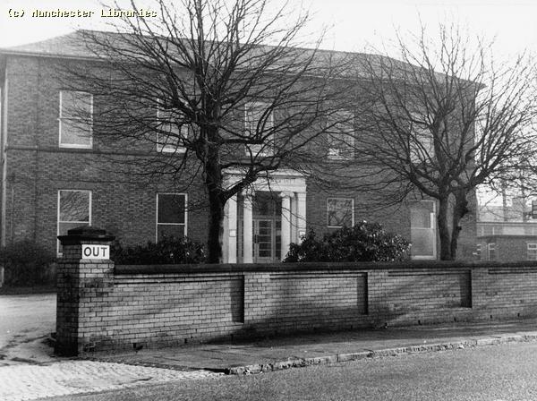
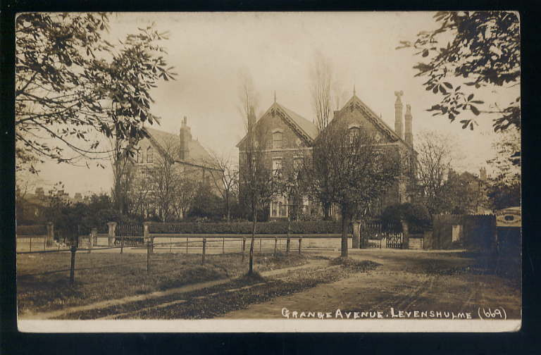
This view shows the Duchess Of York outpatients facility on the opposite side of Burnage Lane. Another grand old 19th century building. ( Manchester Libraries) See also memories of Briarwood, The DOY training school on Marcliffe Drive. Grange Avenue. The original "gated" community. Grange Avenue seems to have been built with the idea of an exclusive "gated" community. Even in the 1970s it was a premium place to live!
These houses are situated at the east end of Grange Avenue. Very Posh!! Talleyrand, Barlow Road, Nelstrop Road Area
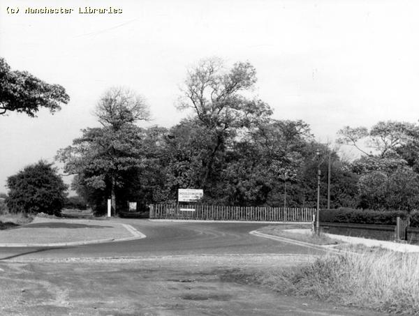
This view taken in 1965 shows the corner of Tither Street and Barlow Road in the area that was commonly known as TalleyRand. The original caption to this photo calls it Tallyrow! ( Manchester Libraries)
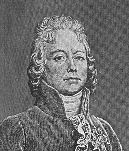
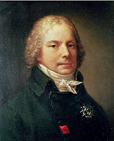
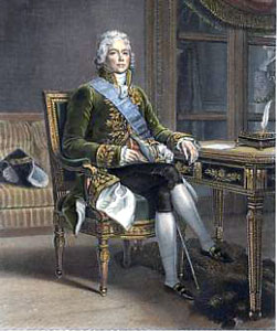
This view shows the corner of Barlow Road and Nelstrop Road in 1965. This is also the Talleyrand area. This corner would also be the boundary between Levenshulme and Reddish, Stockport. ( Manchester Libraries) Talleyrand, Talleyrand House (Barlow House) & Talleyrand Row The area at the east end of Barlow Road near the Junction of Nelstrop Road, Longford Road, has always been referred to as Talleyrand. Why? Well apparently during the period 1792-94, a French nobleman and politician one Charles Maurice de Talleyrand-Perigord is reputed to have lived in the area. The house shown on some maps as Wingate House, later the club house for Houldsworth Golf Course, is probably where he resided. Talleyrand may have been in self imposed exile or on a personal mission for Louis XV1. Talleyrand was a survivor in many ways. He managed to escape the fate of many of the French nobility, namely "Madame Guillotine". He served under Napoleon Bonaparte, and later, following Napoleon's defeat at Waterloo, he served 3 further French monarchs. He was Minister of Foreign Affairs on 4 separate occasions, and was also the First French Prime Minister from July-September 1815. Also renowned as a womaniser, he died of natural causes in his 83rd year. Talleyrand lived from 1754-1838. Thus Levenshulme played its small part in the history of Europe. You can learn more on the history of this great/infamous Frenchman at Wikipedia.
Above are several images of Charles Maurice de Talleyrand-Perigord at different times during his long life. I have recently been contacted by a correspondent, Gail Kopp, who lives in Benton Louisiana, USA. She relates that some of her ancestors lived in the Talleyrand area. Her Great Great Great Grandfather, Thomas Evans lived at Talleyrand House, farmed the area, and owned cottages at Talleyrand Row now Barlow Road. A map dated 1848 shows the house and Talleyrand Row. A later map, dated 1907 shows the house as Barlow House, and the road as Barlow Lane! If anyone knows more about this subject and has photos of the house or farms I would be most interested.
This is the same corner looking east in 1965. The photo was taken from the corner of Nelstrop Road. Note the rough road surface of Nelstrop Road which is still an unadopted road in 2009. The lane straight ahead may be a part of Pink Bank Lane. It led to the Reddish/ Levenshulme reservoirs and the Reddish Locomotive sheds. Note the sign on the corner for Houldsworth Golf Club on Longford Road. ( Manchester Libraries)
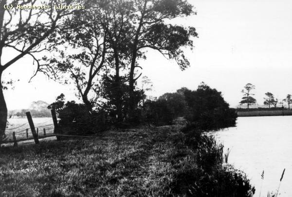
This view is captioned as " Reservoir Levenshulme". I have no real idea of the location, but it could be in the Levenshulme/Reddish area. Early 20th Century. ( Manchester Libraries)
A reservoir off Sandfold Lane in 2007. Could this be the same location as the previous photo?
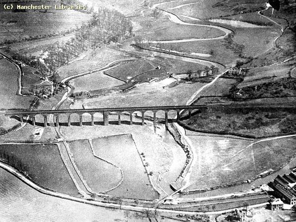
This aerial view taken in 1922 shows Reddish Vale and its famous viaduct. As children we would often take a trip to Reddish Vale as it felt very much like being in the country. We would get there via Barlow Road and Longford Road. It was always quite an adventure! ( Manchester Libraries) Nelstrop Road Levenshulme/Reddish Boundary
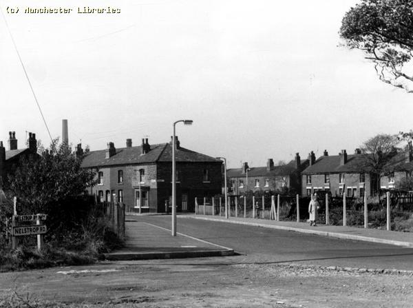
Old houses on Nelstrop Road in 1965. They are probably long gone in 2009. The first house looks like it may have been riding stables. ( Manchester Libraries)
Shore Fold, Nelstrop Road 1965. More horses! ( Manchester Libraries) Reddish Borderline, Reddish Canal Area.
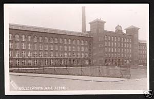
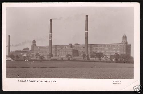
These two cotton weaving mills were a familiar sight to anyone living near to the East border of Levenshulme. Both Houldsworth Mill and Broadstone Mill were to be seen standing proudly alongside the Reddish Canal branch which ran from Hyde Road in Gorton to the Nelstrop Flour Mill on Lancashire Hill in Heaton Norris, Stockport.( via Ebay) Silver Jubilee Celebrations 1977, In Rushden Road. Photos supplied by Peter Southall
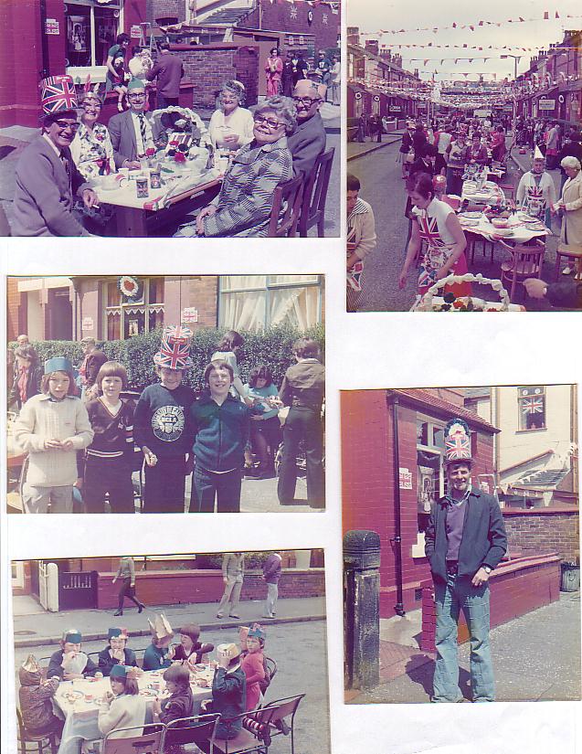
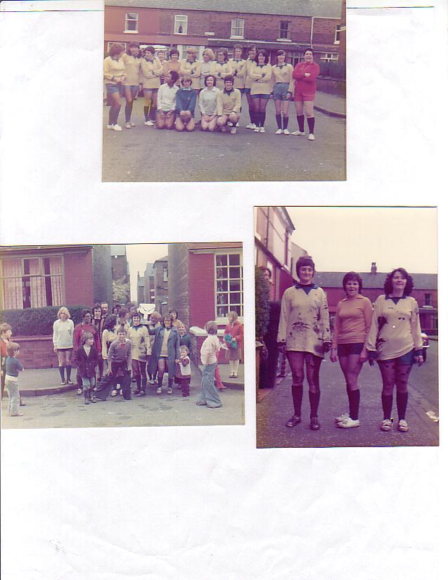
Above are various photos taken during the Queens Silver Jubilee in 1977.
|
|
|
|
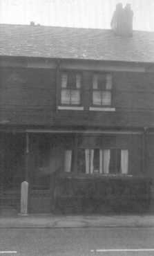
 This photo of Numbers 13
& 14 Crayfield Road was taken in September 1994, on my first return trip
to the UK. At that time I had not lived in Levenshulme for 21 years.
The houses somehow seem smaller than I remember them! On a later visit in
1999, there was a car parked in the front garden of Number 14!! Note
proliferation of burglar alarms. A definite sign of changing times!
This photo of Numbers 13
& 14 Crayfield Road was taken in September 1994, on my first return trip
to the UK. At that time I had not lived in Levenshulme for 21 years.
The houses somehow seem smaller than I remember them! On a later visit in
1999, there was a car parked in the front garden of Number 14!! Note
proliferation of burglar alarms. A definite sign of changing times!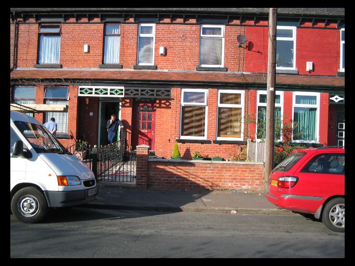
.jpg)
.jpg)
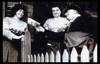 This Photo shows Maureen
Dempsey ,No15, and Mrs. Rennie, No16, saying farewell to a retiring
postman. What was his name? I believe that this photograph appeared in the
Manchester Evening News. Retiring postmen were newsworthy in those days!!
This Photo shows Maureen
Dempsey ,No15, and Mrs. Rennie, No16, saying farewell to a retiring
postman. What was his name? I believe that this photograph appeared in the
Manchester Evening News. Retiring postmen were newsworthy in those days!!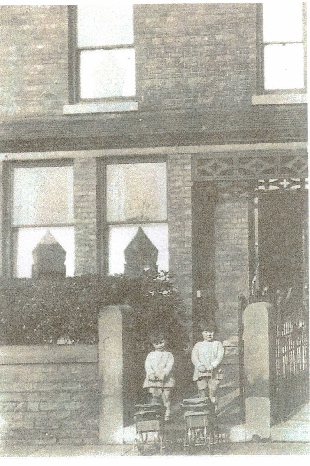
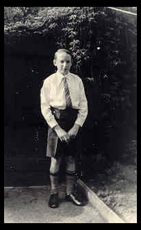 Yours truly taken
in the back garden at 14 Crayfield Road. Looking very smart for Speech Day
1962 at Didsbury Tech. I was in the school choir, and we sang on stage at
the Free Trade Hall. My one and only appearance there! Dressed like that
it's not surprising that I didn't get a return booking!!
Yours truly taken
in the back garden at 14 Crayfield Road. Looking very smart for Speech Day
1962 at Didsbury Tech. I was in the school choir, and we sang on stage at
the Free Trade Hall. My one and only appearance there! Dressed like that
it's not surprising that I didn't get a return booking!! South Levenshulme 1956
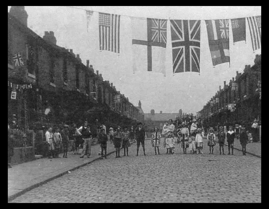
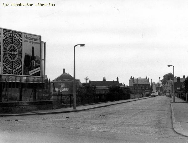 Crayfield Road 1965