 Railway
Memories Railway
Memories
Levenshulme South Station ( Fallowfield Loop Line) |
||
|
HOME
|
 1948
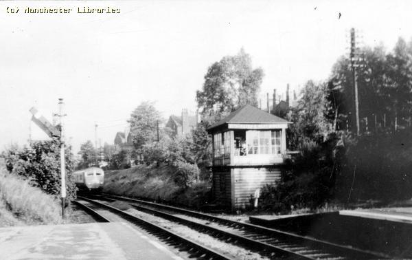
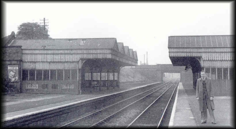
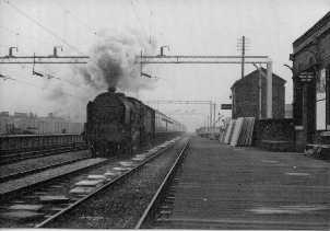
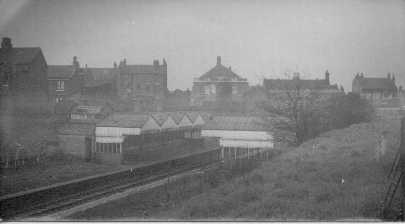
South Levenshulme Station looking East. (Photo: The Fallowfield Line
author E M Johnson Foxline Publishers) 1948
South Levenshulme Station looking East. (Photo: The Fallowfield Line
author E M Johnson Foxline Publishers)
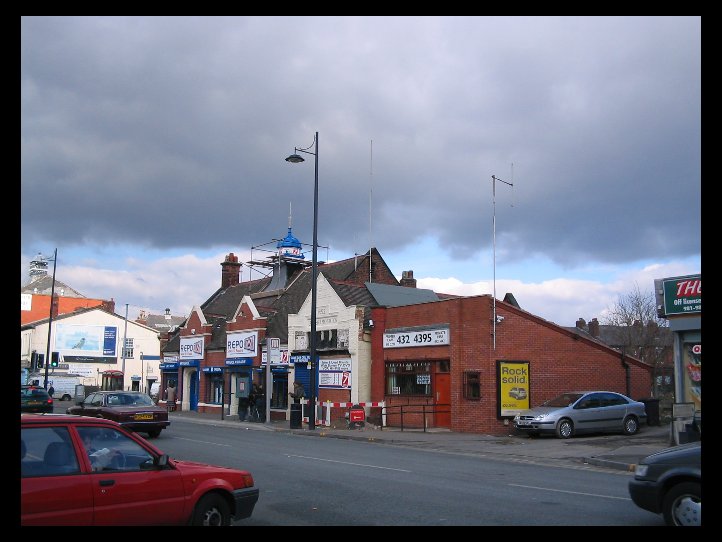
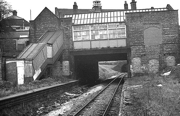
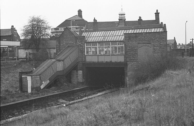
South Levenshulme Station building in March 2004. Renovations in progress. I'm not sure about the blue cupola!! ( Photo Carole Daniels ).
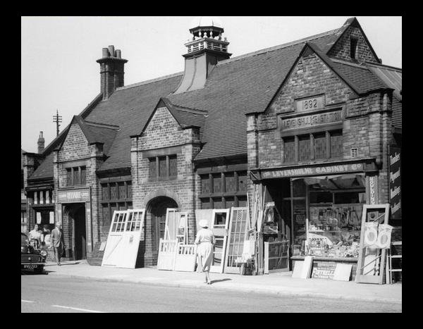
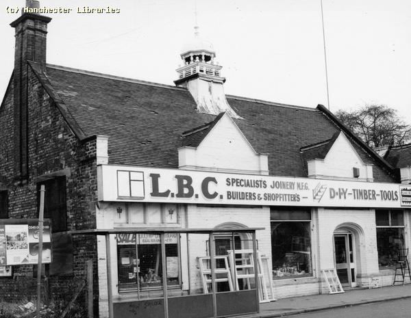
Levenshulme South Station Building 1959. At that time a Wood & DIY shop. Was it two separate businesses? ( Photo. Manchester Libraries)
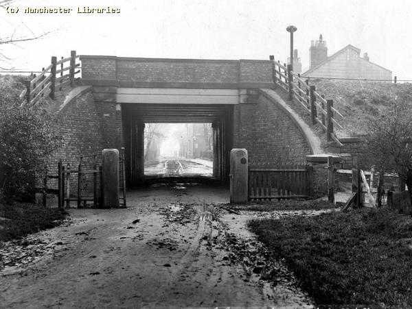
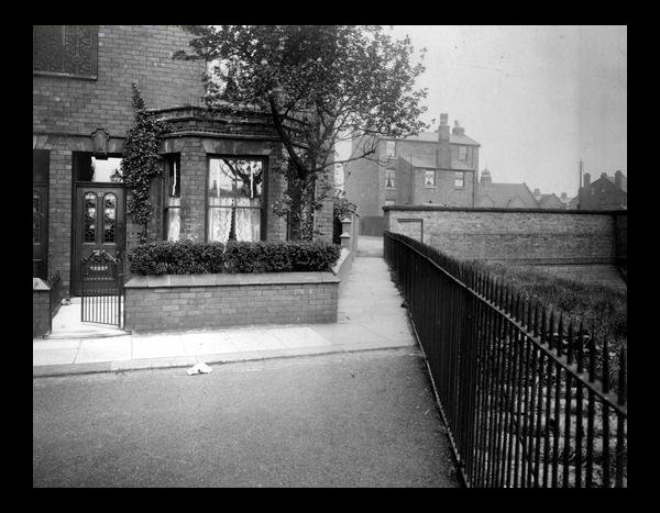
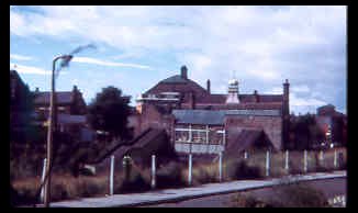
This view, looking east from Parker Street, Shows the wall above the railway embankment, with Levenshulme South Station in the background. The passage leads to Kevin Street. The semi-detached houses in the background were, I think, built by the railway company to house the station master and possibly his assistant. ( Manchester Libraries) Levenshulme North Station. ( Now Levenshulme Station) Albert Road
1910 Levenshulme Station. Albert Road (Photo: Looking Back At Levenshulme & Burnage.1987 Willow Publishing)
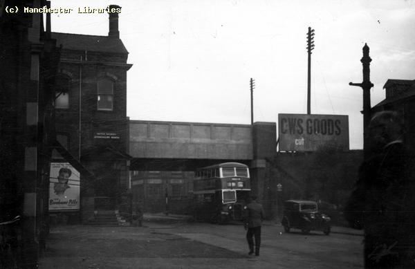
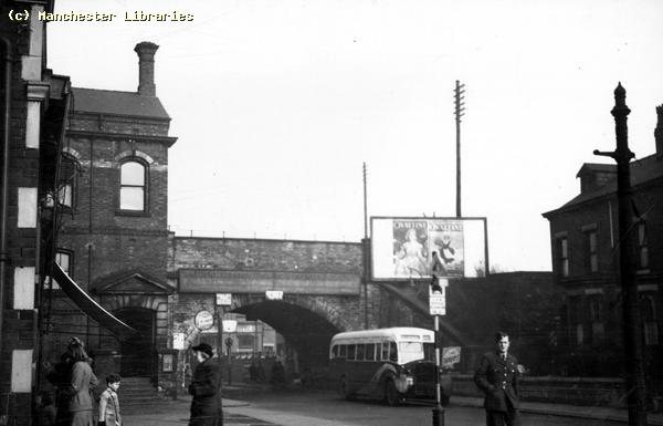
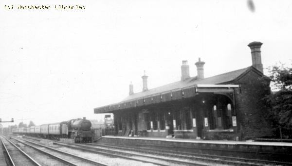
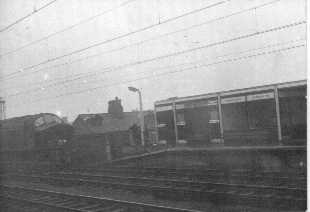
Albert Road Station, Levenshulme North. Note the temporary wooden structure, and the train heading south. I would date this photo as early 1950s. ( Manchester Libraries)
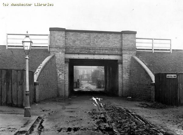
Levenshulme North Station from Albert Road, March 2004. Compare to the above earlier photographs. ( Photo Carole Daniels ).
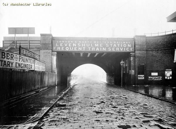
A wet scene on Albert Road, early 20th century.( Photo via Cliff Garratt)
Levenshulme South station 1949.The year that I was born! ( Manchester Libraries)
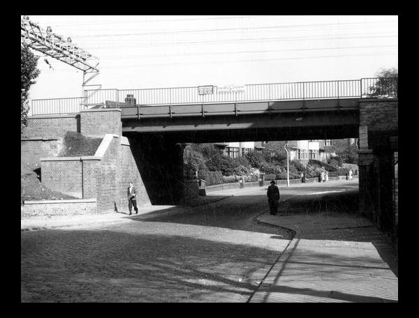
South Levenshulme Station, Albert Road. Compare to the above photo, note the brick bridge wall, airman in uniform. This could be a wartime photo. (Manchester Libraries)
Another very atmospheric photo of Albert Road in the rain during the 1930s. Note the large station sign board. Everything looks very orderly and well maintained. See the photos below for a more up to date view of this area. ( Manchester Libraries)
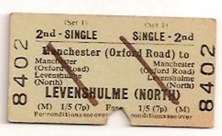
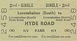
An early 1970s ticket. Note both decimal and shillings and pence fare. Also note The station is still referred to as Levenshulme North, although Levenshulme South ceased to operate in 1958!! ( via Brian Carter)
Another ticket issued at Levenshulme North going to Longsight. Probably dates from the 1960s, note the fare 3 old pence. Also this ticket was never cancelled so is theoretically still valid!! ( image found on Ebay)
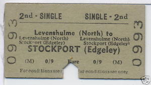
Yet another ticket image found on Ebay. Nine old pence single to Stockport Edgeley. Up to the mid-sixties Stockport had another station at Tiviot Dale, at the bottom of Lancashire Hill.
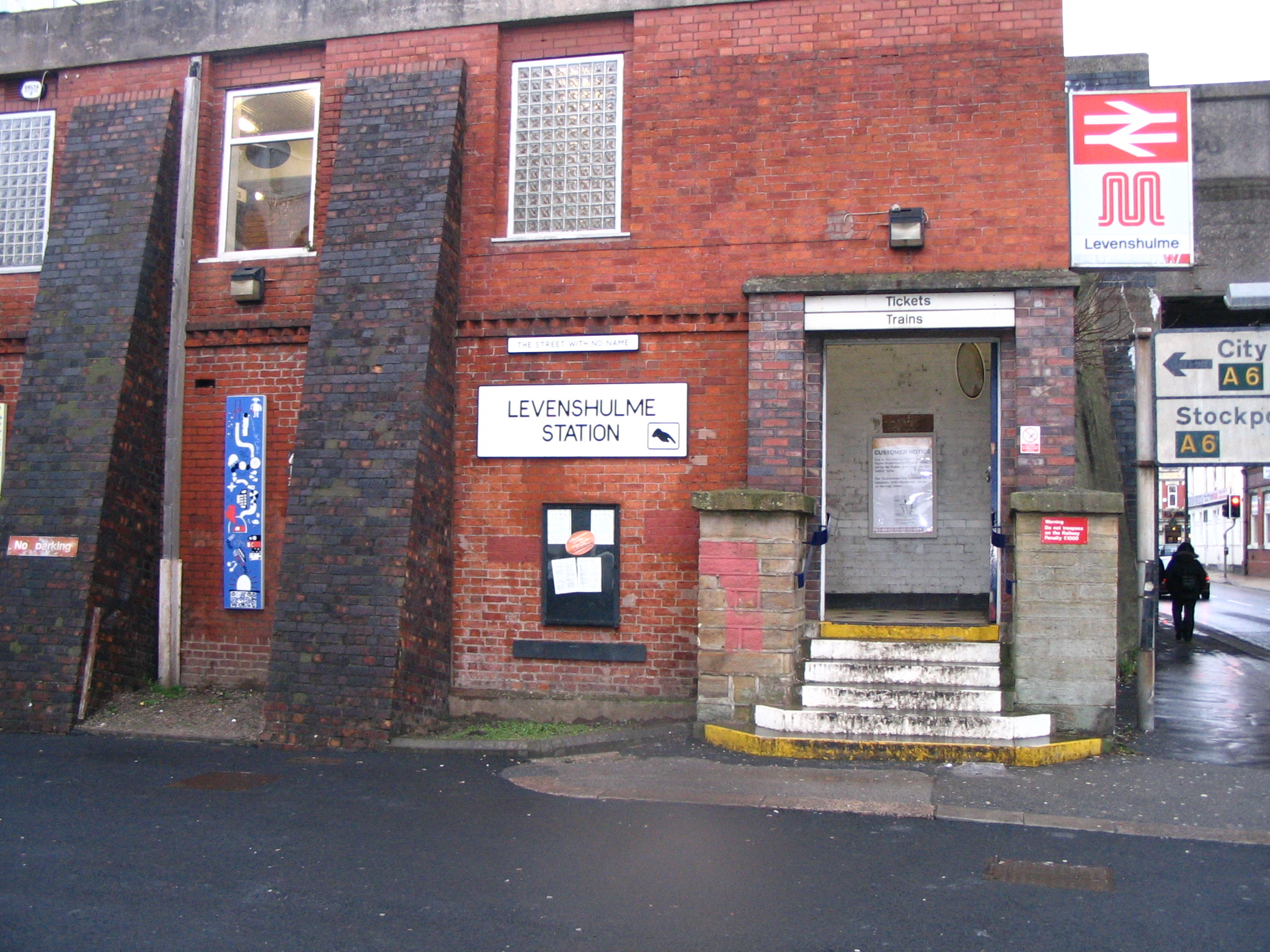
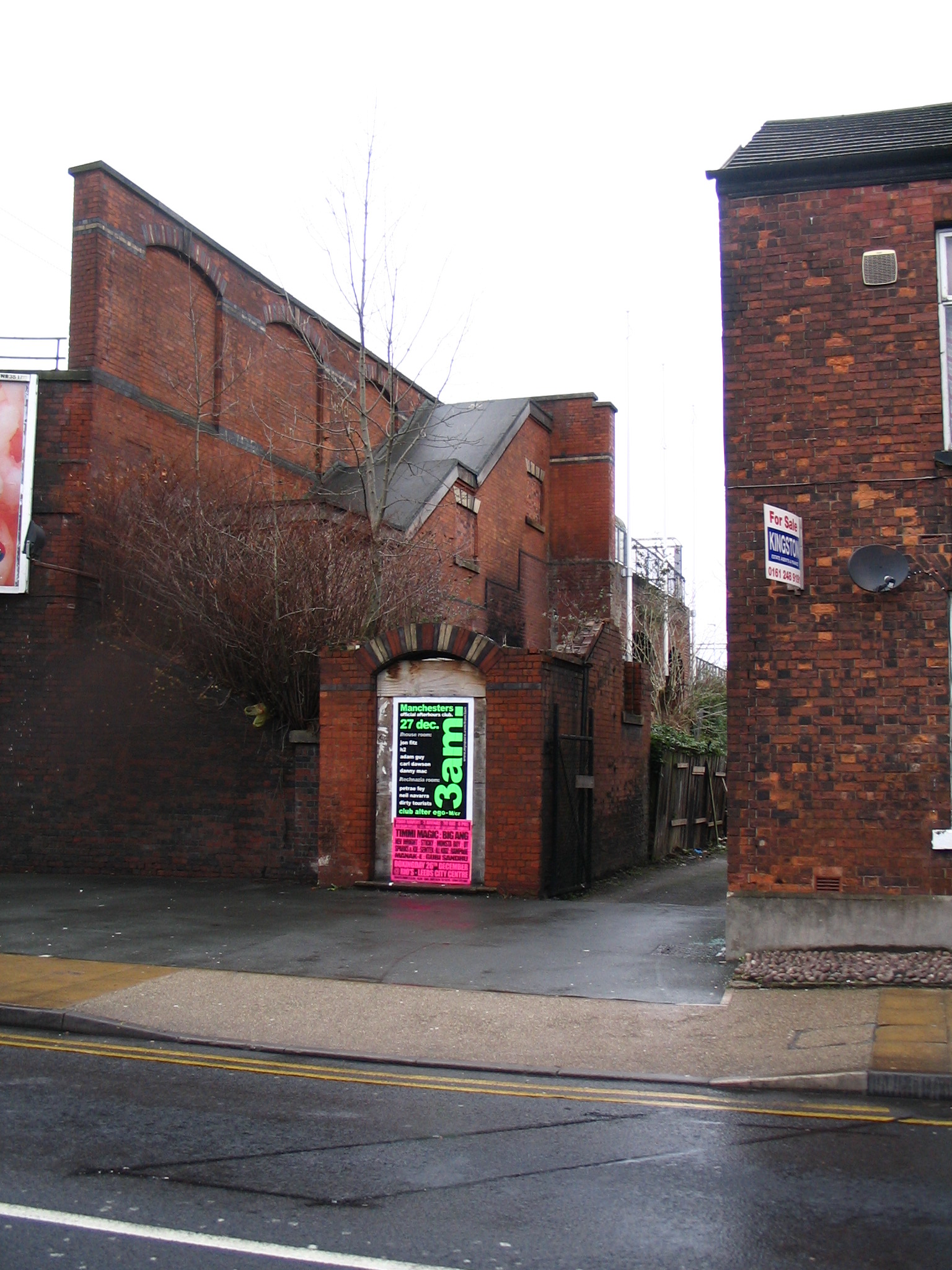
The entrance to Levenshulme Station in December 2007. The posts and steps look similar to the above photo. The street at the side of the station is now signposted " The Street With No Name"!!
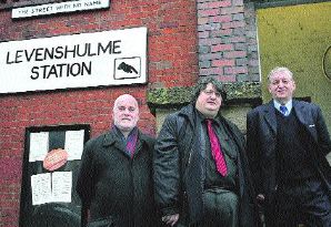
Another photo of "The Street With No Name". My old pal Steve Lambert is on the right.
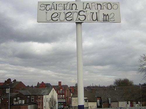
Levenshulme Station 2009. A sign of the changing ethnicity of South Manchester.
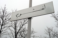
Not to be outdone, the is also a sign in Gaelic!! A sign of Levenshulme's long Irish tradition.
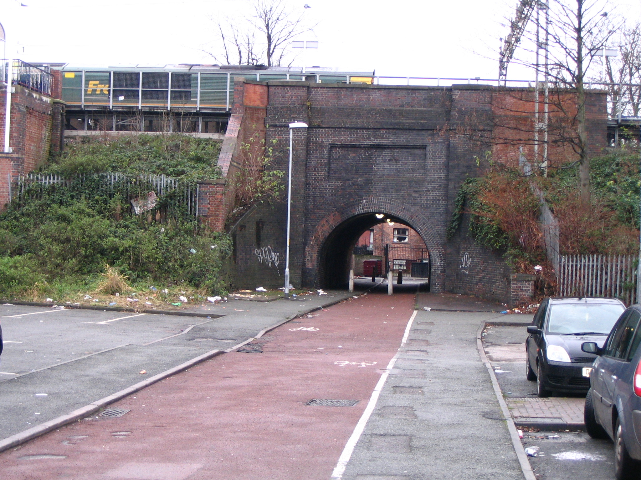
This is the entrance to Levenshulme Station on the other side of the bridge nearer to Stockport Road. No longer in use and looking derelict, it is still possible to view some of the original structure of the Victorian Station. December 2007
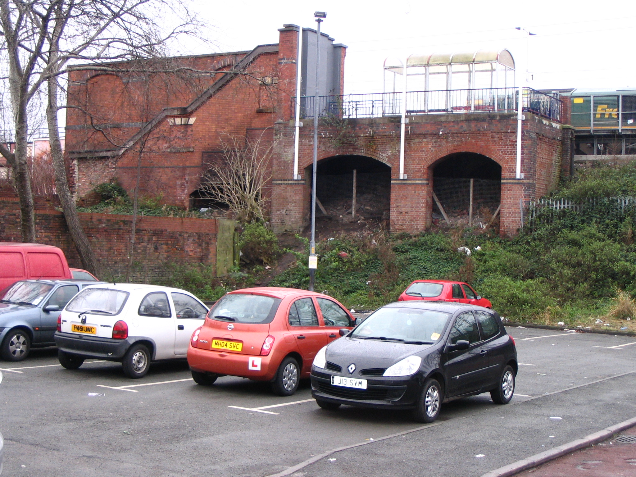
The East side of the station seen from another angle. There were houses where this car park now stands
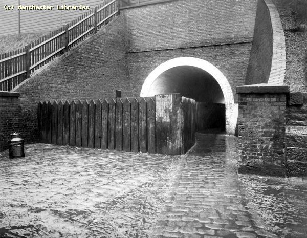
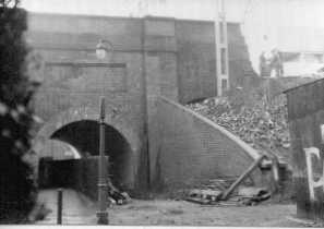
The pedestrian tunnel looking west . Note different colours of brickwork. The red bricks were from the early 1960s when the the South Levenshulme Station was heavily " modernized". The tunnel was at one time divided by a heavy wooden fence. To the right of this view once stood Burdett's Bakery,
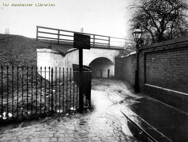
This is the same view, taken in 1908. Note the wooden fence. What was its purpose? ( Manchester Libraries)
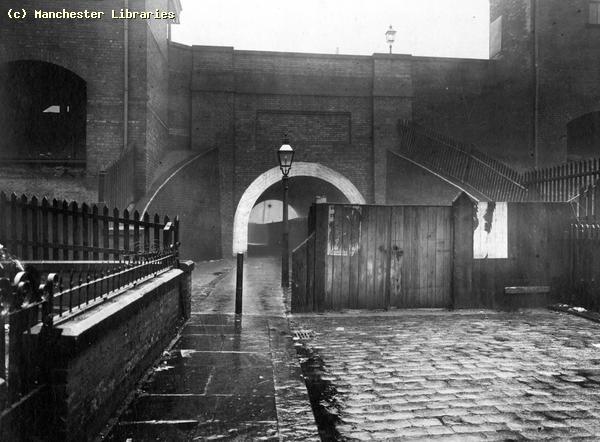
The other side of the tunnel in 1908. Note the gates, gas lamp and the beginning of the wooden ramp up to the north bound platform on the left. ( Manchester Libraries)
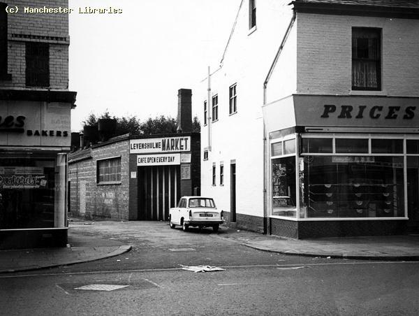
This street, known as either Station Grove or Station View is The same street as the above photos. Taken in 1970, this shows the old Burdetts Bakery, at that time serving as Levenshulme Market. Now no more. Note the two bakers on both corners. Levenshulme folk loved their cakes!! ( Manchester Libraries)
Levenshulme North Station in 1949. These buildings all disappeared in the rebuilding in 1959 (Photo Manchester Libraries)
A train heading north through Levenshulme North 1949.( Manchester Libraries)
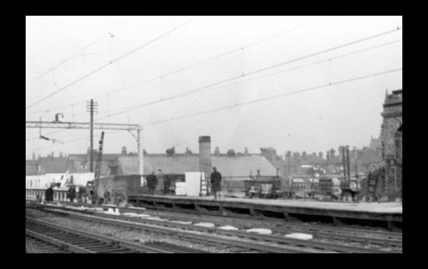
Re-building 1959, Electrification has arrived and the old station buildings have been demolished. ( Photo Manchester Libraries)
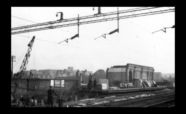
Another view during re-building. The end building survived because it housed the entrance stairs from Albert Road.( Photo. Manchester Libraries)
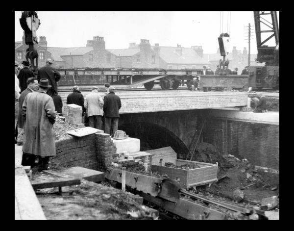
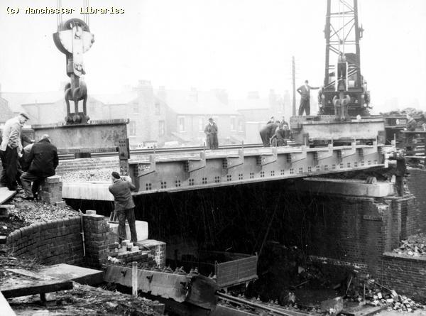
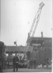
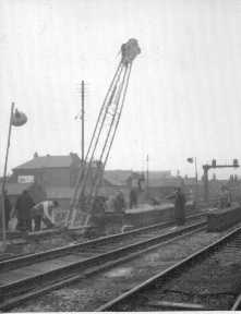
Re-construction of Albert Road bridge. When the London-Manchester line was electrified a great deal of work was carried out on widening the track bed & rebuilding a number of the bridges. Most of the Levenshulme bridges were rebuilt, although the ones at Alma Road & Clare Road do not seem to have been extensively altered. ( Photo Manchester Libraries)
Another view of the Albert Road bridge rebuilding ( Manchester Libraries) Re-building Levenshulme North Station 1959. ( A series of views by B R Robinson) My old friend, the late Brian Robinson took a series of photos during the re-building of Levenshulme North Station, on Albert Road during 1959/60. I was given these photos recently, summer 2012. They are a unique record of a major change to the South Manchester railway scene.
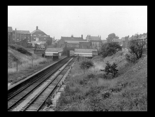
Two views showing the major changes at Levenshulme North as the old buildings were demolished. Interestingly quite a lot of the old station structure still remains in 2012.
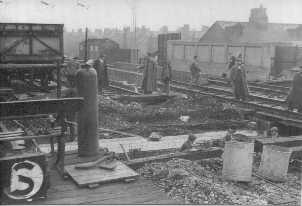
Track work at Levenshulme North. Both views are looking south. Does the "S" denote the direction?
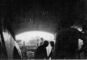
These two views show, 1) the interior of the tunnel connecting both platforms at the station, and 2) the pedestrian tunnel running from South Street to the so called "Street With No Name".
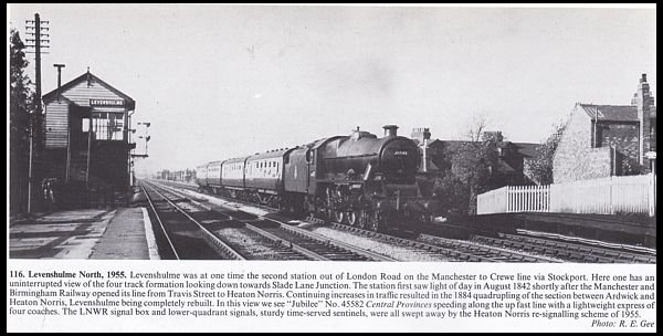
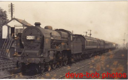
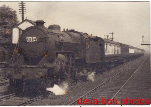
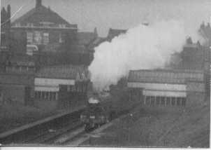
A couple of photos found on the internet showing locomotives waiting to proceed south near the Levenshulme North signal box. 1950s? ( via deva-bob photos)
An unusual view taken from the platform of Levenshulme North Station looking East towards St Peters church. In the left of the picture is the roof of the Palace cinema & the roof of the bakery. The picture was taken in the early 1980s by Colin Irving.
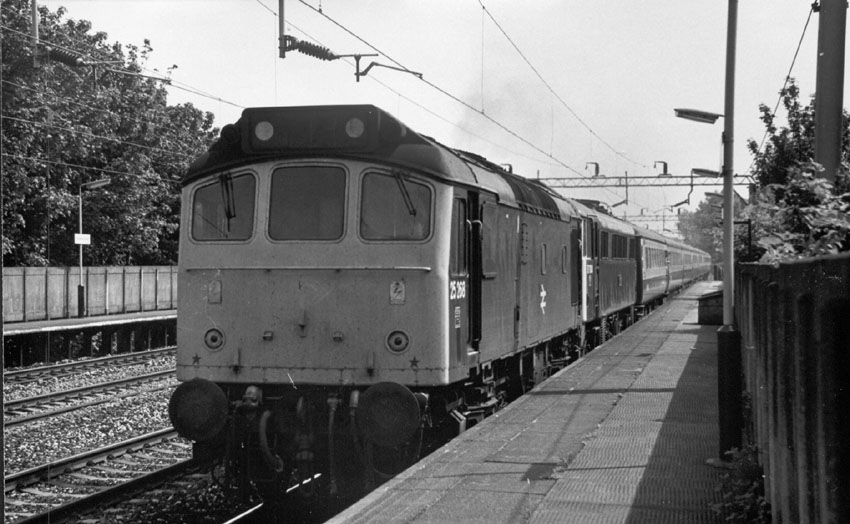
A Class 25 Diesel locomotive, hauling a Glasgow to Euston passenger train, passing through Levenshulme North Station in 1983. (via Internet)
A Diesel Multiple Unit DMU passing through Levenshulme North. Heading north on a service to Manchester London Road/Piccadilly Station. These DMUs were a familiar sight on this line, and were the predecessor of the modern Sprinter units. We used to take these trains to Middlewood and Disley to get to Lyme Park.
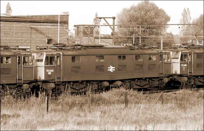
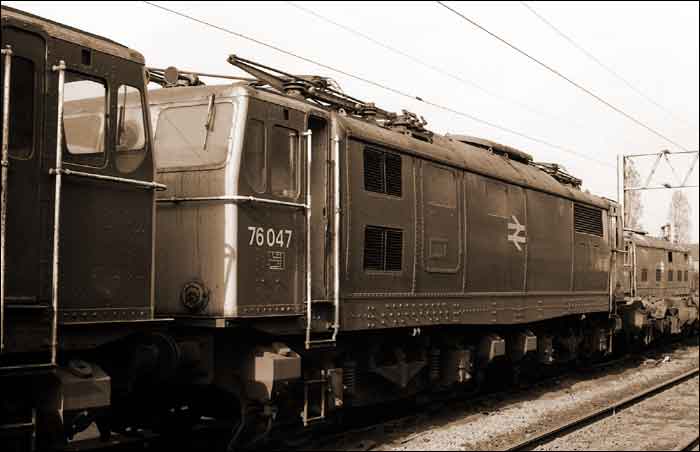
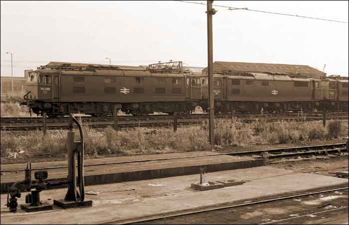
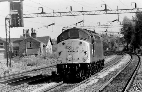
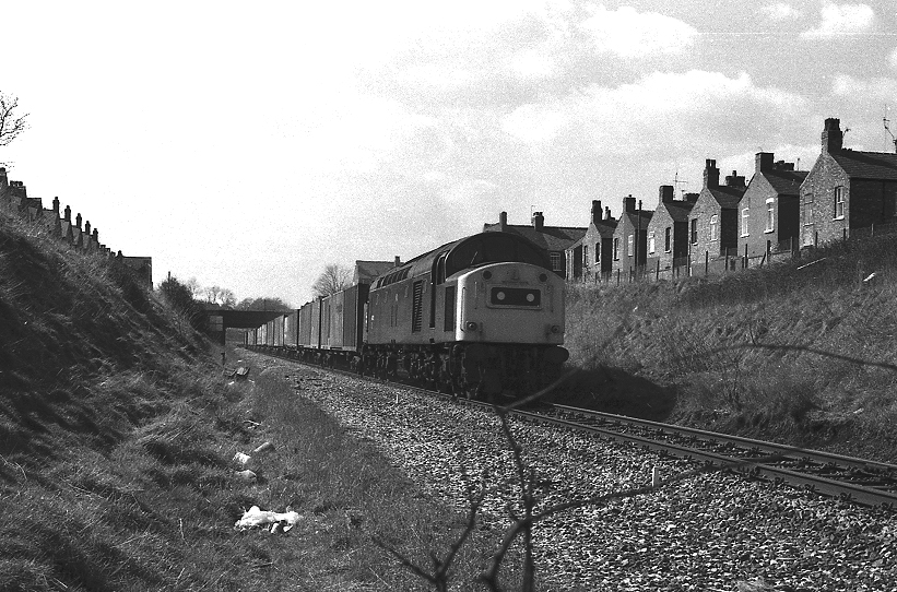
A Deltic type locomotive heading north on the LMS main line through Levenshulme. The location seems to be in the vicinity of Claire Road/Errwood Park. A selection of Locomotive photos, Steam & Electric at Levenshulme North, 50s & 60s.
The above train photos taken in the 1950s & 60s show the transition on the main London-Manchester line from steam to diesel electric traction. If anyone can identify the type of locomotives I would be grateful.
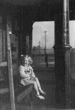
This photo shows Brian Robinsons daughter, Allyn, sitting on a porters cart at Levenshulme North in 1949. Note the ice cream cone! South Levenshulme Goods Yard Broom Lane
An interesting view of the UCP ( United Cattle Products) factory and its famous chimney, taken from just behind the signal box on the South Levenshulme line. Also in view is the lattice work iron footbridge.( See Below) This photo taken in 1965 also features part of the dereliction of " The Brickie" ( Manchester Libraries)
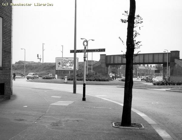
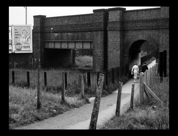
The Fallowfield Loop line passing under Kingsway a little way south of Moseley Road. Note the UCP poster on the advertising hoarding. ( Manchester Libraries)
I was recently sent this photo of a Freightliner train heading east on the Fallowfield Loop Line, about to cross under Kingsway and soon to pass the remains of Levenshulme South Station. It was taken in 1983. It would be good to have a contemporary shot of this location! (photo:- Neil Ferguson-Lee via Robert Todd) Levenshulme South Station. Built 1892. Closed 1958 The South Levenshulme Station, originally just known as Levenshulme Station, was built in 1892 and was one of several stations on the Fallowfield Loop Line from Manchester Central Station to Fairfield Station. I lived on Station Road, later Crayfield Road, which ran alongside the north side of the station. I recently discovered a fascinating website called "The Disused Railway Site Index" which has a page on South Levenshulme Station plus hundreds of other disused railway and station sites around Great Britain. Some of the images below are from this site.
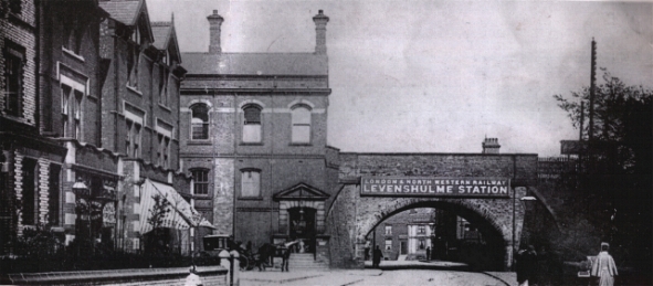
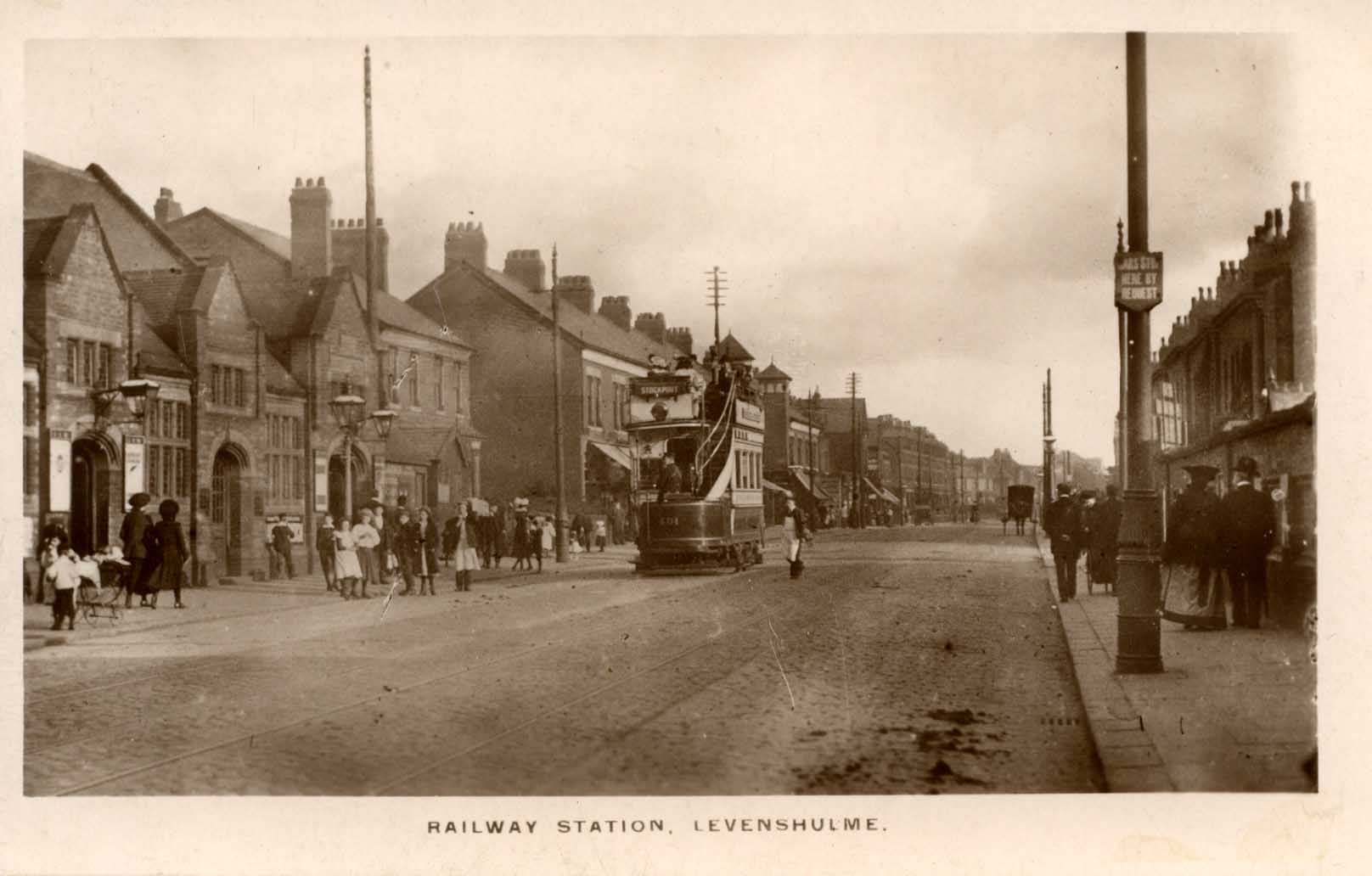
This postcard view shows the front of South Levenshulme Station, Stockport Road, in 1910. Note the open topped tram and the absence of motorized traffic. Quite a busy, bustling scene. The houses on the right of the photo, past the railway bridge, must have been demolished around 1928 when the CO-OP building was built. ( Photo via John Alsop)
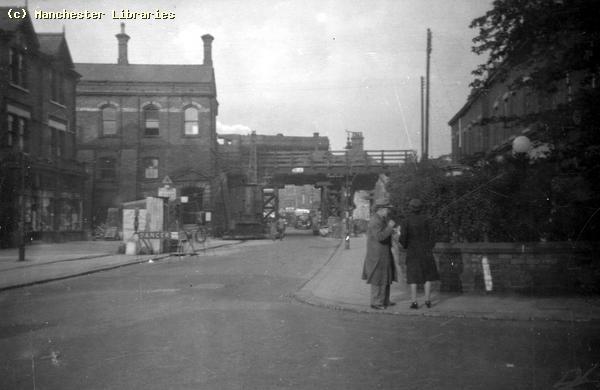
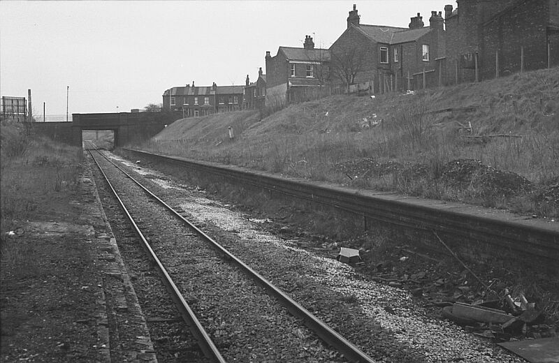
An interesting photo taken in the early 1970s. The rail track is down to one single track. Still showing one of the covered stairs to the platform intact, but looking pretty shabby. (via Alan Hampson)
A slightly different view of the back of Levenshulme South Station taken from the north embankment by Alan Hampson in 1976. ( Via Alan Hampson)
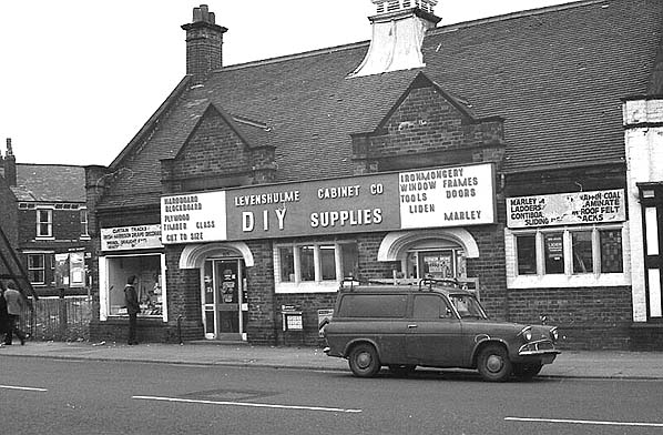
The South Levenshulme Station frontage in the early 1970s. It was still in use as a DIY shop at that time.( Via Alan Hampson)
Two photos of the South Levenshulme Station Building. The first shows the building in 1986, Still a DIY store. Note the bus shelter, and the British Rail poster board at the side. The second photo shows Rushton's shoe repair shop witch was attached to the station building sometime after 1910. ( both Manchester Libraries)
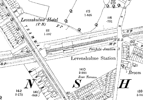
This is a very interesting map, probably from the late 1890s showing Levenshulme Station, but all the land north and south of the station is still fields! This was before the Levenshulme Council Offices and Station Road, Gordon Ave, Bristol Ave and Langdale Ave were built. ( Via Nick Catford)
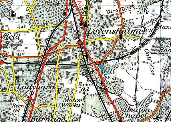
A general view of the Fallowfield Loop Line passing through Levenshulme. Probably a pre-WW2 map as it shows Fairey Aviation on Crossley Road as Motor Works.( map via Nick Catford) Levenshulme South Memorabilia
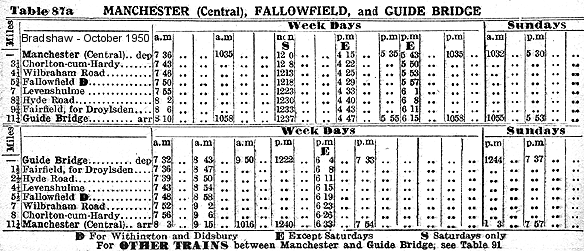
Railway Timetable, from Bradshaw's Railway Guide for October 1950, Showing all the Stations on the Fallowfield Loop Line. ( via Nick Catford)
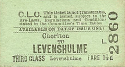
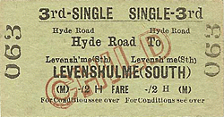
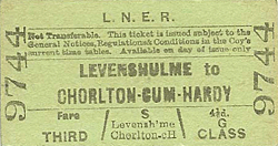
Various railway tickets issued to and from Levenshulme South Station. Two tickets are pre-nationalization, L.N.E.R & C.L.C. The other two are probably from the British Railways era! Note the prices and classes. Also none of these tickets appear to have been cancelled ( punched by a ticket clerk or canceling machine!!) ( ticket images via Michael Stewart)
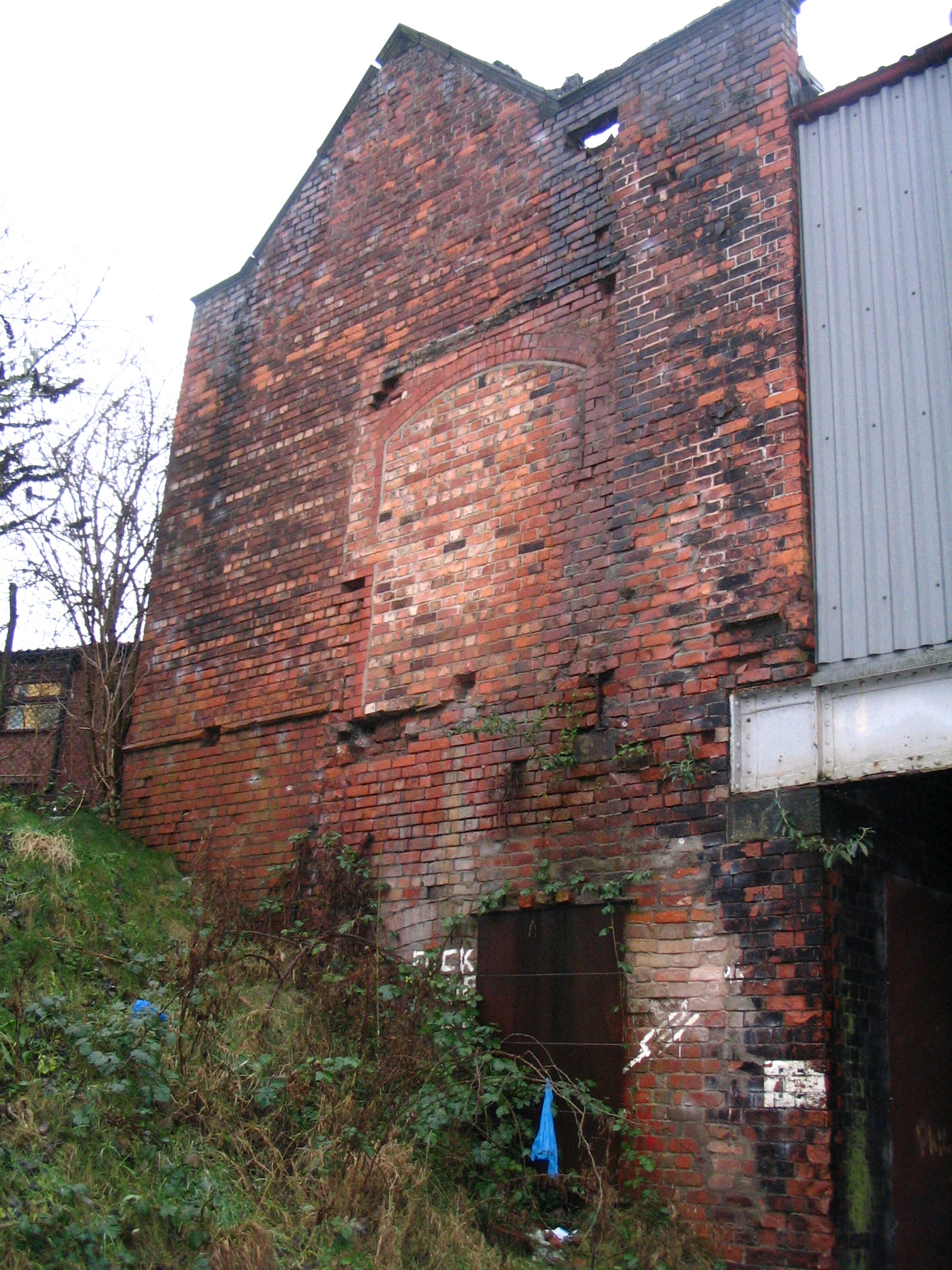
2001. A great view of the back of Levenshulme South Station as it then looked. The platforms are gone. The covered stairs leading down to the platforms were demolished in the 1970's The Station fell to "Dr.Beeching's Axe" in July 1958,but the bulk of this very unique & odd shaped building still exists. This view is looking West ,the Main London to Manchester line can just be glimpsed through the tunnel. (Photo: Aidan O'Rourke)
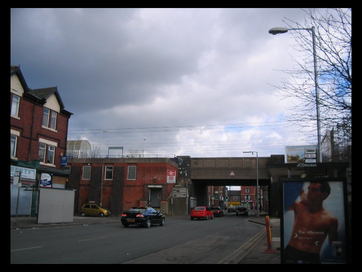
December 2007. Not much remedial work has been carried out on the old station building. Compare to previous photo.
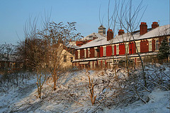
A nice winter view of Crayfield Road taken from the new cycle path.
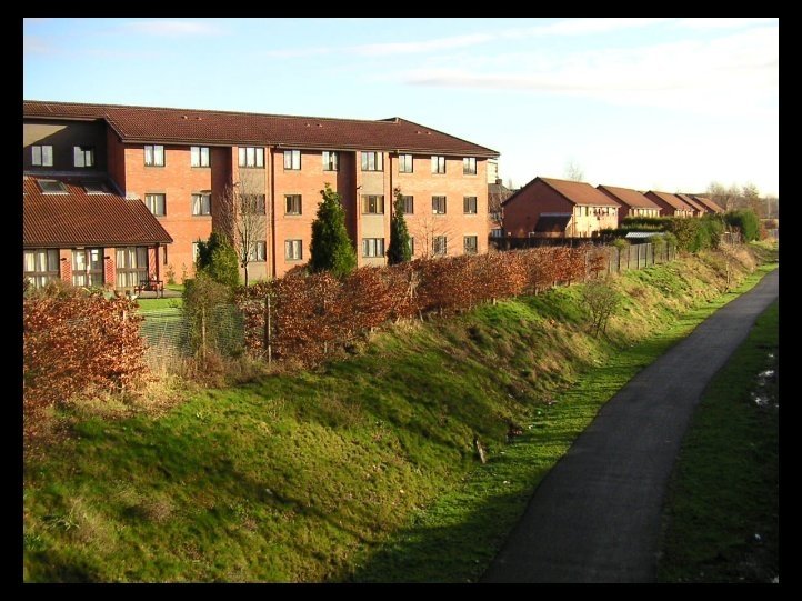
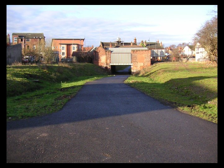
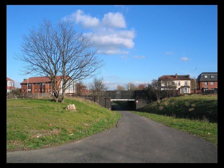
South Levenshulme Station, February 2004, showing the new footpath & cycle way. The embankment does not look as deep as I remember. The access is from Crayfield Road to the right. You can walk west as far as Chorlton. The footpath ends at Highfield Road currently. (Photo. Andrew Barber)
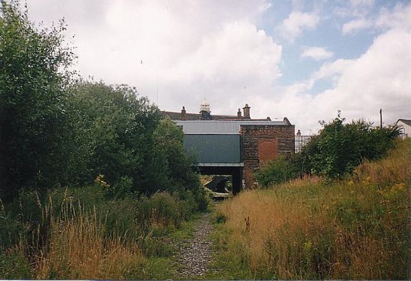
The same view as above prior to the cycle/footpath being built. Just see how overgrown the station area had become.
Another view from further back showing how overgrown the track bed had become. You can still see the South platform edge in this view.
A nice photo of Levenshulme South Station in 1971. Single line and the platforms slowly disappearing. Compare to the next two photos.
This photo, taken in 1965, shows the derelict South Levenshulme Station before the platform buildings were demolished. Note how overgrown the platforms had become, also the remains of the station gas lamps. ( Photo Manchester Libraries)
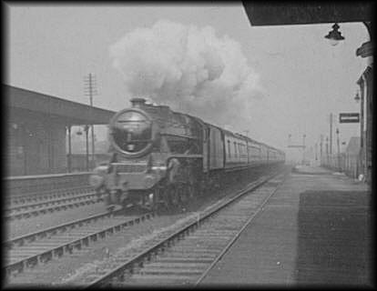
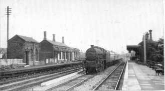
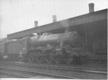
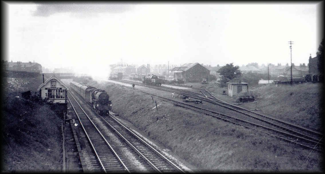
The previous two photos show South Levenshulme Station some time after its closure in 1958. The top photo shows the intact station buildings with the familiar shape of the Co-op Stores in the background. The second photo shows the "Flying Scotsman" passing through the station. Anyone put a date to these photos? ( via B R Robinson)
This is the view looking the opposite way towards Broom Lane, March 2004. Note the pathway has been raised up at this pint to allow access to the cycle/footpath from Crayfield Road. ( Photo. Carole Daniels)
Another "fuzzy" photo showing the rear of Levenshulme South station after the demolition, or collapse, of the south staircase.
Overgrown station and track bed 1980s.
The opposite view from the one above. Taken during the early stages of building the foot and cycling path.
The same view in December 2007. Note that a new tunnel has been created, probably to strengthen the bridge on Stockport Road. Pity about the graffiti!!
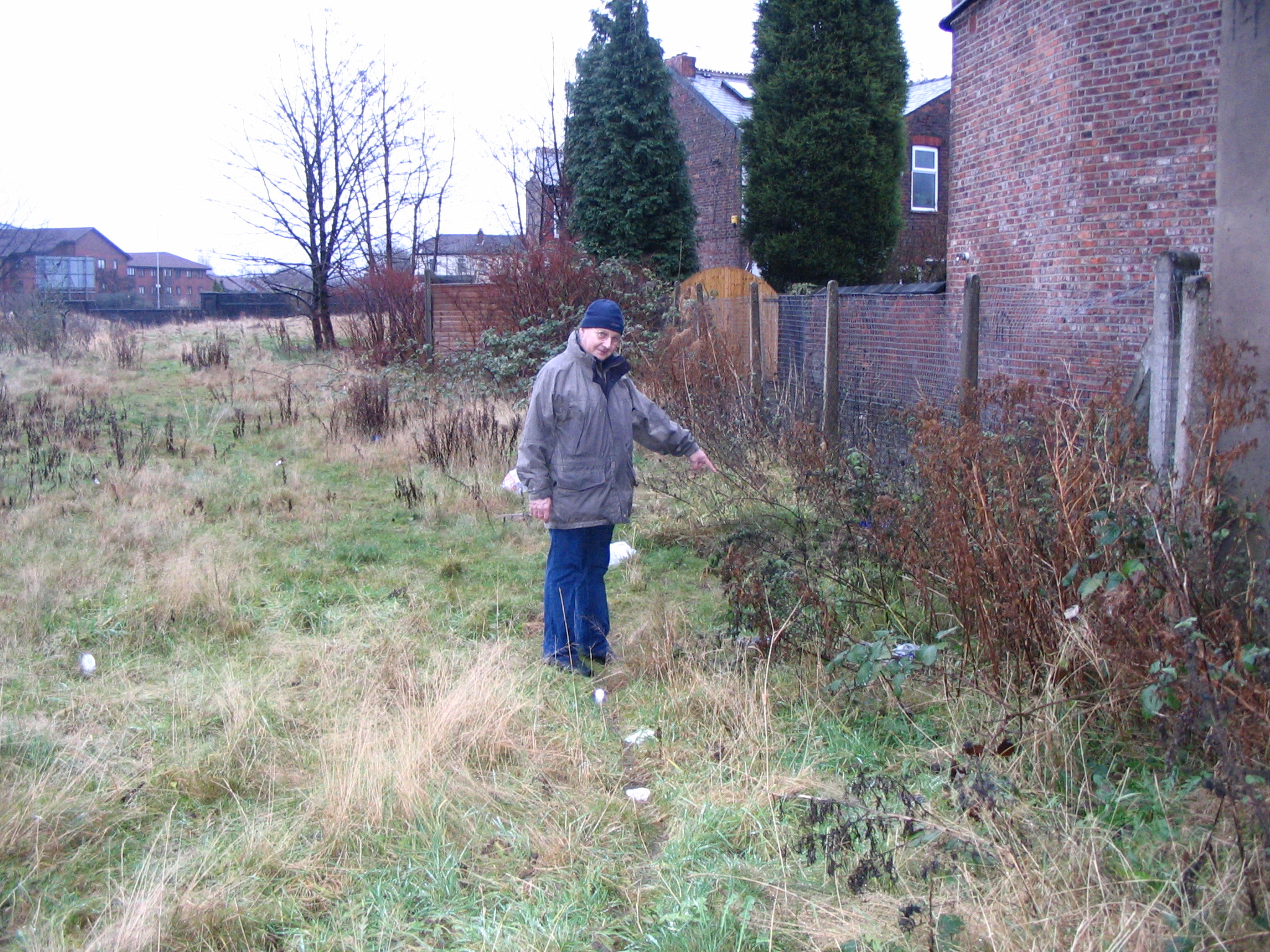
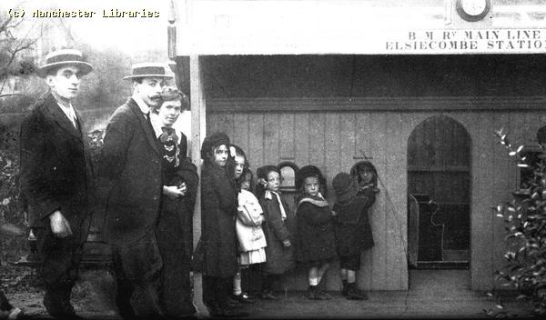
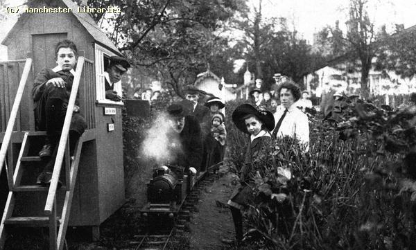
The Model Steam Train, South Levenshulme Does anyone remember the model steam train which ran on a track at the top of the embankment on the south side of South Levenshulme Station? How long was it there, and who built and operated it? I seem to think the owner gave rides on it to local children during the summer. I never got to ride on it though!
This photo shows the approximate location of the model steam railway. I got my friend Dave Irving to point to where the line was located. Nothing there now to show that it ever existed. December 2007.Update: I have recently been given some information by Jennifer McKay, who lives in Canada. She states that " With reference to the photographs of the railway station in South Levenshulme especially the one about the model railway line, yes I remember it well in fact the person who owned and ran the train lived at No. 12 Samuel Street and his name was Mr Standen. My very good friend lived next door to him. Mr & Mrs Standen passed away many years ago so we have no idea what happened to the trains, probably they went to some model enthusiast".( information received 23rd March 2009).
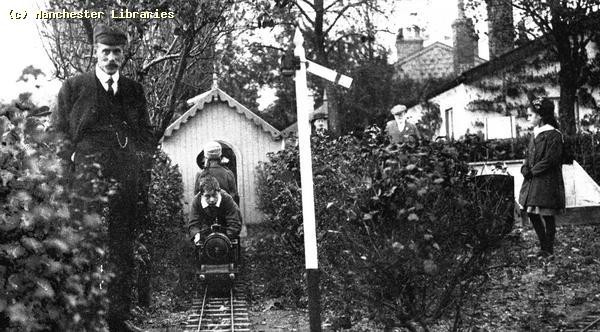
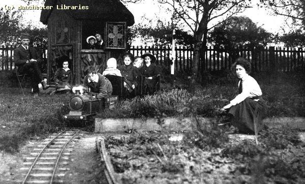
Finally evidence of the model railway! I recently found this photo of the buildings on South Levenshulme station before they were demolished. The photo, taken in 1967 from the front bedroom window of 20 Crayfield Road, clearly shows the model railway line running across the top of the far embankment. It looks like a low fence! The photographer, Peter Bower, was a student living at number 20 Crayfield Road. He was using up a roll of 35mm colour film, and this was the last shot! This view was almost the same as it would have been from my parents house at 14 Crayfield Road. The station at this time had been closed for nearly 10 years, the glass and iron canopies had been removed, and the buildings look ready for final demolition. ( photo Peter Bowers) Another local model garden railway I found these photos of a garden railway situated in Burnage, and dated 1912. Can anyone shed any light on the possible location of this railway. Obviously a very wealthy family!! ( photos via Manchester Libraries)
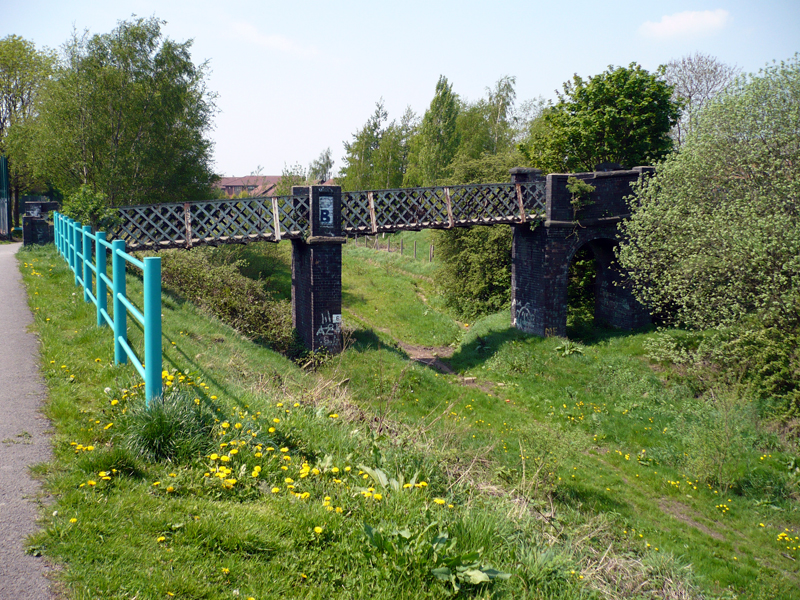
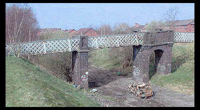
A Levenshulme Railway Landmark The following series of photographs show a Levenshulme railway landmark which must be familiar to generations of Levenshulme residents. It is the very unique iron foot bridge which crosses the Fallowfield Loop line east of South Levenshulme Station. Did the bridge have a name? I only hope that future generations see its significance as a piece of unique railway architecture! I have no idea when the bridge was built but it must be of a similar age to the railway line. The bridge was accessed, and still is, from a rather overgrown footpath starting on Broom Lane . The bridge led to the, in my generation, wonderful open aspect of Jacksons "Brickie" This vast excavated area was used as a landfill in the 1970's & 80's and is now a kind of Country Park.
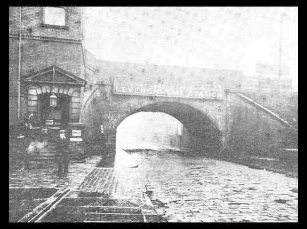
Passenger train passing under the foot bridge 1948. ( photo Levenshulme Loop Line)
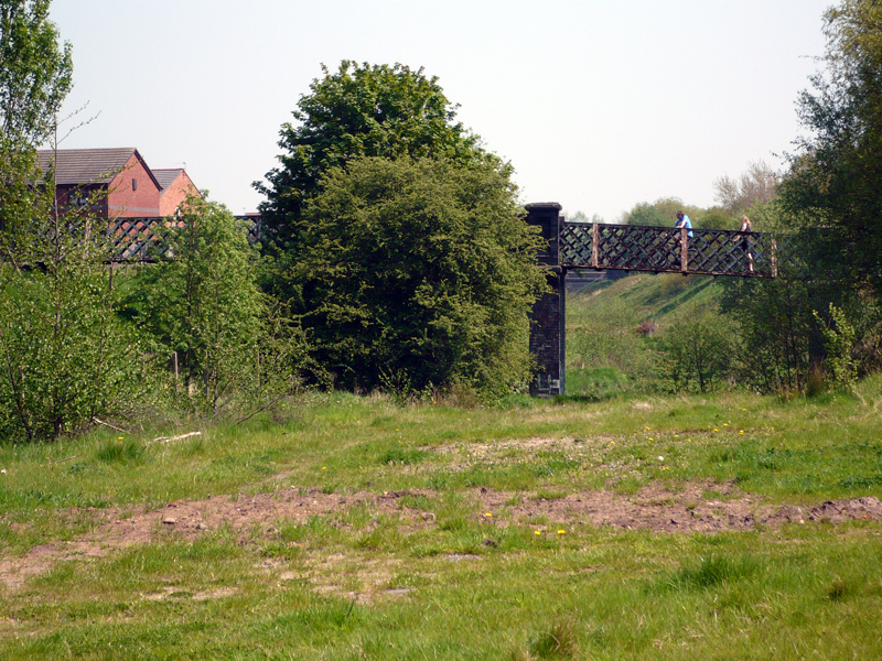
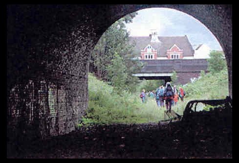
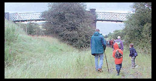
The above photographs show my old school friend Tony Woodford standing on the bridge in 1999. As kids we used to watch the steam trains pass under the bridge & run up and down through the clouds of smoke & steam. I can still smell the smoke!! The second photo shows a group of enthusiasts trekking along the Fallowfield Loop line in July 2002. The rail bed is now being turned into a walking & cycling pathway. ( 2nd Photo. Aiden O'Rourke )
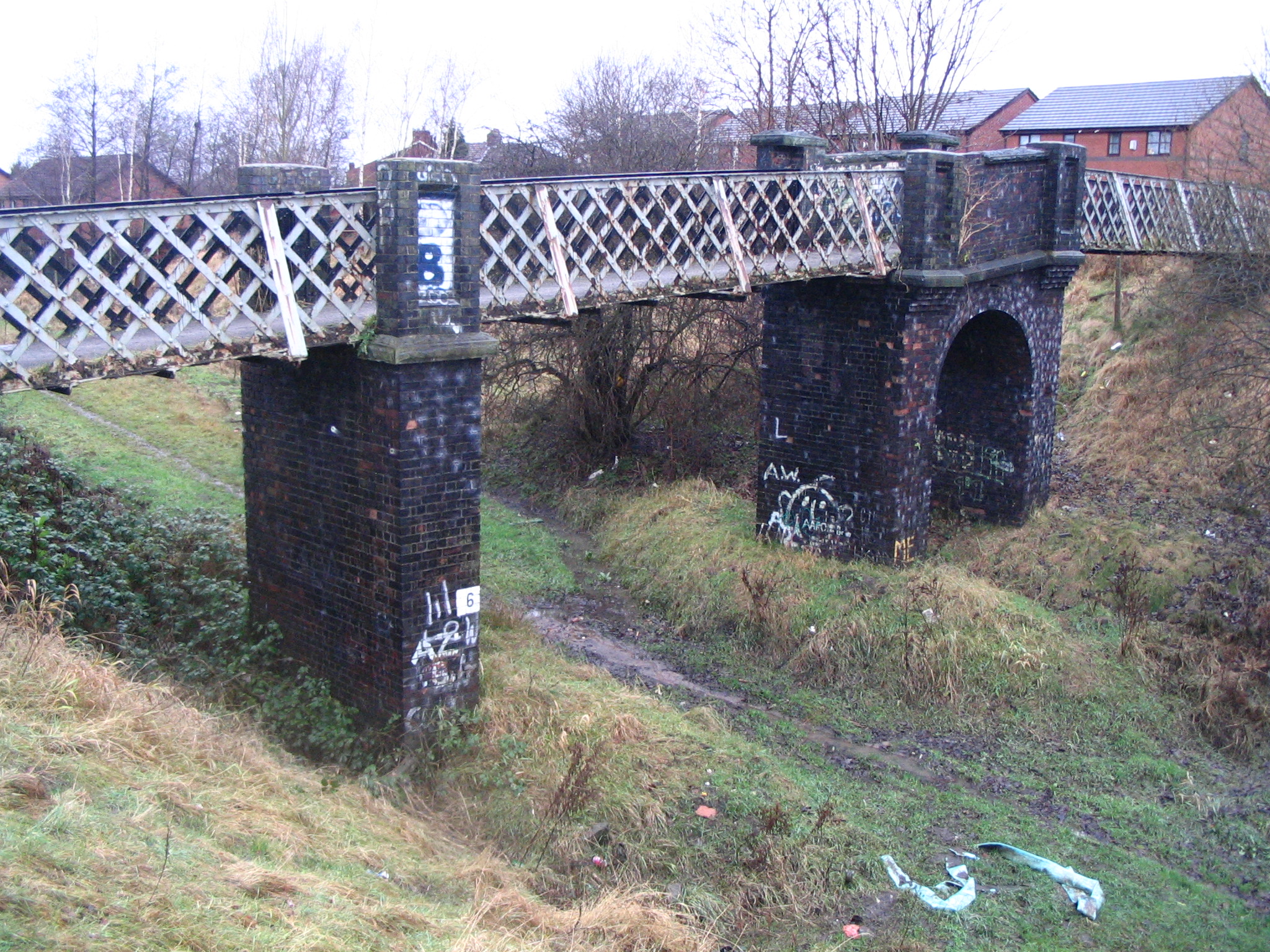
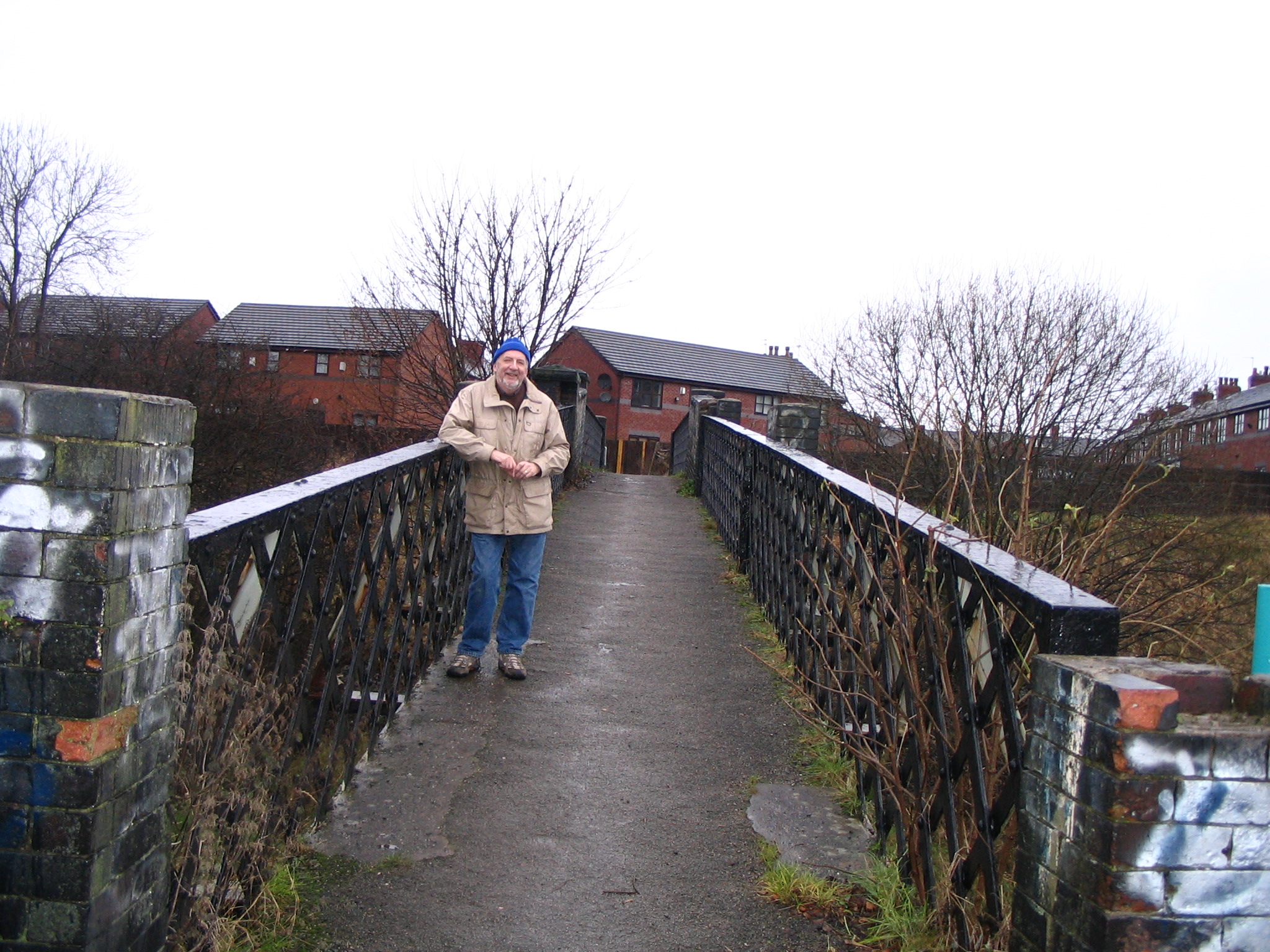
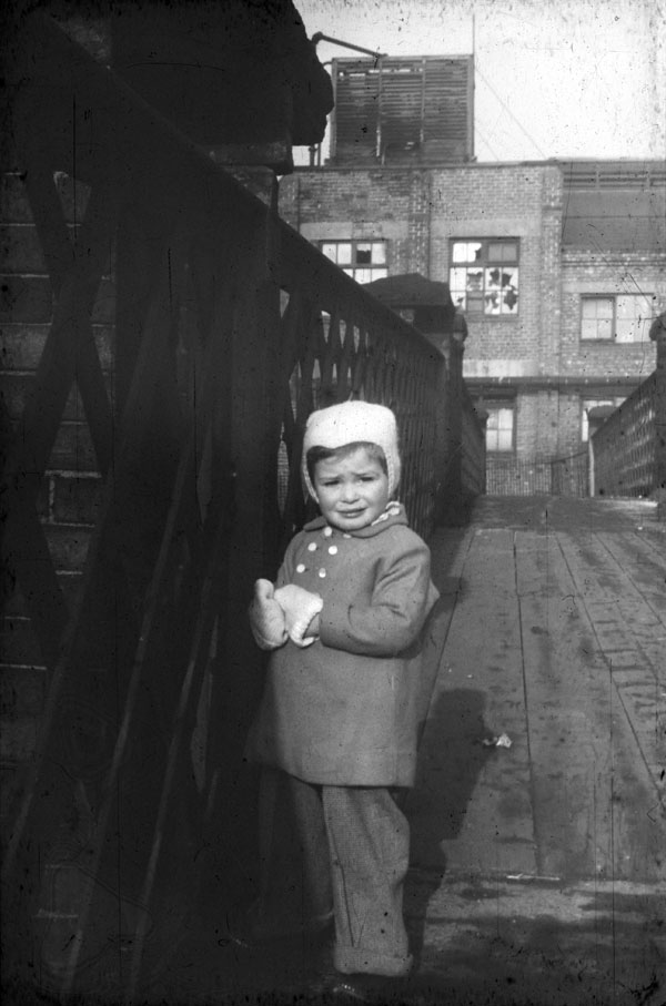
Two views of the footbridge looking north, December 2007. Thats me in the second photo! This bridge seems to get to look more dilapidated every time I see it. Any hope for some preservation? Question? Why does the cycle/footpath leave the original rail bed here? Is the bridge considered unsafe to walk under? The two photos below were sent to me by Cedric Woodhall, who used to live at 71 Langdale Ave and also in Greenway Ave. He states " I have found some old pics my father took, one of me on the " lattice bridge" aged probably two, so that puts the photo winter 1957/58. You can see the UCP in the background. I was up in September 2008 and took another at exactly the same spot, 50 years later" How time flies. You don't look a day older Cedric!
The above photos are recent, 2009, shots of the Lattice Bridge sent via
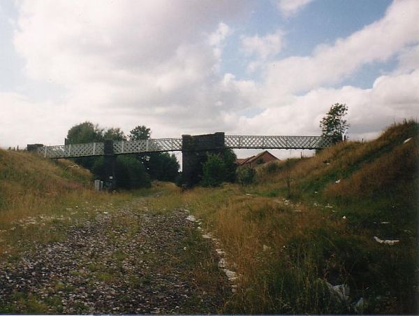
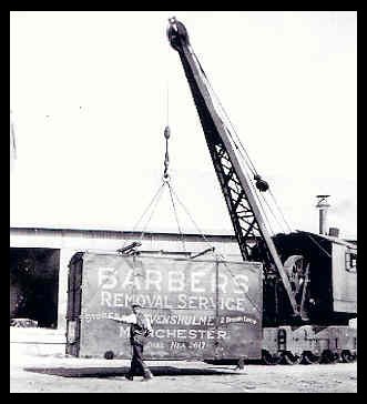
Robert Todd. The lattice Bridge prior to the cycle/footpath. Some of the track bed still in place. The Levenshulme Railway Goods Yards I am looking for information on the two Levenshulme Railway goods yards. When were they built, how long were they in operation, what type of goods were handled Etc. During my childhood they seemed to be mainly used as Coal sidings servicing the local coal merchants. The coal probably came from the South Yorkshire coalfields, but it could also have been mined locally. The two yards were, Alma Road (BR Midland Region) & Broom Lane (BR Fallowfield Loop Line ). The coal merchants that I remember are Barbers, Harry Kay, Hodgkinson's. There were others! I remember the 3 wheeler Scammell trucks used by some coalmen & by British Railways. In the early fifties it was quite probable that some coal was still delivered by horse & cart. Alma Road Goods & Mineral Yard
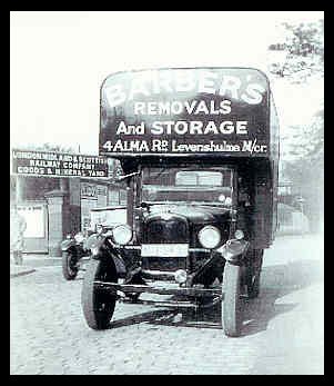
The photos above show:- #1 A Barbers Removals Van, parked on Alma Road opposite the gates to the London Midland & Scottish Railways (LMS) Goods & Mineral Yard. This photo, taken in the 1930s, shows the gates leading to the goods yard. I believe the sign was still there in the 1960s! #2 A Barbers Removals container being loaded or unloaded. I don't know where this was taken, but it probably is not in Levenshulme!
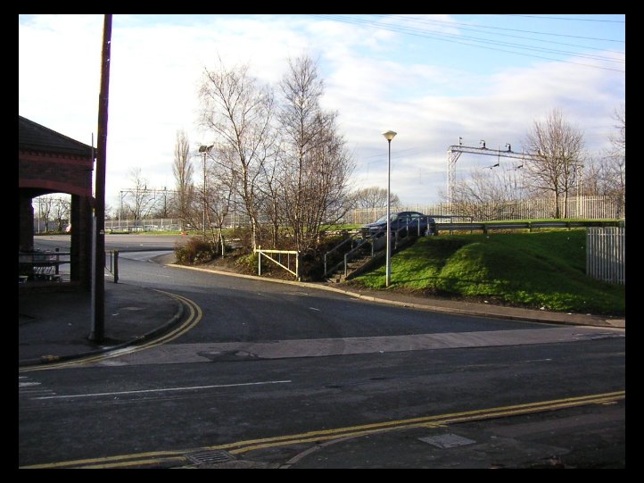
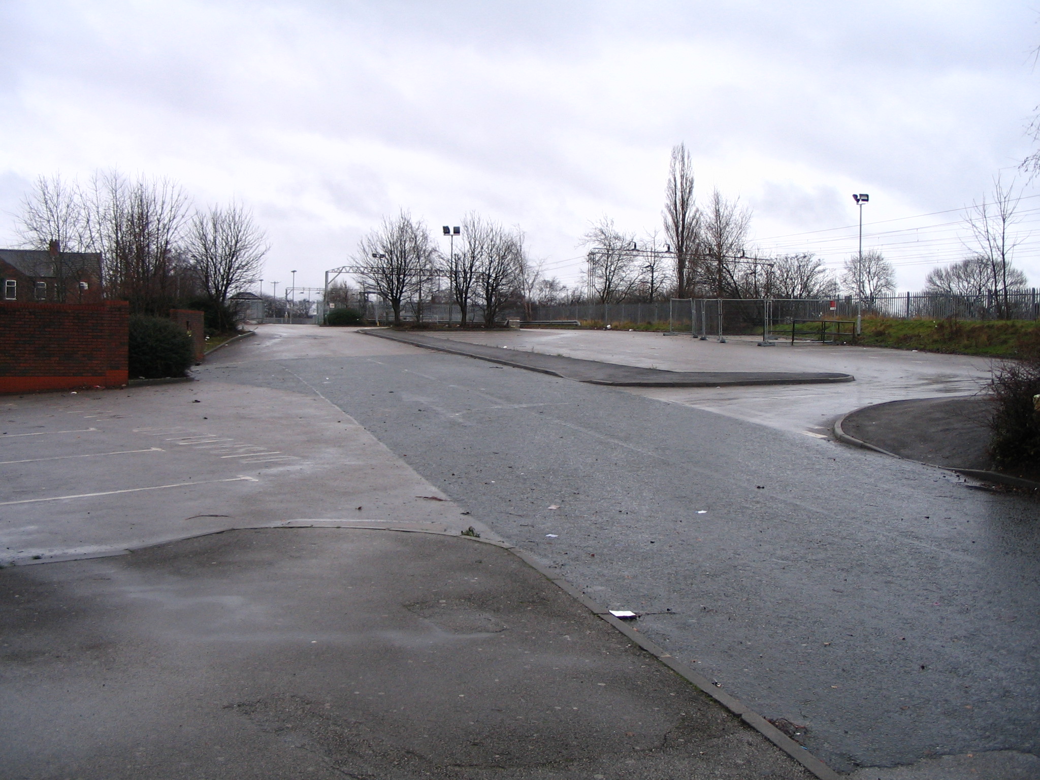
The site of the Alma Road Goods & Mineral yard, February 2004. This is now the Kwik Save parking lot. This is roughly where the gateway to the old yard stood. ( Photo Andrew Barber )
The Alma Road goods yard site in December 2007. Since the previous photo Kwik Save has closed down so the car park is currently disused. Broom Lane Goods & Coal Sidings
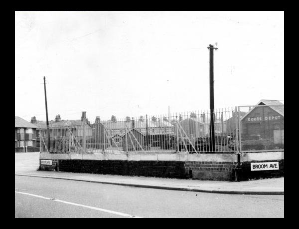
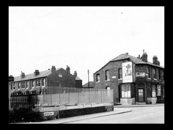
This view from 1959 shows the re-built bridge parapet on the corner of Broom Lane & Broom Ave. Note the Goods Depot buildings and various coal merchants buildings, including Mitchell's. ( Photo. Manchester Libraries)
The same corner looking south down Broom Lane. Note The railway bridge parapet on this side of the lane was rebuilt during the early 1960s. ( Manchester Libraries)
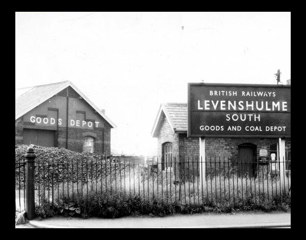
The above photos taken in 1959 show the South Levenshulme Goods Yard when t was still in operation. Compare to the view immediately below. ( Photo. Manchester Libraries)
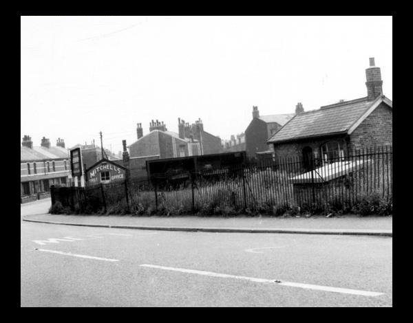
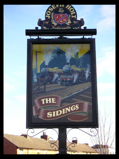
The above three photographs show views of the South Levenshulme Goods Sidings site as it exists in February 2004.The Sidings Pub & a small modern housing development now stand where coal & mineral wagons were once shunted in and out of a busy railway depot. (Photos. Andrew Barber )
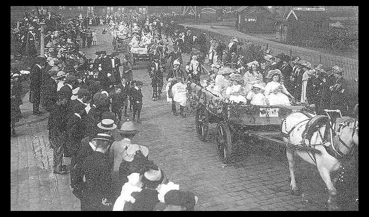
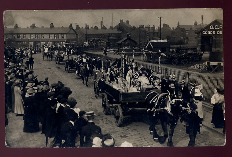
Not a very clear photograph, but it does show a parade passing by the Broom Lane Sidings in 1912. The photo was taken from the corner of Station Road, looking north east. The various buildings/huts shown in this picture still existed in the 1950s. The farthest one was a coal merchants office, the centre one was the weigh scale office and the nearest one is again a coal merchants office. The iron railings still existed in the 1980s. Note, the cobbled surface of Broom Lane and Station Road and also the fine dress of the onlookers. The photo came from a 2002 calendar sent to me by my sister.
This could be the same parade as the one shown previously. This is right beside the South Levenshulme Goods Yard. Most of the buildings in the background still exist to this day. Also most of the buildings and coal offices still existed into the 1960s. A locomotive named "LEVENSHULME"
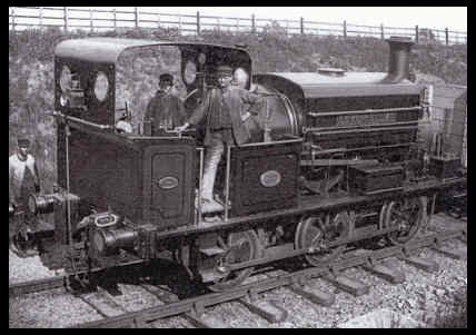
The above photo shows a locomotive bearing the name "LEVENSHULME". The locomotive is an "M" class contractors locomotive,0-6-0 saddle tank No.1113. This locomotive was built in 1889 by Manning Wardle & Co. of Leeds, and delivered new to T A Walker the contractors for the Manchester Ship Canal. It later passed to Topham, Jones & Railton and was used in the construction of The Great Central Railway between Leicester & Rugby in the period 1894-98. Later still it worked on the Kings Dock contract in Swansea between 1904-09. Nothing is known after that time. This photo was taken on 12th June 1897, working between Aylestone & Rugby. The locomotive probably never worked in the Levenshulme area, so how did it get its name? Any thoughts? ( Photo via Leicestershire County Council, Photographer S W A Newton) Crossley Road Railway Bridge
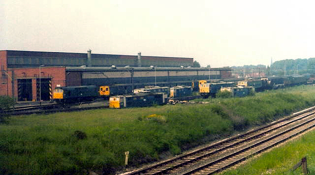
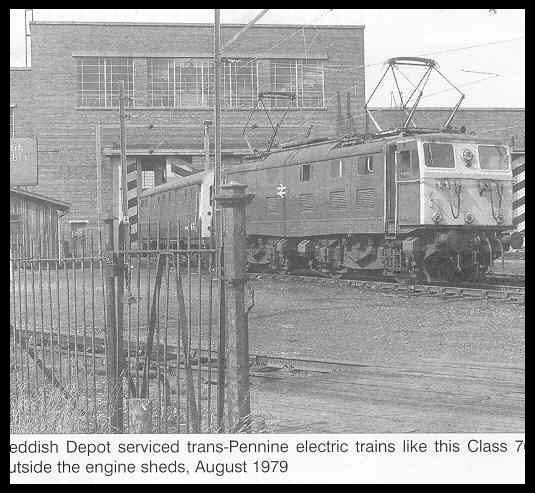
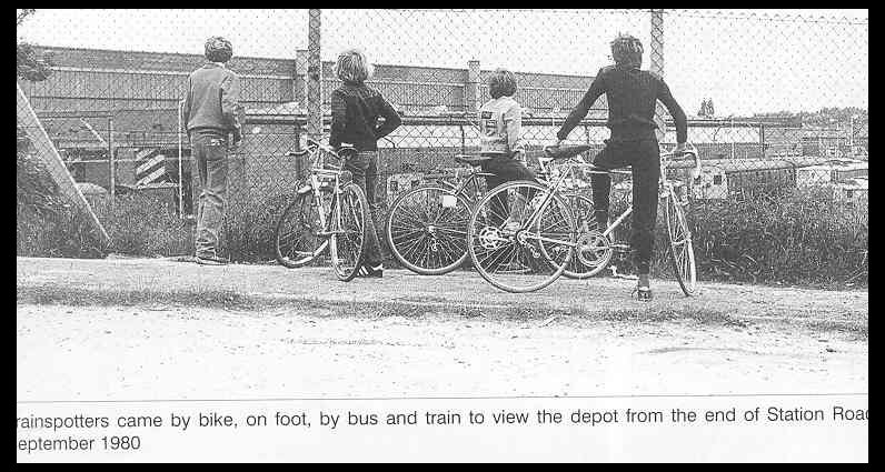
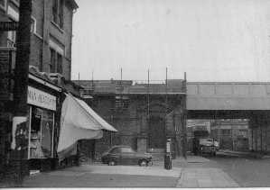
The Crossley Road bridge in 1959, looking east towards Lloyd Road.. This re-built bridge eventually enabled double decker buses to pass under it. In this view the road surface has yet to be lowered, so in 1959 only single deck buses such as the No 22 Eccles service were able to pass through. When the road was lowered it created a steep dip in the road which has been subject to flooding during heavy rain. This problem persists to the present day!! ( Photo. Manchester Libraries) Reddish Sheds ( The Reddish Depot) The Reddish Diesel Locomotive Depot, affectionately known as "Reddish Sheds" was located just over the Stockport border near the reservoirs in Reddish. To several generations of Levenshulme train spotters it was a place of fascination, as indeed it was for train spotters countrywide. This busy depot was built in the 1950s, but alas it is no more. Only broken bricks & general desolation remain!!
A bustling Reddish Sheds circa 1979. (via Robert Todd)
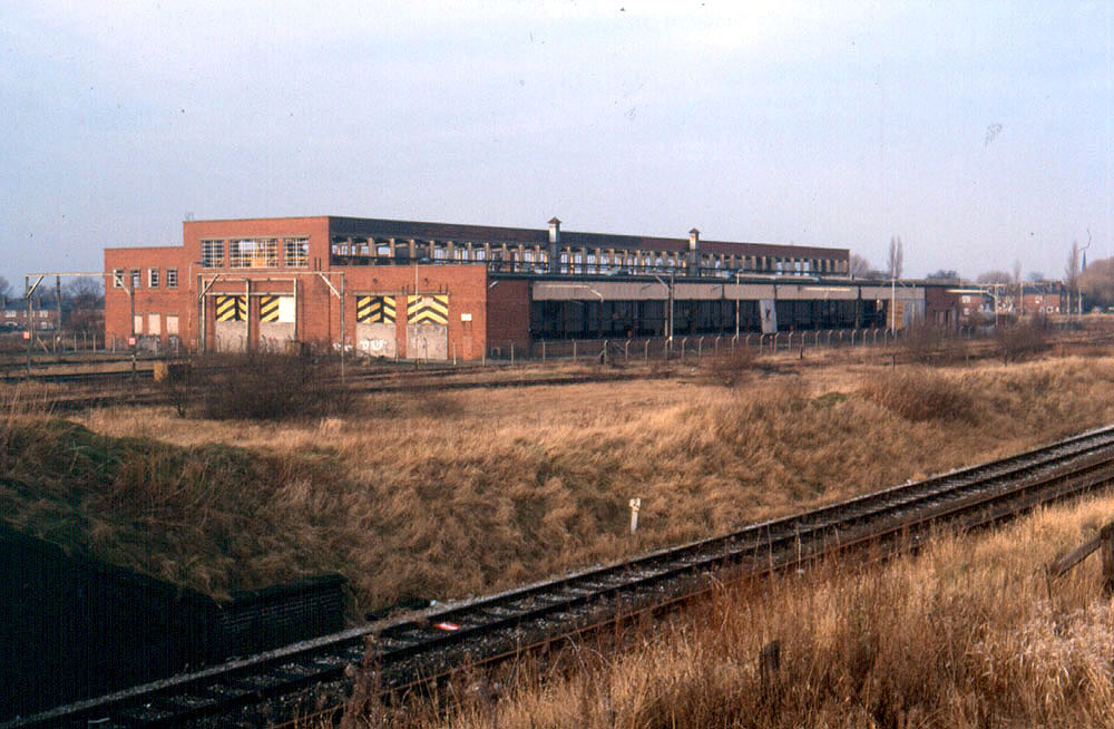
Abandoned, but not yet derelict Reddish Sheds 1989. ( via Robert Todd)
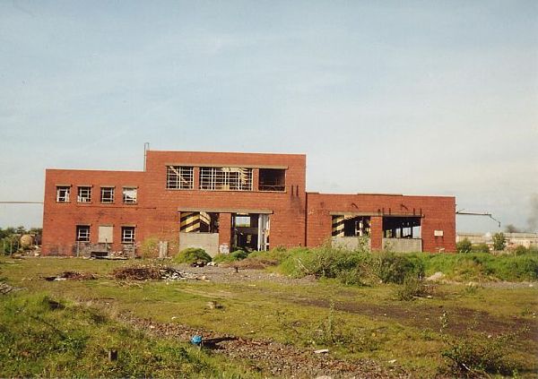
Derelict Reddish sheds 1980s. All these buildings have now been demolished.
The next three photos taken at Reddish Sheds in the 1970s.
Heading towards Levenshulme from Reddish. This is Sandfold Lane Bridge.
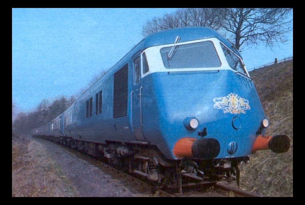
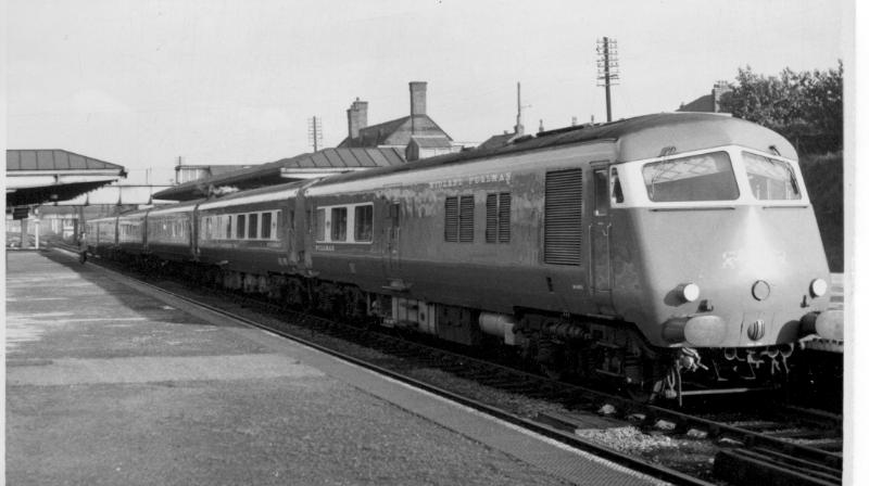
These two photographs show something of what used to exist at Reddish Depot. ( Photos Andy Sparks via Stockport Heritage Magazine) The Blue Pullman For a short period in the early 1960s a new Pullman service was operated between Manchester Central Station & St Pancras in London. The service was known as the " Midland Pullman", and was unusually only First Class. The diesel units used on this service were maintained at Reddish Sheds, and used the Fallowfield Loop Line to transit to and from Manchester Central. The diesels were brand new units, and were only ever used on the London Midland and West Country services. I remember these trains passing through the long closed Levenshulme South station, and I often saw them early on the morning waiting on a signal right in front of my house in Crayfield Road. I would love to find some photos of these trains passing through Levenshulme. Someone must have photographed them! In the meantime here are a couple of photos found on the internet.
Not Levenshulme, but a very good shot of a Midland Pullman train at rest. The train looks old fashioned by todays standards, but was "state of the art" in 1960.
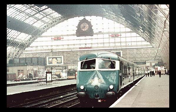
The Midland Pullman at Manchester Central Station in the 1960s. This once very busy mainline terminus is now the site of the G-Mex exhibition & conference centre, and the magnificent train hall and the "Clock" still exist.
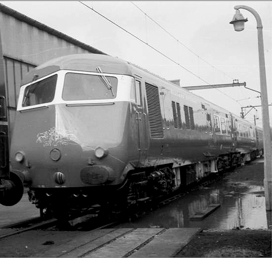
The Blue Midland Pullman heading west. Possibly Fallowfield Station. 1960s.Update:-The train is actually passing through Withington on a London St.Pancras morning express. Info via Robert Todd. ( Manchester Libraries) Update: I have been informed that this station is more likely Chorlton!!
The Blue Pullman at Cheadle Heath Station 1960s The Blue Pullman at Reddish Sheds mid 1960s. ( Photo via Robert Todd) Pedestrian Tunnels under the LMS Mainline railway in Levenshulme. There are several pedestrian tunnels under the old LMS Mainline railway that runs north to south through Levenshulme. Most of them are north of the Levenshulme station, but there is at least one under the tracks next to Errwood Park. Whether this was ever used as a pedestrian tunnel is a mystery, as in my day and currently it is fenced off!! The Crescent Tunnel
This is the west side of the tunnel facing towards The Crescent and Stockport Road. Dated 1912
This is the east side of the tunnel, taken from The Crescent in 1971. Facing towards Central Ave and Slade Lane. Park Grove Tunnel
Park Grove Tunnel in 1907. Compare to the next view 103 years later!
"Graffiti Rules" The same view in 2010.
The other end of the tunnel 2010. The tunnels appear to have been partially re-built, probably during the electrification of the line in the early 1960s. Spot the speeding train!! ( both 2010 photos via Mike Berrell) Slade Hall Road Tunnel
Slade Hall Road Tunnel in 1903. West side facing east towards Stockport Road.
Slade Hall Road Tunnel facing west towards Slade Hall Road and Slade Lane. Note this is at this time a dirt road.
Railway Bridges in Levenshulme. There are a multitude of railway bridges in Levenshulme. Mostly elevated on the London to Manchester (LMS) mainline, or passing over the old east to west Fallowfield Loop line.
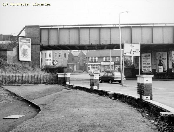
This is the bridge at the junction of Moseley Road and Kingsway. Carrying the Manchester to Crewe line. This bridge is on the boundary of Levenshulme and Rusholme. Taken from the old Birchfields Tram/Bus Depot in 1971. The old Kingsway Picture House can be seen standing derelict through the bridge.
The same bridge seen from the opposite side in 1959. Taken from beside the Kingsway Picture House.
|
CKN!BGk~$(KGrHqMH-CMEs82!,!pqBLU2CCr6qQ~~_35.jpg)
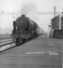
 Passenger Train
heading South through Levenshulme North Station, Albert Road. Probably in
the 1950's. Note the wooden platforms! The Station was modernized in the
early 1960's.
Passenger Train
heading South through Levenshulme North Station, Albert Road. Probably in
the 1950's. Note the wooden platforms! The Station was modernized in the
early 1960's.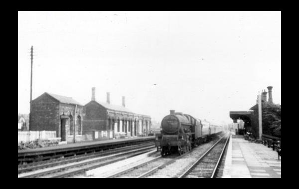
IQ~~_12.jpg)
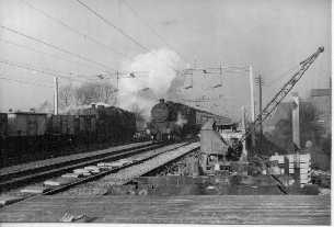
 1962
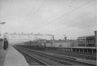
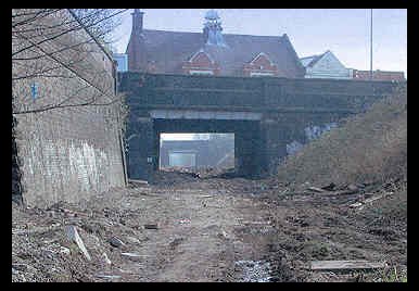
The Main Line & Goods Yard near Levenshulme South Station, looking west.
The train is the Liverpool to Hull boat train. Yes, this was a main line!
It operated up to October 1988. The track bed is now being turned into a
walking/cycling pathway. (Photo: The Fallowfield Line)
1962
The Main Line & Goods Yard near Levenshulme South Station, looking west.
The train is the Liverpool to Hull boat train. Yes, this was a main line!
It operated up to October 1988. The track bed is now being turned into a
walking/cycling pathway. (Photo: The Fallowfield Line)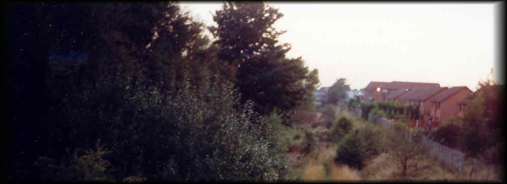 . Not a particularly good photograph, but it shows roughly the same view as
above in May 1999. New houses, and a Pub now exist where the Goods Yard
once stood.
. Not a particularly good photograph, but it shows roughly the same view as
above in May 1999. New houses, and a Pub now exist where the Goods Yard
once stood.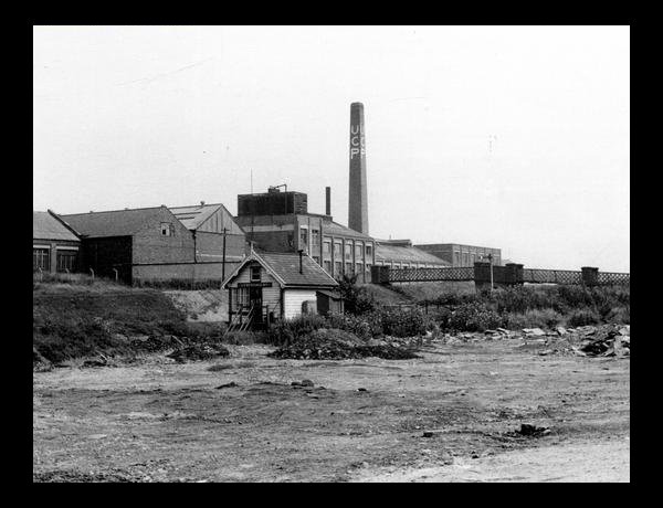
5.jpg)
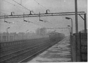
 This image is taken from a transparency that I took in 1971. I was trying
out my new Practika SLR camera. The photo is a little fuzzy, but it shows
the rear of South Levenshulme Station at that time. The covered steps to
the station were still there, and the windows at the rear were still
intact. The photograph was taken through the front room window at 14
Crayfield Road.
This image is taken from a transparency that I took in 1971. I was trying
out my new Practika SLR camera. The photo is a little fuzzy, but it shows
the rear of South Levenshulme Station at that time. The covered steps to
the station were still there, and the windows at the rear were still
intact. The photograph was taken through the front room window at 14
Crayfield Road.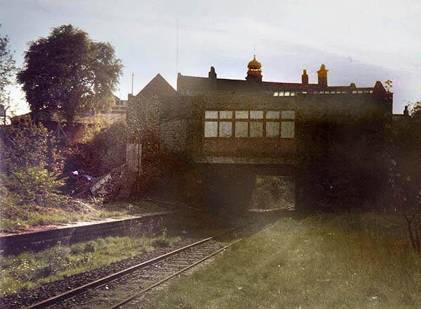
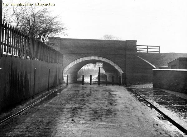
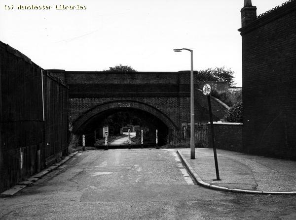
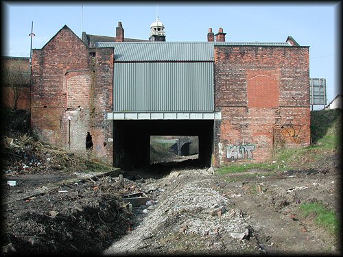
 This photo shows the railbed in 2002 looking East from the tunnel beneath
the London to Manchester Midland Region/LMS line. Note the burned out car,
a current abandoned railway feature! Over the bridge parapet you can see
the top of South Levenshulme Station on Stockport Road.
This photo shows the railbed in 2002 looking East from the tunnel beneath
the London to Manchester Midland Region/LMS line. Note the burned out car,
a current abandoned railway feature! Over the bridge parapet you can see
the top of South Levenshulme Station on Stockport Road.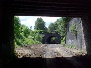
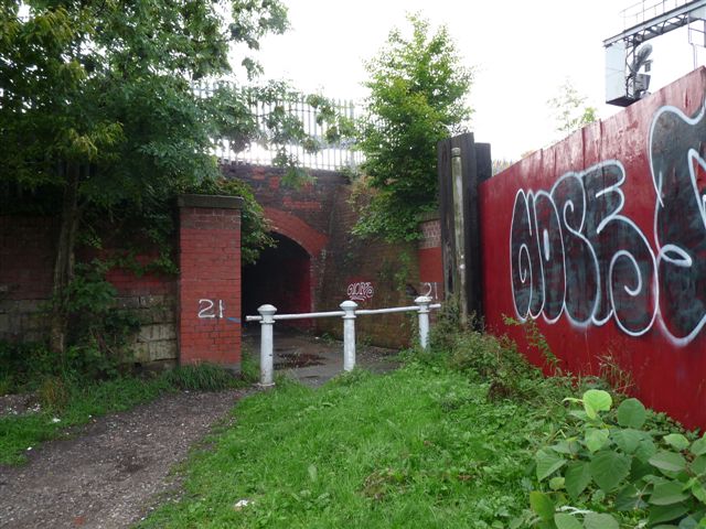
 This
photograph shows a later view of the same area during the building of the
new cycle & footpath. ( Photo Aidan O'Rourke)
This
photograph shows a later view of the same area during the building of the
new cycle & footpath. ( Photo Aidan O'Rourke)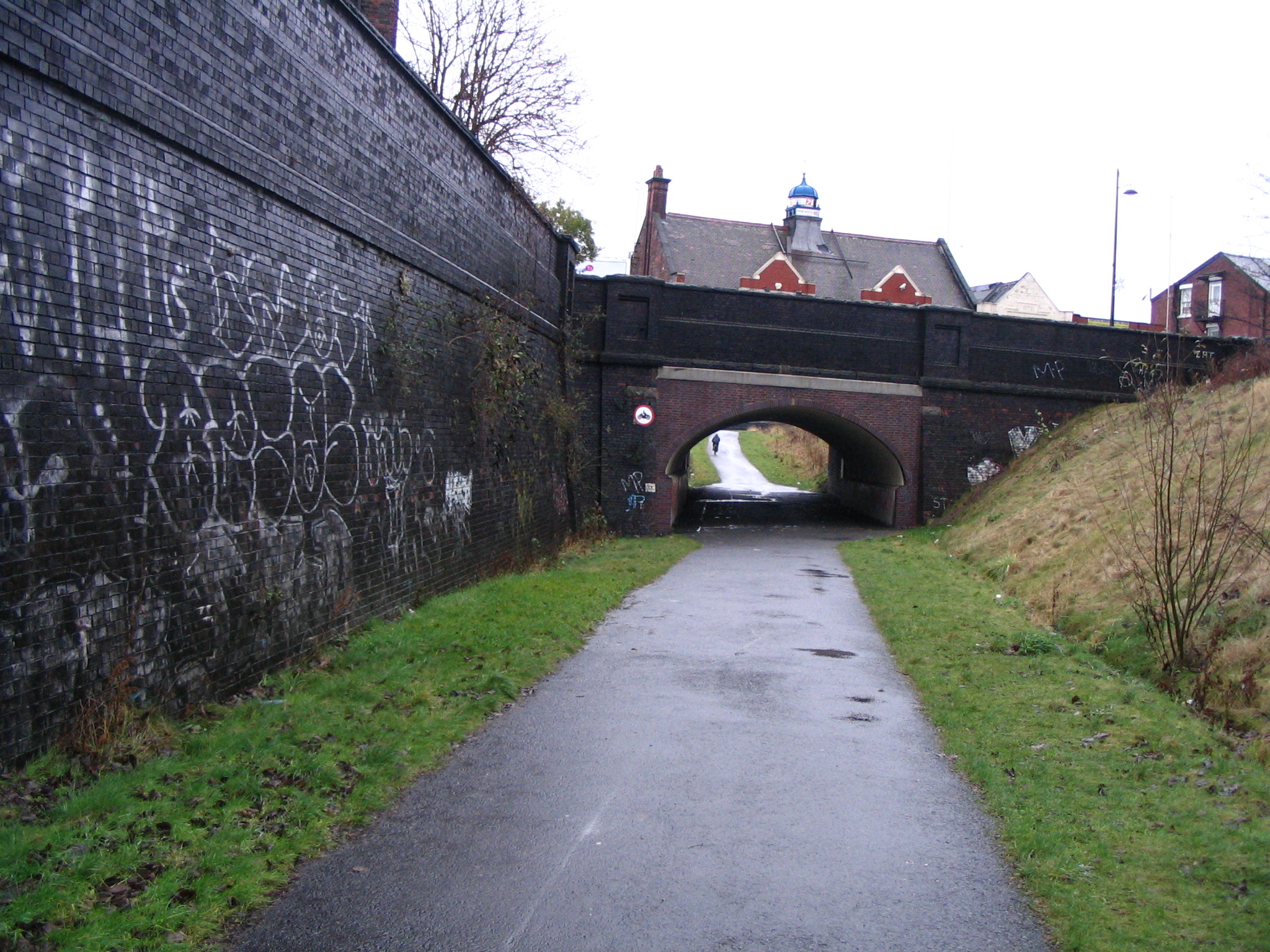
16.jpg)
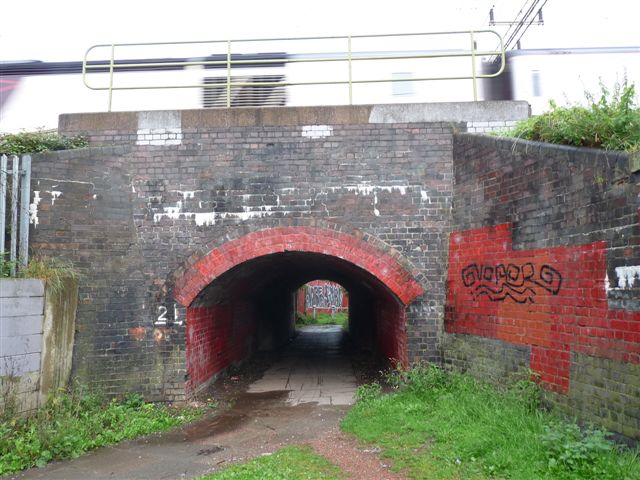
 These two photos are a before & after view of the bridge. The first shows
the last train to use this line, October 1988. Note the ruins of the UCP
in the background. ( Photo: The Fallowfield Loop Line.E. M. Johnson ) The
second shows the bridge in recent times, including graffiti & burned out
car.( Aidan O' Rourke )
These two photos are a before & after view of the bridge. The first shows
the last train to use this line, October 1988. Note the ruins of the UCP
in the background. ( Photo: The Fallowfield Loop Line.E. M. Johnson ) The
second shows the bridge in recent times, including graffiti & burned out
car.( Aidan O' Rourke )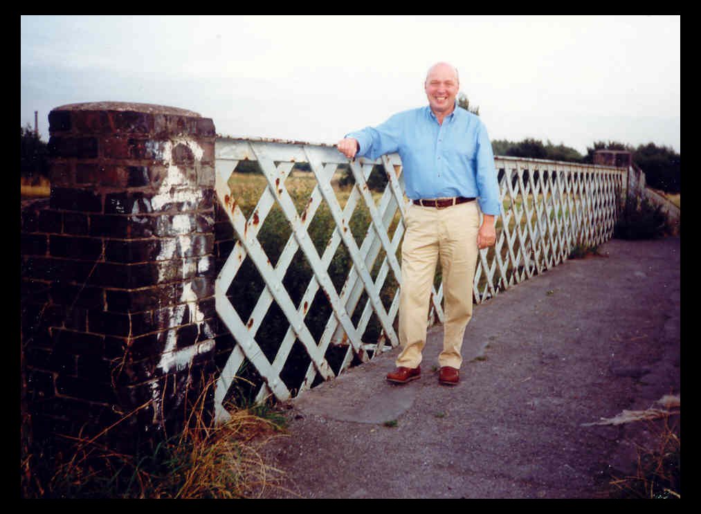
 Cedric Woodhall aged two. Note the broken windows at the UCP!
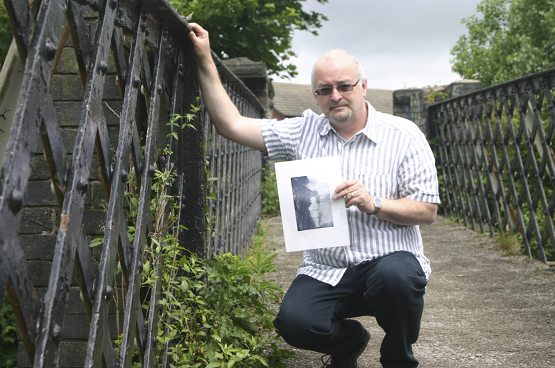 Cedric
aged 52, 2008. Holding a copy of the above photo. ( Information received
January 11th 2009)
Cedric
aged 52, 2008. Holding a copy of the above photo. ( Information received
January 11th 2009)