 Sports & Leisure, Parks and Playing Fields.
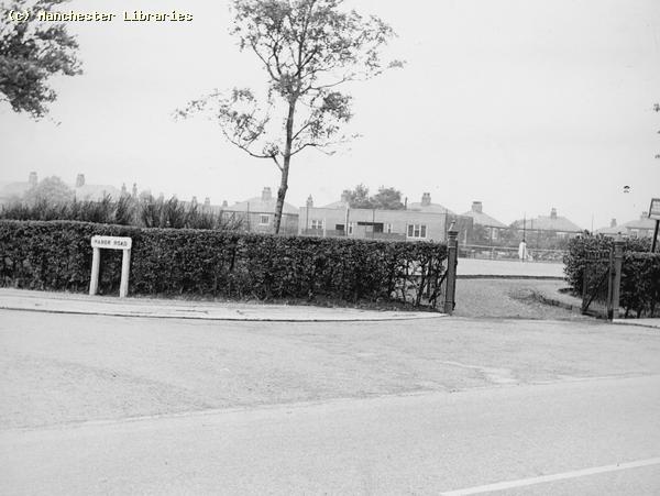
This page is intended to be a reflection of Sport & Leisure pursuits during the 40's 50's & 60's. I have little knowledge of the sports, both amateur & professional, that occurred in the Levenshulme area. I will need assistance on this subject from readers of these pages. However, I would assume most local sports took place in the many parks & playing fields dotted around the Levenshulme area. The parks that I remember personally were Chapel Street Park & Errwood Park, both well cared for in the 1950's, by resident groundskeepers & the "ever vigilant " Parkie!! The local playing fields were Greenbank Playing Field between Manor Road & Barlow Road, & Cringle Fields off Crossley Road & Errwood Road. Errwood Park & Cringle Fields
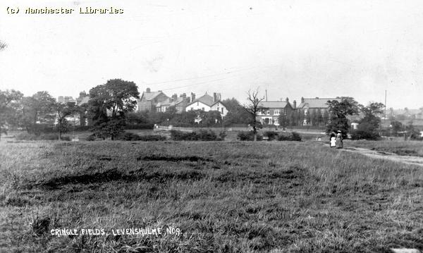
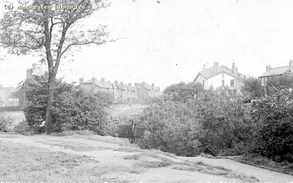
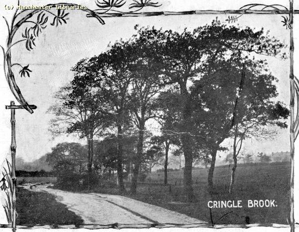
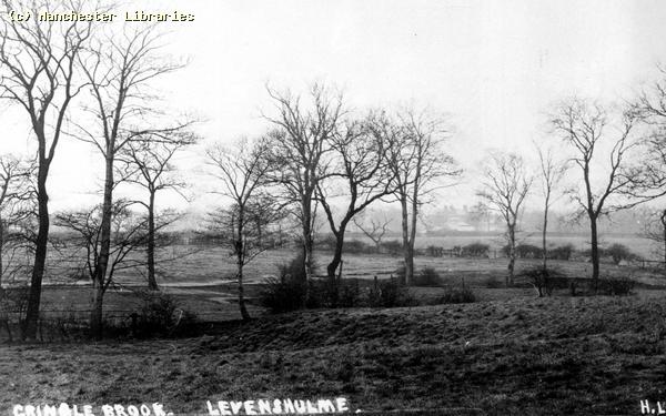
The West corner or Errwood Park, then called Cringle Fields 1910 ( Manchester Libraries)
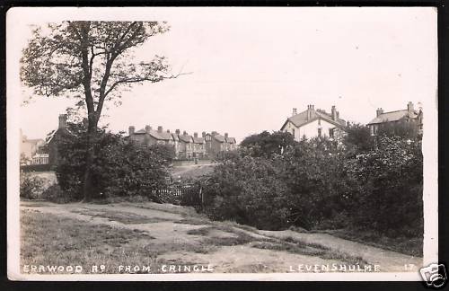
A similar view to the one above, but from a closer viewpoint. (via Ebay) The Bandstand Errwood Park
This is the approximate location of the Bandstand. Compare with the above photo. When was it demolished? Photo taken December 2007.
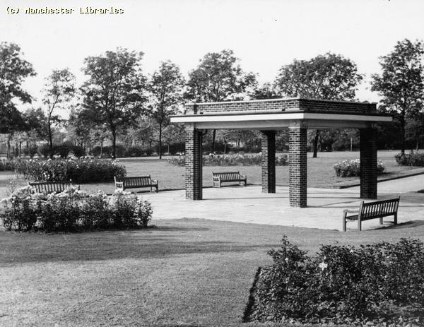
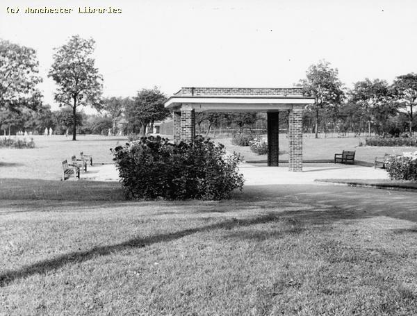
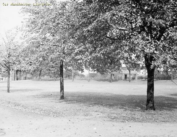
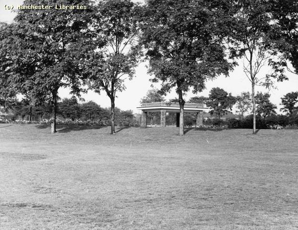
These four images were taken around the former bandstand in 1963. How well cared for it looks! Now no more!! (Manchester Libraries)
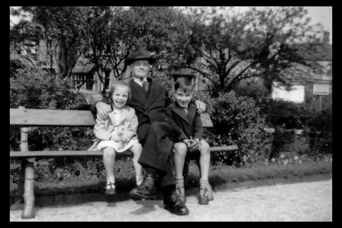
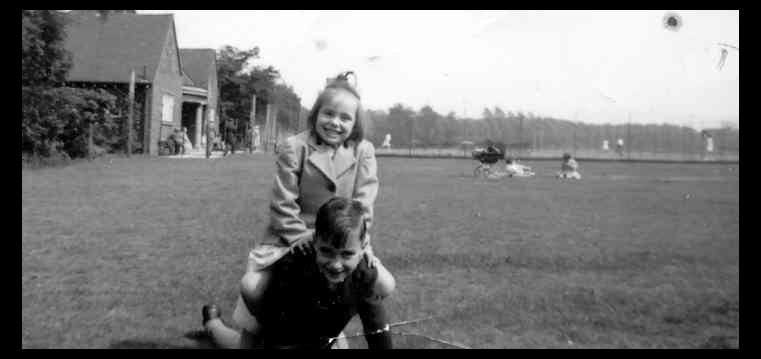
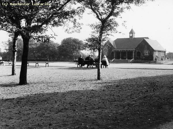
Two photos taken in Errwood Park in the early 1950s. The first shows my wife Mavis, her brother David & her Grandad, Albert Yarwood. Taken near the park gate at Davenhill Road. The second, again with Mavis & David, was taken at the back of the Bowling Pavilion with the Tennis Courts in the background. Do you remember the Nursery/Garden Centre on the corner of Clare Road & Davenhill Road? I seem to remember it was called " Davenhill & Berry"! You could get sweets & glasses of mineral water there during the summer.
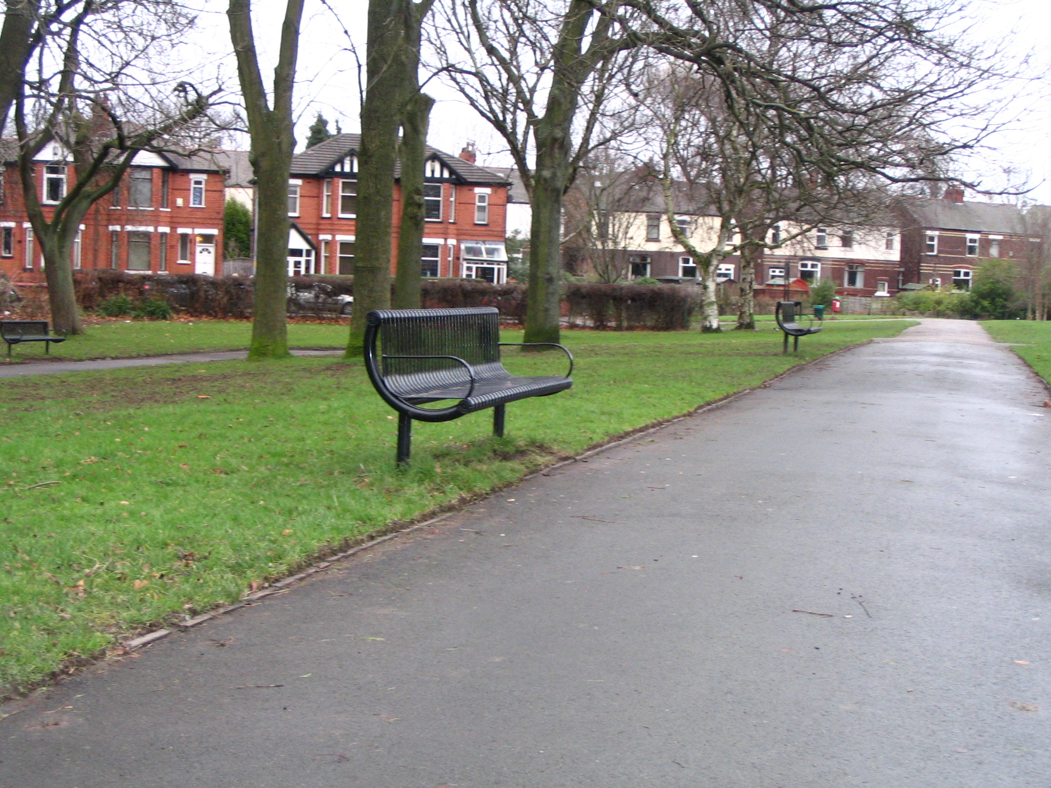
This Photo was taken in December 2007 in the approximate location where Mavis, David and Grandad Yarwood are sitting. The vegetation has certainly been thinned out since the 1950s. The Bowling Pavilion Errwood Park
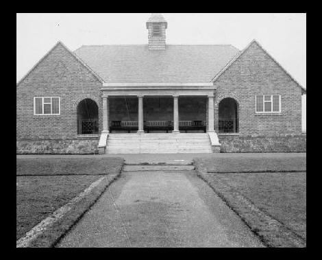
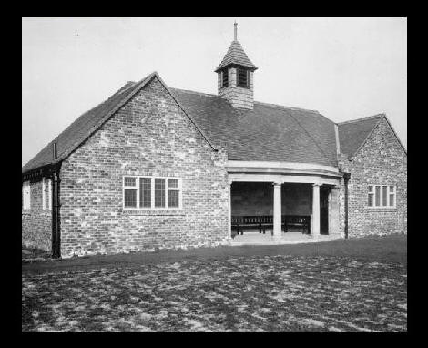
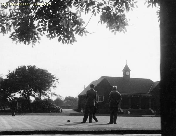
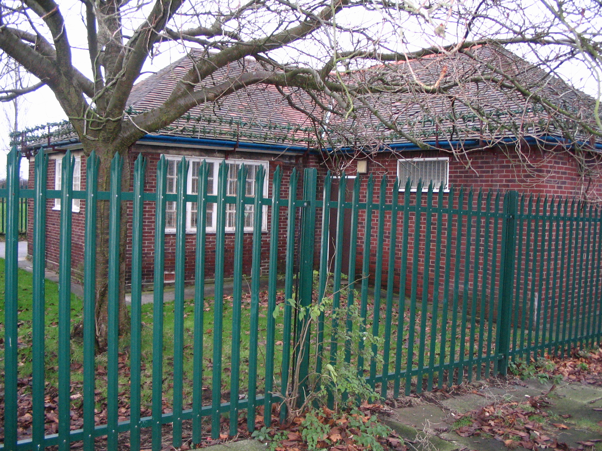
The above two photos, probably taken shortly after the bowling pavilion was built, show how the building looked when I was a child. The front and back were shelters, and the side rooms housed changing rooms and toilets. Compare to the 2007 photos below. What happened to the central turret? Does this building serve any useful purpose now or is it just an eyesore!!
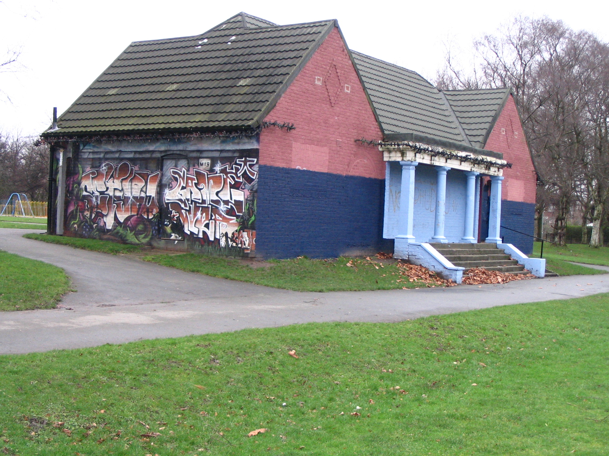
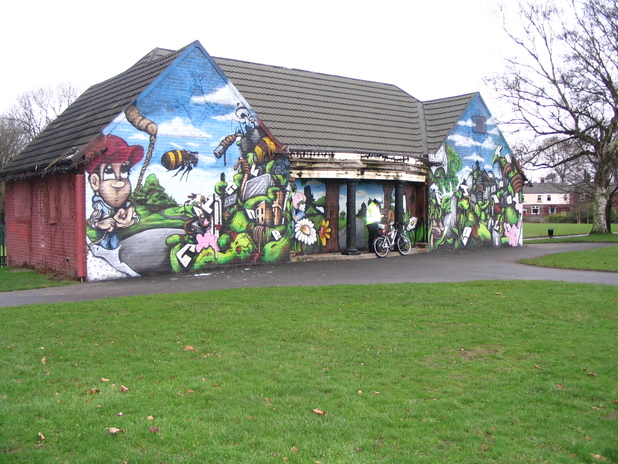
The Errwood Park Bowling Pavilion December 2007. Is this vandalism or what? Did they really need to paint the building?
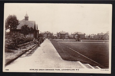
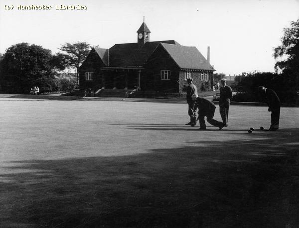
Another view of the bowling green and pavilion in earlier days. Note the houses on Errwood Road before the trees had grown.
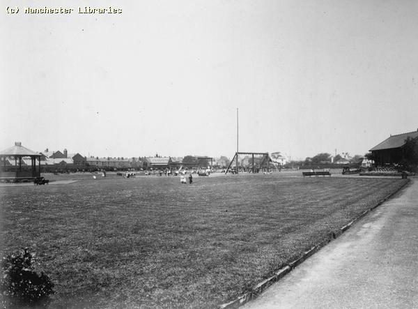
A familiar summer scene in Errwood Park. The well kept bowling greens in 1963. The forth image shows the footpath heading towards Errwood Road and the bridge over Cringle brook. ( Manchester Libraries)
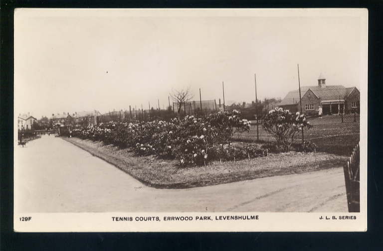
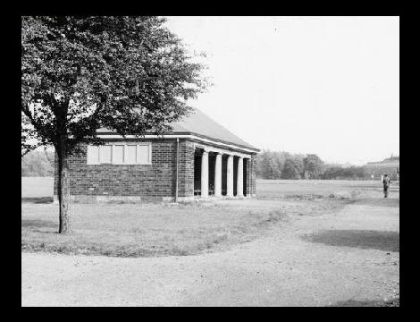
Tennis courts Errwood Park pre-WW2. There were no courts in this location by the 1950s. Note the bowling pavilion.
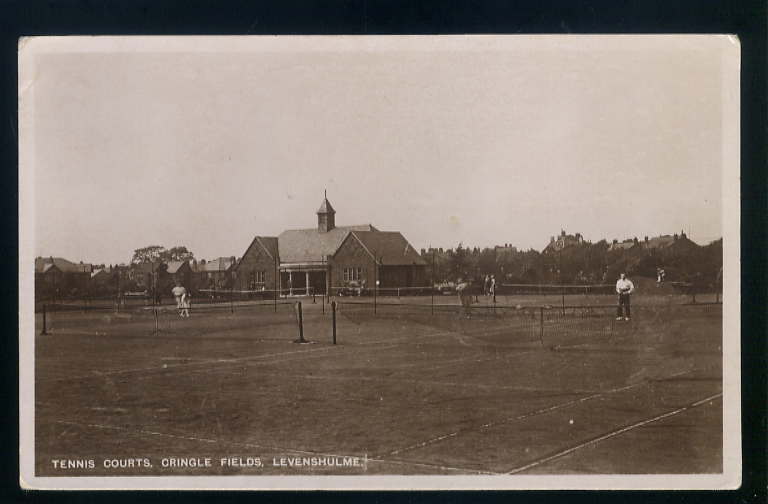
These were the tennis courts that I remember. Still there I think!
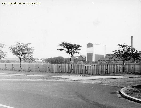
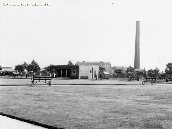
This photo shows the putting green, or pitch and putt green, in 1965. The little hut on the right hand side was where you paid to have a game, and where the clubs and balls were kept. I seem to remember during the summer they also sold ice cream from the hut. Note Crossley Motors and Fairey Engineering in the background. ( Manchester Libraries) The Cafeteria/Refreshment Room Errwood Park
This building, which seems contemporary with the Bowling Pavilion, was used in the summer months as a Refreshment Room or Cafeteria. You could buy mineral water, tea, coffee, sweets and sandwiches. There used to be a drinking fountain with a metal cup chained to it just outside. How unsanitary! Yet we all used it, and survived to tell the tale!! The building has been used for many years as a child day care centre. Note the fences and razor wire on the roof. Stalag Errwood maybe!! A sign of the times in our modern world.
The Refreshment Room in December 2007.
This is a view of a shelter that existed until the 1960s. Contemporary with most of the other structures in Errwood Park, it was situated south of the bandstand parallel to Crossley Road. In the background you can see the Crossley Motors factory, and the tall trees surrounding the open air swimming pool.
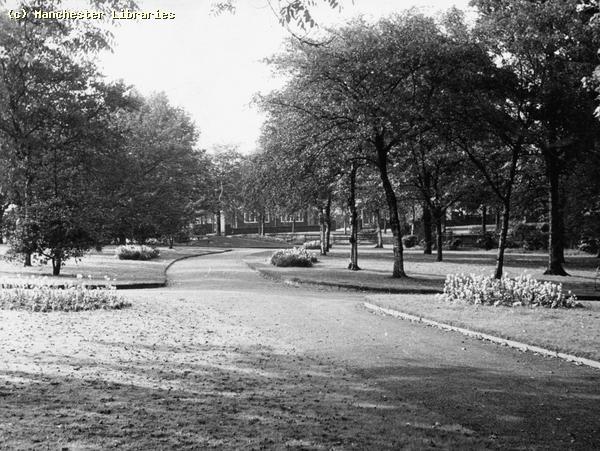
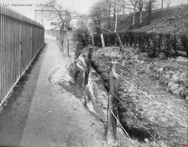
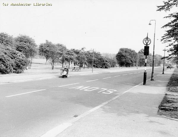
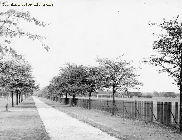
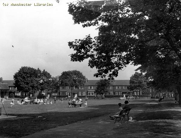
More images of Errwood Park in 1963. The third image is the entrance to the park on Woodlands Road. The fourth image is the side of Errwood Park from the corner of Crossley Road and Errwood Road. ( Manchester Libraries) Cringle Brook Various Images Cringle Brook meandered through South Levenshulme, and was perhaps the most well known water course in Levenshulme. It starts somewhere on the edge of Levenshulme near Lloyd Road and disappears into a culvert on the West side of Errwood Park. According to the 1907 Ordnance Survey Map, Cringle Brook becomes Black Brook and forms the border between Levenshulme and Heaton Chapel. The following images show the brook at various times during the 20th Century.
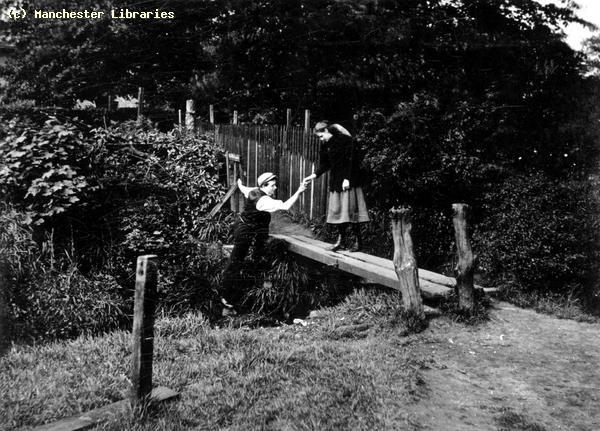
A crude footbridge across Cringle brook 1910. ( Manchester Libraries)
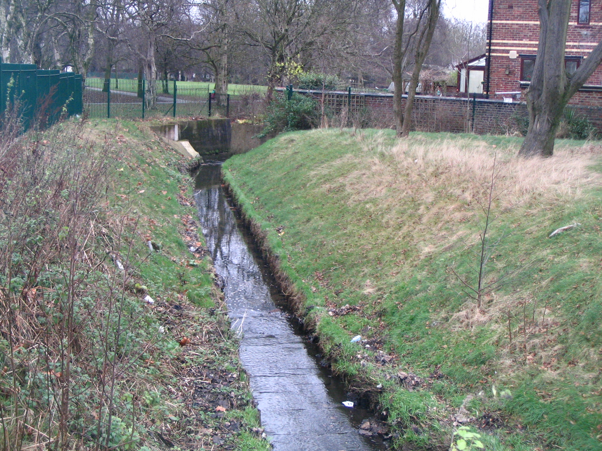
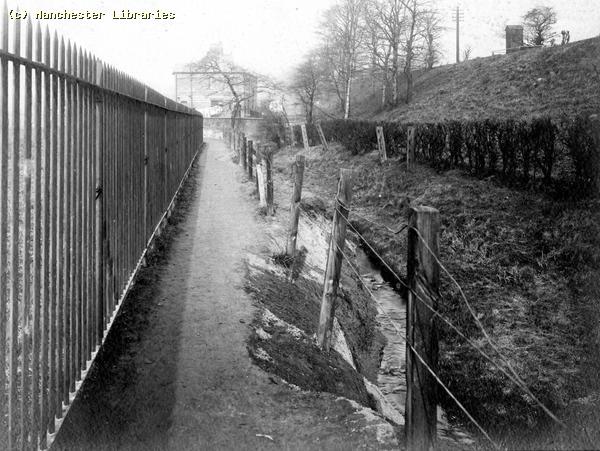
Cringle Brook near Woodlands Ave December 2007.
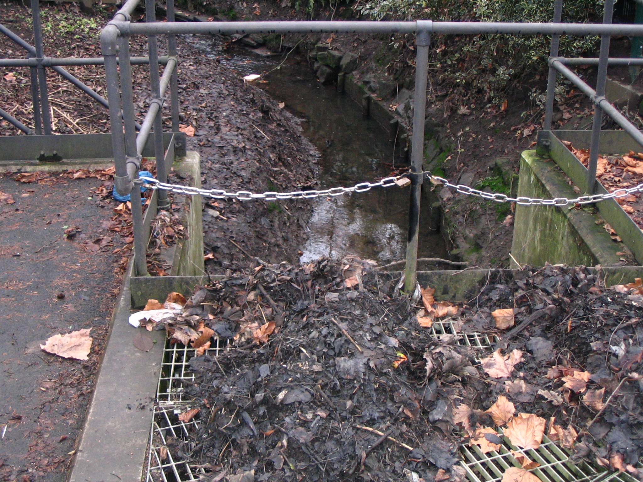
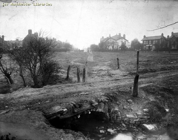
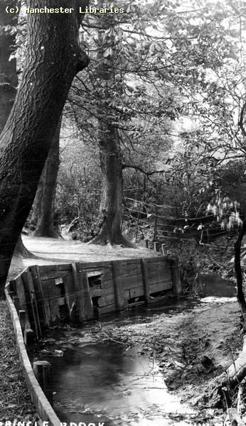
Cringle Brook near West side of Errwood Park/Cringle Fields December 2007. This is where the little bridge used to be and where it disappears into a culvert. Does it appear above ground anywhere north or west of this location?
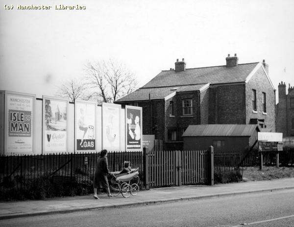
Near Cringle Brook and Clare Road 1900. ( Manchester Libraries)
Another view of Cringle Brook, exact location unknown, probably early 20th Century.( via Ebay ).
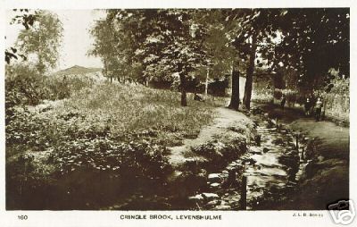
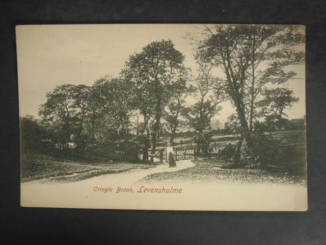
Cringle Brook 1910 postcard view. ( Manchester Libraries)
Another crude bridge over Cringle Brook 1910. The houses in the background are now on Errwood Crescent. (Manchester Libraries)
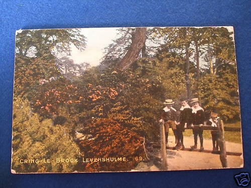
Another early view of the Cringle Brook area. Note the boys in straw boaters and uniforms.
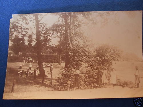
This photo could also be in the vicinity of Cringle Brook.
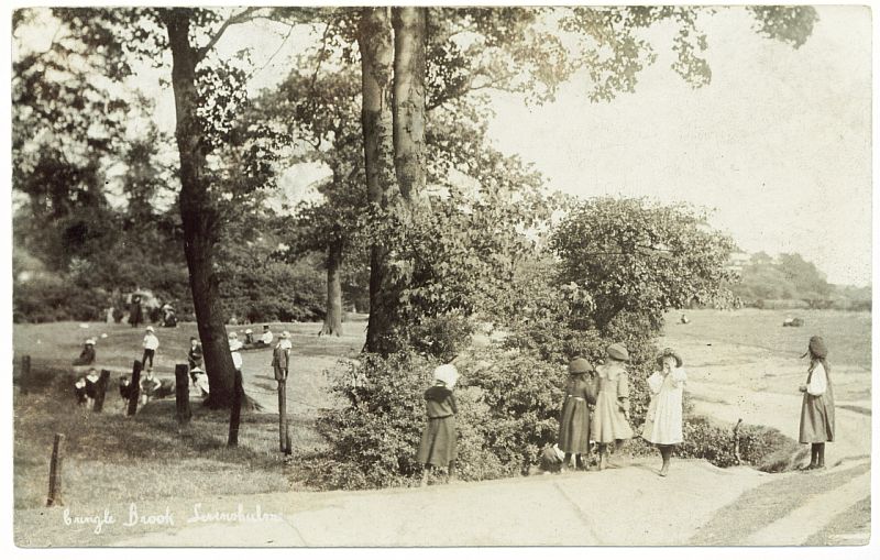
Cringle Brook was certainly a popular beauty spot at the turn of the 20th Century. A very rural scene.
Another Cringle Brook view. When did the brook cease to be a beauty spot?
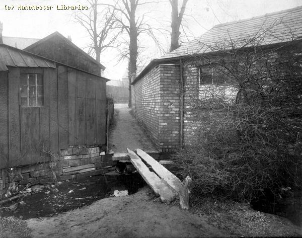
There seem to be no end of Cringle Brook photos. This looks like it could be on Cringle Fields. (Via Brian Carter) Brook House Farm. Brook House and Farm, along with Brookfield House and Burnage House stood on the land that later was developed into Errwood Park. All these properties still existed in 1907.
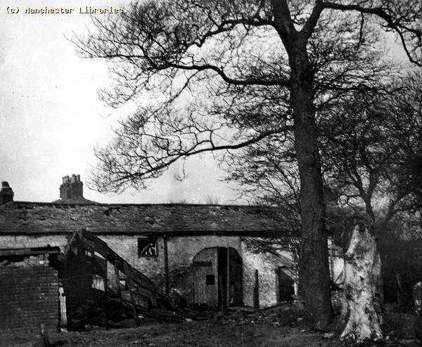
Brook House Farm Buildings in 1929. Looking rather dilapidated! ( Manchester Libraries)
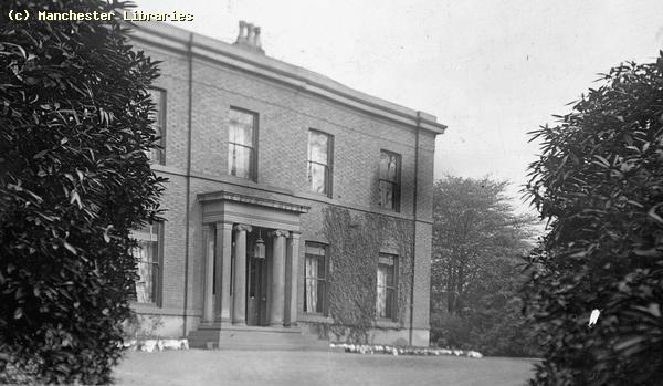
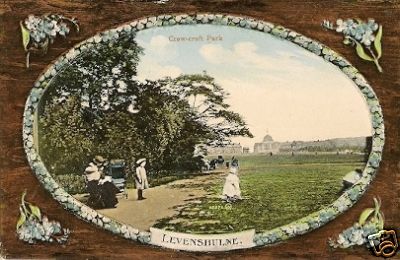
Brook House date unknown ( Manchester Libraries) Crowcroft Park Levenshulme??
I always considered Crowcroft Park to be in Longsight, but with the boundary changes over the last century who knows. This postcard, found on the Internet, definitely states "Crowcroft Park, Levenshulme"!!
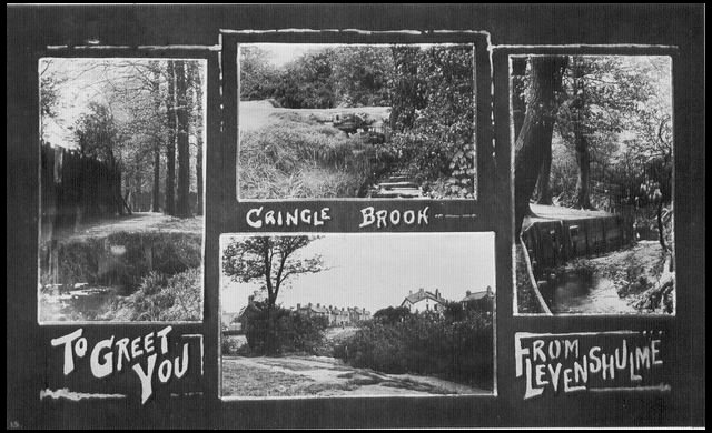
The above postcard shows views of the Cringle Brook, and probably shows what the area that became Errwood Park looked like at the dawn of the 20th century. Can anyone identify the exact locations? ( photos via Les Cotton)
Various images of Cringle Brook between 1905 and 1915 ( Manchester Libraries)
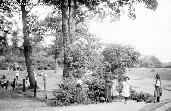
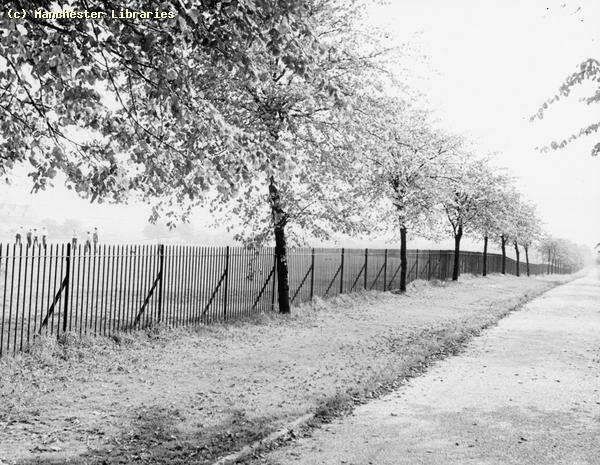
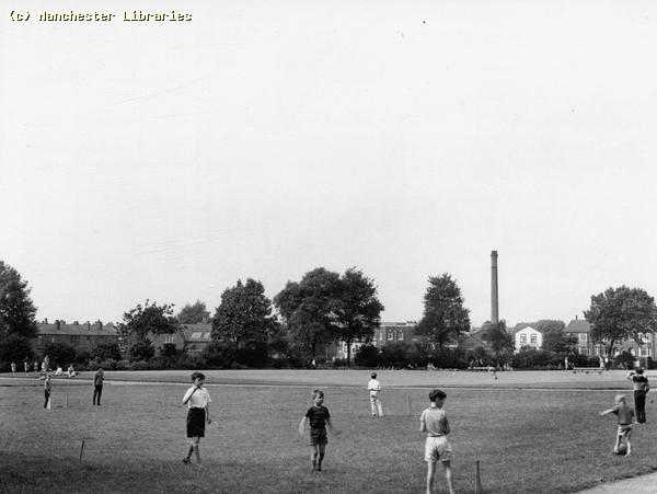
The above photos were taken on the outside perimeter of Cringle Fields in 1963. ( Manchester Libraries)
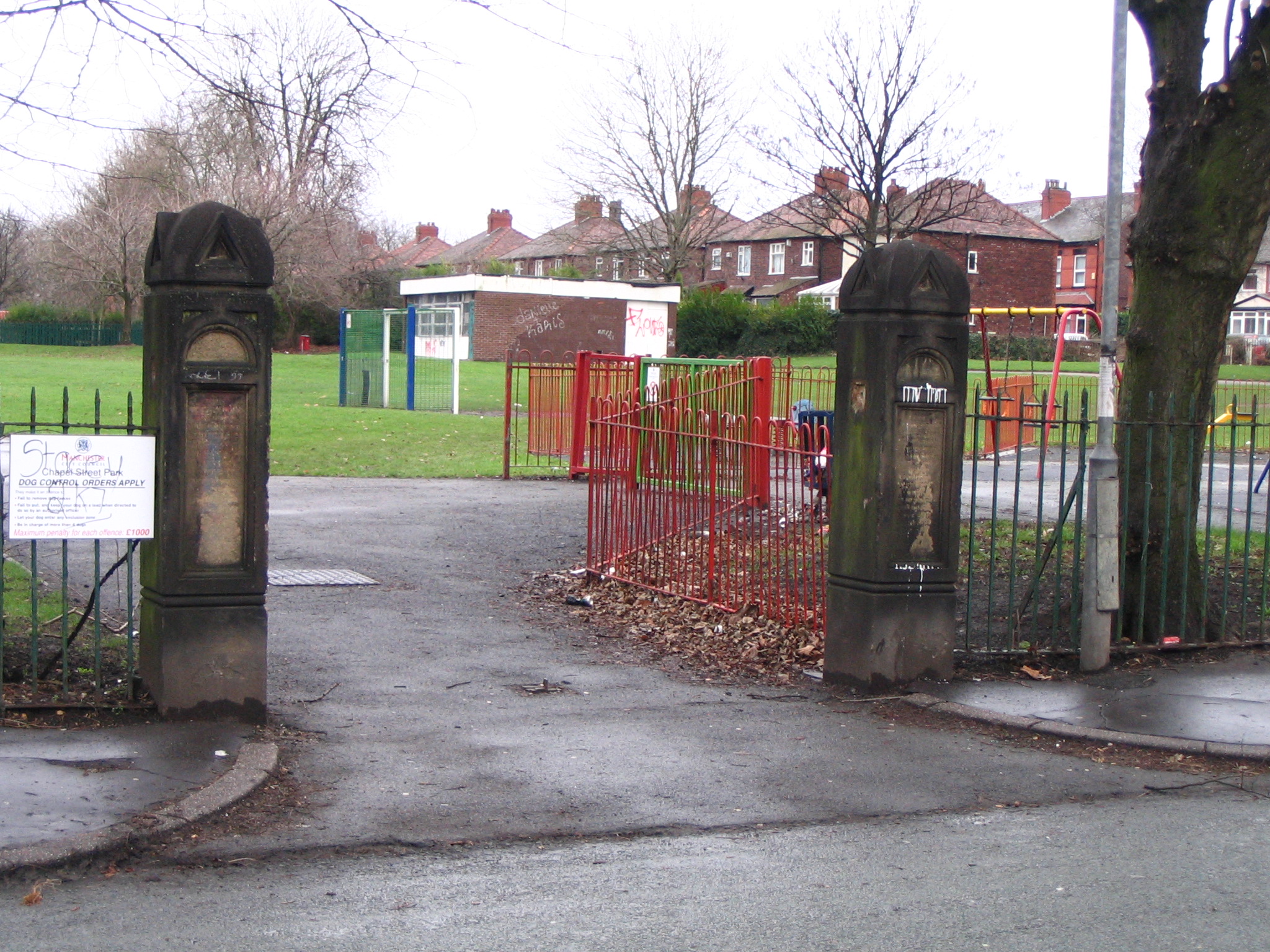
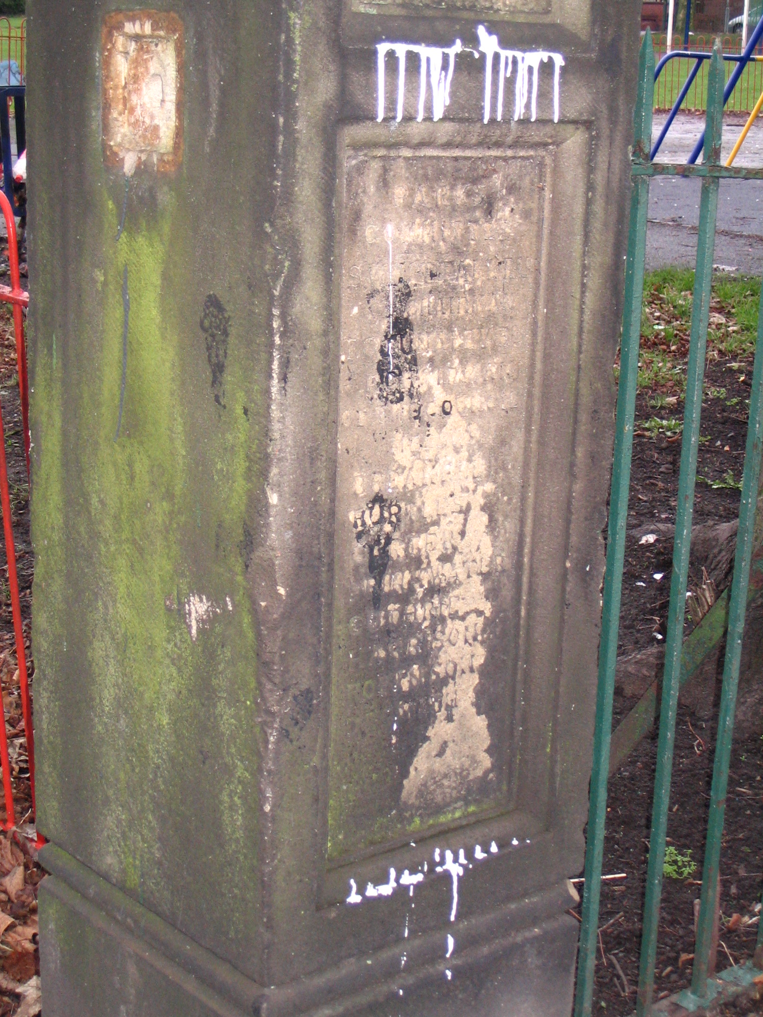
Chapel Street Park Chapel Street Park has changed a great deal since my childhood, but is reassuring to see that the original gate posts are still in existence. There are inscriptions on the posts, probably commemorating the opening ceremony and the dignataries who took part. The inscriptions are very badly weathered, but someone may be able to decipher them. Help needed on this.
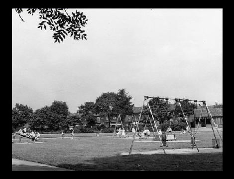
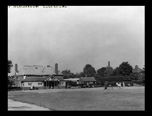
The two photos above show Chapel Street Park in the 1964. These were the original swings, roundabouts, see-saw and, out of frame, rocking boat that were installed at the end of the 1950s. Notice the original shelter and toilet block in the background. The second photo shows the Bowling Pavilion, Park maintenance building, and dominating in the background the rear of The Bluebell Inn on Barlow Road.
Two more views from 1964. The first shows the previously mentioned rocking boat, and houses on Garfield Avenue. The second is looking north showing the Levenshulme Baths, Wash House and Pear Tree Garage in the background. Note the tall chimney belonging to the public baths. The baths were heated by a coal fired boiler. Anyone recognize the cricketers? (All photos via Manchester Libraries)
The Bandstand and shelters in Chapel Street Park 1905. At the time it was known as Levenshulme recreation grounds. The Shelter was there in the 1980s, but has since been replaced by a prefabricated building. When did the bandstand disappear? This photo must be early in the 20th century before the houses on Lincoln Avenue were built. The houses in the background would have been those on Broom Lane.( Manchester Libraries)
Another view looking northwest 1905. Note the children's playground where the bowling greens are now. No sign of the bowling pavilion. Chapel Street School to the left. Could the buildings in the right background be the old Blue Bell Inn? (Manchester Libraries)
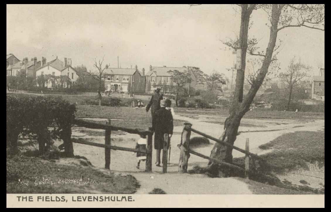
Greenbank Playing Fields and Park.
Greenbank Playing Fields were situated across Barlow Road from Chapel
Street Park, and consisted mainly of football pitches and open spaces.
There was a very thick area of bushes alongside Barlow Road in the 1950s &
60s. This was a great place to build dens and hide from the "Parkie". Does
anyone remember the park keeper called " Abie"? He was a holy terror! I
think his name was Abraham Rose, possibly Jewish, and he ruled the fields
, putting fear into the hearts of mischievous kids. When the cry " Abie"
was heard the bushes would empty of kids running in all directions. He was
probably a kindly but firm old man. The view above shows the small public
park, with bowling greens and childrens
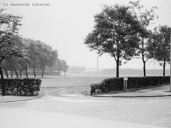
Greenbank Park, Mount Road. 1950s. ( Manchester Libraries)
Greenbank Playing Fields, 1959. This view taken on the corner Manor Road and Mount Road. ( Manchester Libraries)
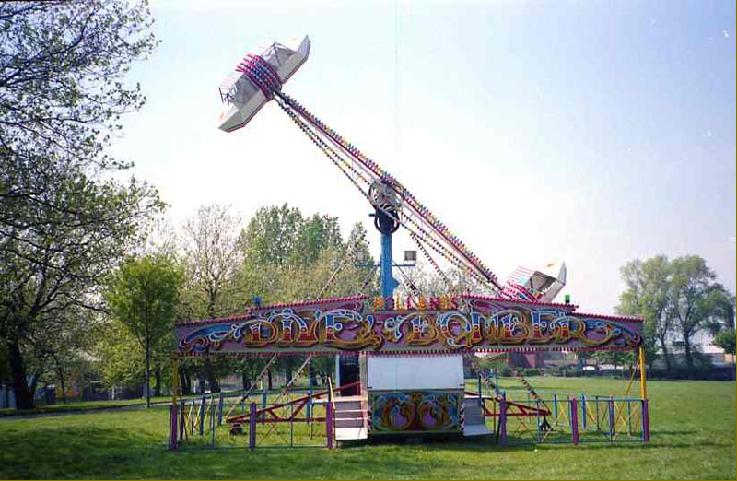
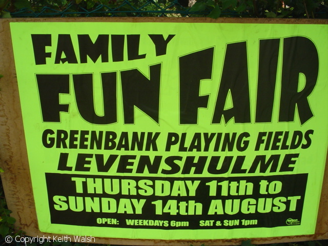
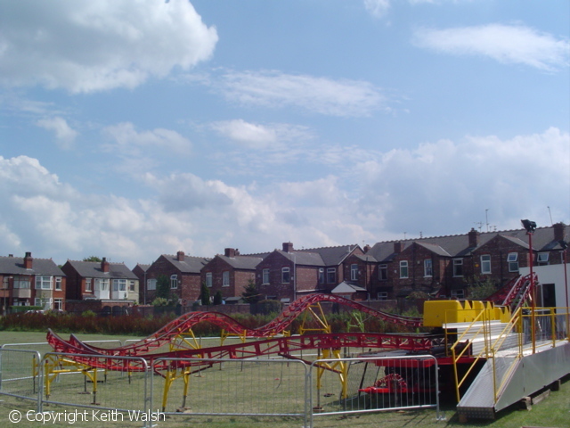
Do you remember the Levenshulme Funfairs? I found this photo on the Funfair Society site. Taken on Greenbank Playing Fields, close to Barlow Road. The year is not mentioned! A very typical fairground ride. The photo looks to have been taken either during the set up or take down of the funfair. There is no evidence of worn out grass, so I suspect it was during the set up!! Does anyone out there have any Levenshulme funfair photos. I seem to remember that two fairs visited during the summer. One on Cringle Fields, usually early summer, and later on Greenbank. They may have been the same fairs. Do fairgrounds still visit Levenshulme??
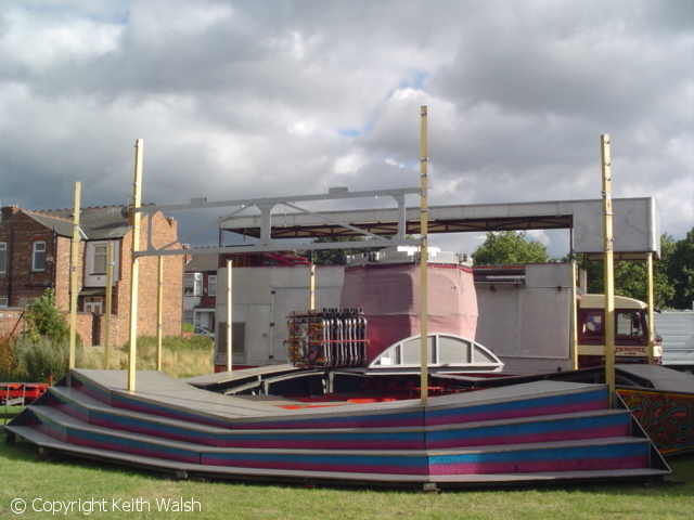
Contemporary Fair Ground photos sowing the rides being set up on Greenbank Playing fields. The houses in the background would be on Byrom Avenue. ( internet via Keith Walsh)
West Point Park. West Point Levenshulme.
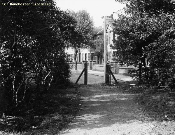
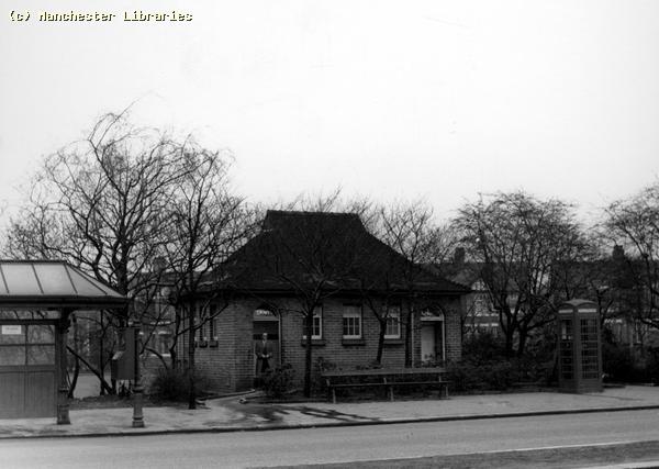
This is a small park situated at West Point, Levenshulme. Note the end of the old tram shelter, similar to the ones at Lloyd Road. The photo was taken in 1962. I had almost forgotten about this park. I often wondered about the name West Point. It always made me think of the famous Military Academy in the USA!! ( Manchester Libraries)
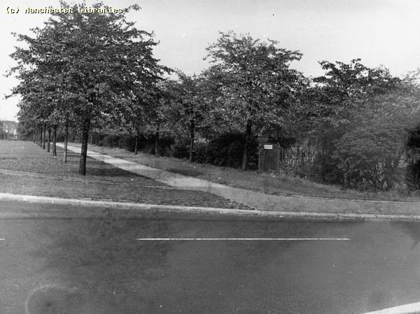
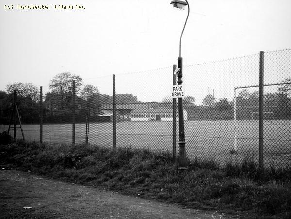
Park Grove Playing Fields This photo of Park Grove playing fields was taken in 1971. Were these playing fields run by the City of Manchester? Note the electric lamp standard converted from a gas lamp. Also the railway in the background. ( Manchester Libraries) Cricket Clubs in Levenshulme Levenshulme appeared to have had two separate cricket clubs. One off Slade Lane & the other off Elsa Street/Barlow Road.
The entrance to the Slade Lane Cricket Club 1965. ( Manchester Libraries)
Ticket for a Fund Raising event to help purchase the Slade Lane grounds, dated 1926 (via Ebay)
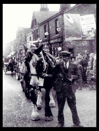
Levenshulme Festivals, Carnivals & The Queen Of Happiness Do you remember the various Levenshulme Festivals, Carnivals & Fun Fairs? I have a vague memory of an event called "The Queen of Happiness"! This may not be its correct title, but I believe it was a kind of May Queen event. It was held during the summer, and consisted of a parade, events in the parks and possibly a fair of some kind held in Levenshulme Town Hall. The event probably did not last into the 1960's.
|
||
|
|
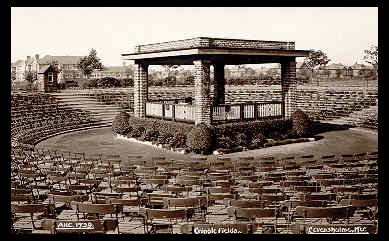 The Band Stand in
Errwood Park. This is taken from a postcard, probably pre-WW2, as it
states it to be Cringle Fields! The bandstand was a prominent feature of
the park. It was probably built in the late twenties or early thirties in
a "modern" style. The wooden platform fell in to disrepair in the 1960's,
but the roofed structure was retained as the centre piece of some formal
flowerbeds. It may still be there if it has not succumbed to "vandalism"!!
NOTE Levenshulme Girls High School in the background & Errwood Road
virtually devoid of trees.
The Band Stand in
Errwood Park. This is taken from a postcard, probably pre-WW2, as it
states it to be Cringle Fields! The bandstand was a prominent feature of
the park. It was probably built in the late twenties or early thirties in
a "modern" style. The wooden platform fell in to disrepair in the 1960's,
but the roofed structure was retained as the centre piece of some formal
flowerbeds. It may still be there if it has not succumbed to "vandalism"!!
NOTE Levenshulme Girls High School in the background & Errwood Road
virtually devoid of trees.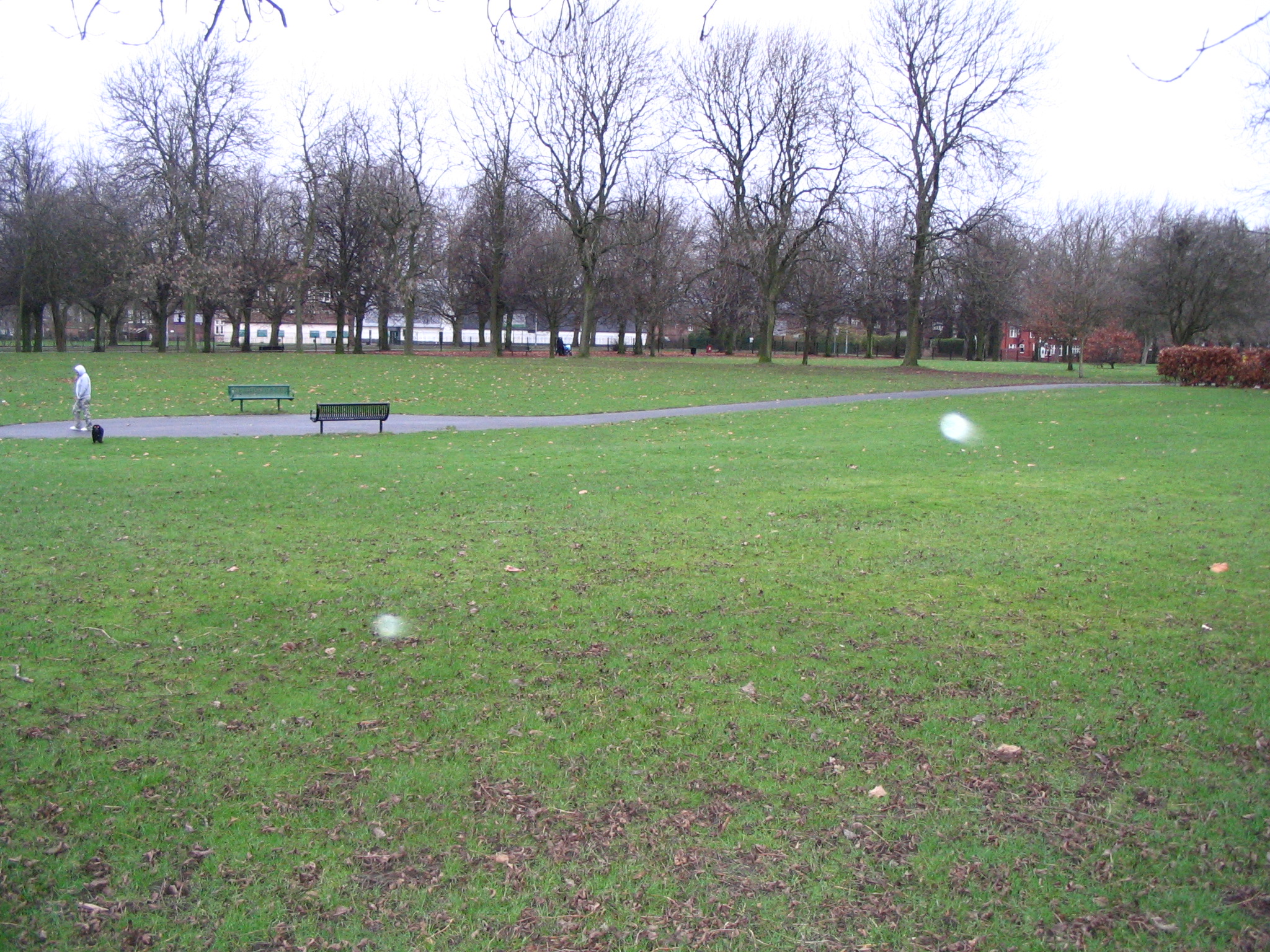

pqshS3NBMiQb0j6Vg~~_12.jpg)
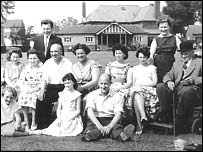 A family group in Chapel
Street Park 1950s. Note the bowling pavilion.
A family group in Chapel
Street Park 1950s. Note the bowling pavilion.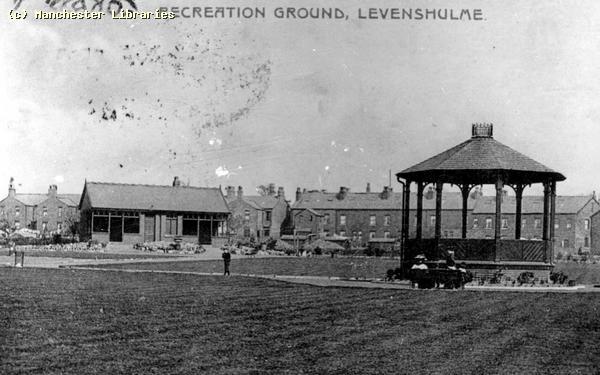
 Playground, which was situated off
Manor Road and Mount Road. ( Photo. Manchester Libraries
Playground, which was situated off
Manor Road and Mount Road. ( Photo. Manchester Libraries
0P6j!!mk~$(KGrHqUOKjUEwMekuVEwBMPH)v0tnw~~_12.jpg)
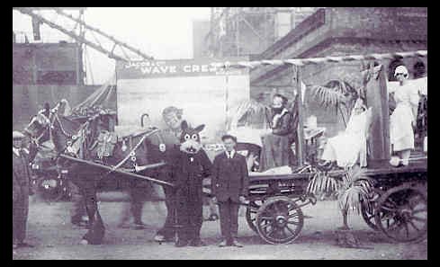 This photograph shows a parade float for a 1920's Levenshulme festival.
The photo was taken on Crossley Road, and shows the McVitie & Price
biscuit factory under construction. The cart belonged to Barbers Removals.
Note the Felix the Cat costume! (Photo via Andrew Barber)
This photograph shows a parade float for a 1920's Levenshulme festival.
The photo was taken on Crossley Road, and shows the McVitie & Price
biscuit factory under construction. The cart belonged to Barbers Removals.
Note the Felix the Cat costume! (Photo via Andrew Barber)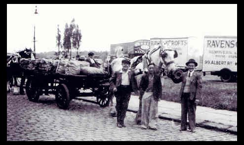
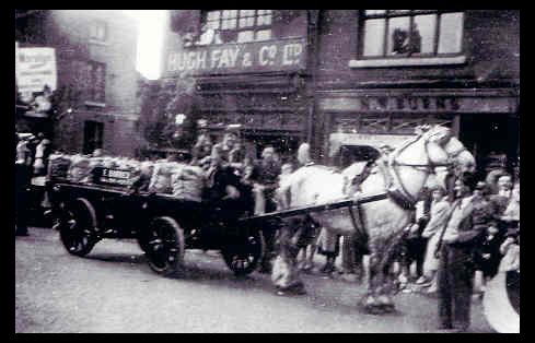
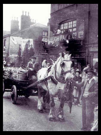 The above sequence of photographs were taken during a Levenshulme Festival
in the 1940's. The Cart shown belonged to Barbers Removals & was used for
coal deliveries. The parade appeared to start at Greenbank Fields on Manor
Road. It probably then went along Barlow Road, turned south at St
Peters Church and went down Stockport Road as far as Crossley Road. The
parade would probably have ended at Cringle Fields. Things to note on the
photographs, Barbers & Ravenscroft Removal vans in second photo. The very
clean coal sacks & shrubs on the cart, and the parade numbers on the
horses. Hugh Fays grocers shop on the corner of Delamere Road. The petrol
pumps on the other corner of Delamere Road, this building was a kind
of 1940's filling station. I remember the pumps as a child. ( Photos all
via Andrew Barber)
The above sequence of photographs were taken during a Levenshulme Festival
in the 1940's. The Cart shown belonged to Barbers Removals & was used for
coal deliveries. The parade appeared to start at Greenbank Fields on Manor
Road. It probably then went along Barlow Road, turned south at St
Peters Church and went down Stockport Road as far as Crossley Road. The
parade would probably have ended at Cringle Fields. Things to note on the
photographs, Barbers & Ravenscroft Removal vans in second photo. The very
clean coal sacks & shrubs on the cart, and the parade numbers on the
horses. Hugh Fays grocers shop on the corner of Delamere Road. The petrol
pumps on the other corner of Delamere Road, this building was a kind
of 1940's filling station. I remember the pumps as a child. ( Photos all
via Andrew Barber)